- [01] Adams Co, OH (18)
- [02] Allen Co, OH (2)
- [03] Ashland Co, OH (14)
- [04] Ashtabula Co, OH (11)
- [05] Athens Co, OH (20)
- [06] Auglaize Co, OH (5)
- [07] Belmont Co, OH (24)
- [08] Brown Co, OH (32)
- [09] Butler Co, OH (8)
- [10] Carroll Co, OH (22)
- [11] Champaign Co, OH (9)
- [12] Clark Co, OH (3)
- [13] Clermont Co, OH (10)
- [14] Clinton Co, OH (4)
- [15] Columbiana Co, OH (19)
- [16] Coshocton Co, OH (14)
- [17] Crawford Co, OH (13)
- [18] Cuyahoga Co, OH (15)
- [19] Darke Co, OH (8)
- [20] Defiance Co, OH (7)
- [21] Delaware Co, OH (10)
- [22] Erie Co, OH (4)
- [23] Fairfield Co, OH (9)
- [24] Fayette Co, OH (3)
- [25] Franklin Co, OH (12)
- [26] Fulton Co, OH (4)
- [27] Gallia Co, OH (9)
- [28] Geauga Co, OH (10)
- [29] Greene Co, OH (1)
- [30] Guernsey Co, OH (34)
- [31] Hamilton Co, OH (6)
- [32] Hancock Co, OH (5)
- [33] Hardin Co, OH (5)
- [34] Harrison Co, OH (15)
- [35] Henry Co, OH (4)
- [36] Highland Co, OH (15)
- [37] Hocking Co, OH (7)
- [38] Holmes Co, OH (12)
- [39] Huron Co, OH (15)
- [40] Jackson Co, OH (8)
- [41] Jefferson Co, OH (11)
- [42] Knox Co, OH (13)
- [43] Lake Co, OH (2)
- [44] Lawrence Co, OH (9)
- [45] Licking Co, OH (17)
- [46] Logan Co, OH (5)
- [47] Lorain Co, OH (13)
- [48] Lucas Co, OH (5)
- [49] Madison Co, OH (6)
- [50] Mahoning Co, OH (13)
- [51] Marion Co, OH (5)
- [52] Medina Co, OH (9)
- [53] Meigs Co, OH (15)
- [54] Mercer Co, OH (3)
- [55] Miami Co, OH (4)
- [56] Monroe Co, OH (28)
- [57] Montgomery Co, OH (11)
- [58] Morgan Co, OH (20)
- [59] Morrow Co, OH (9)
- [60] Muskingum Co, OH (24)
- [61] Noble Co, OH (15)
- [62] Ottawa Co, OH (8)
- [63] Paulding Co, OH (6)
- [64] Perry Co, OH (8)
- [65] Pickaway Co, OH (7)
- [66] Pike Co, OH (9)
- [67] Portage Co, OH (8)
- [68] Preble Co, OH (9)
- [69] Putnam Co, OH (9)
- [70] Richland Co, OH (11)
- [71] Ross Co, OH (7)
- [72] Sandusky Co, OH (8)
- [73] Scioto Co, OH (16)
- [74] Seneca Co, OH (16)
- [75] Shelby Co, OH (5)
- [76] Stark Co, OH (16)
- [77] Summit Co, OH (5)
- [78] Trumbull Co, OH (3)
- [79] Tuscarawas Co, OH (15)
- [80] Union Co, OH (9)
- [81] Van Wert Co, OH (5)
- [82] Vinton Co, OH (9)
- [83] Warren Co, OH (3)
- [84] Washington Co, OH (34)
- [85] Wayne Co, OH (20)
- [86] Williams Co, OH (4)
- [87] Wood Co, OH (5)
- [88] Wyandot Co, OH (10)
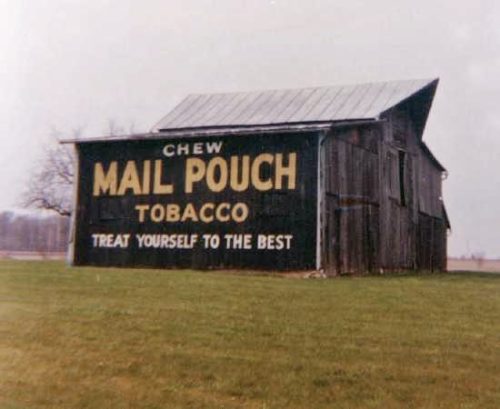
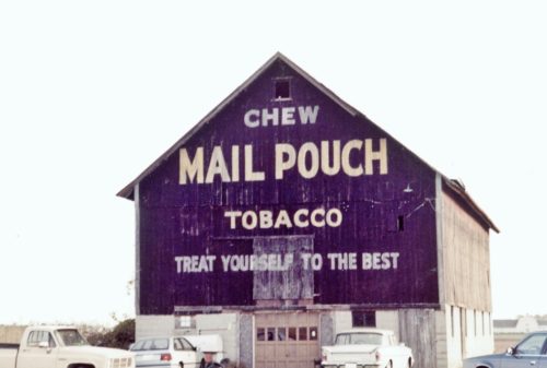
*GONE* (razed and removed) Along the east side of McCutcheonville Rd (OH-199) south of the intersection with US-6 by 2.0 miles. The barn was on the left side of the road headed south from US-6. There was a Mail Pouch sign on both ends of the barn. Black Backgrounds.
*GONE* (razed and removed) Along the west side of N. Dixie Hwy. (OH-25) north of the Wooster St. (OH-64) intersection, in Bowling Green, by 6.4 mils. The barn was on the left side of the highway headed north from Bowling Green. The Mail Pouch sign faced north. One end. Black background.
*GONE* Along the northeast side of McCutchenville Rd. (OH-199) southeast of the Indiana Ave. intersection, in Perrysburg, by 5.2 miles. The barn was on the left side of the road headed southeast from Perrysburg. The Mail Pouch sign faced southeast. One end. Black background.
*GONE* (fallen) Along the south side of OH-293 (Lincoln Hwy.) west of the N. Warpole St. intersection, in Upper Sandusky, by 7.2 miles. The barn was on the left side of the highway headed west from Upper Sandusky. Two ends. Black backgrounds.
The Steer Restaurant, in Upper Sandusky. US-30 west of US-23 by-pass by about 1.0 mile. The restaurant is on the right side of the highway headed west. The Mail Pouch sign faces east. One side. Red background.
*GONE* (faded away) OH-67 just past the intersection with Co. Rt. 16. The barn is on the right side of the highway headed northeast. Mail Pouch sign on the northwest side; and, Mail Pouch sign on the norhteast end.
*GONE (dismantled)* US-30 (Old Lincoln Hwy.) east of OH-231 by about 0.5 mile. The barn was on the left side of the highway headed east. The Mail Pouch sign faced east. One end. Black background.
*GONE* (razed and removed) Along the north side of CH-330 (old US-30) east of OH-37 by 1.9 miles. The barn was on the left side of the highway headed east from OH-37. The Mail Pouch sign faced south. One side. Black background.
*GONE* (faded away maybe painted over) Along the south side of CH-330 (old US-30) west of the US Rt. 30 intersection by 2.1 miles. The barn is on the left side of the highway headed west. The Mail Pouch sign faced north. One side. Original black background.
*GONE* (razed and removed) Along the west side of OH-37 southeast of the Mary St. intersection, in Forest, by 3.3 miles. The barn was on the right side of the highway headed south. The Mail Pouch sign faced southeast. One end. Black background.
*GONE* (razed and removed) Along the northwest side of OH-67 (Tarhe Trail) northeast of the intersection with OH-53 by 3.8 miles. The barn was on the left side of the highway headed northeast from OH-53. The Mail Pouch sign faced northeast. One end. Black background.
Upper Sandusky. Ohio area. One end. Black background.
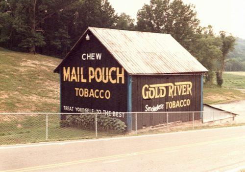
*GONE* OH Rt. 146 (Blue Bell Rd.) just south of the OH Rt. 146 & OH Rt. 672 junction. South of OH Rt. 821 (Marietta Rd.), in Pleasant City, by about 5.5 miles. The barn is on the left side of the highway headed southwest. The Northeast end was a Mail Pouch sign. The northwest side was a Gold River sign. Black.
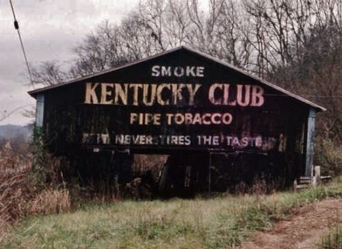
US Rt. 52 (Ohio River Scenic Byway) west of the Scioto County line by about 9.5 miles. MP sign faces west. KC sign faces east. Two ends. Black background.
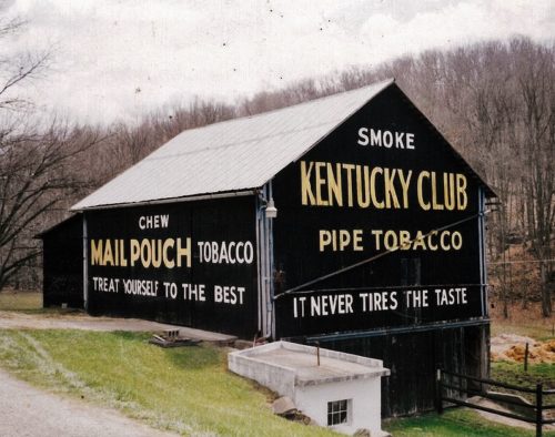
US Rt. 33, south of US Rt. 50 by about 2.8 miles. South of Twp. Hwy. 62 (Robinson Rd.) by about 600'. Barn is on the left side of US Rt.33 headed south. One end - Kentucky Club. One side - Mail Pouch. Black.
OH-125 southwest of US-62 by about 3.0 miles. The barn is on the right side of the highway headed southwest. Two ends (One Mail Pouch, facing east & one Kentucky Club, facing west). Two sides, facing north and south (Mail Pouch). Black backgrounds.
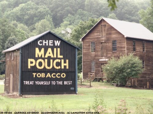
OH-332 (Scio Rd.), south of Carrollton by about 4.5 miles. At the Algonquin Mill Historical Site. One end. Black background.
*GONE* US Rt. 30 (Lincoln Hwy.) east of OH Rt. 9 (1st St.), in Hanoverton, by about 3.5 miles. East of MPB 35-15-02 by 500'. The barn was on the left side of the highway headed east. Two ends. East end - Kentucky Club sign. West end - Mail Pouch sign. Black backgrounds.
*GONE* (razed and removed) OH-4 south of OH-103, in Chatfield, by 2.3 miles. The barn was on the left side of the highway headed south from Chatfield. The Mail Pouch sign faced north. One end. Black background.
*GONE* US Rt. 42 northeast of OH Rt. 37 by about 2.4 miles. The barn was on the left side of the highway headed northeast. The MP sign faced southwest. The KC sign faced northeast. Two ends. Black.


