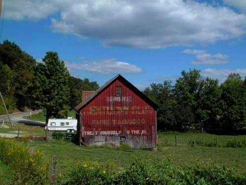
Along the northeast side of OH-13 southeast of US-22, in Somerset, by 3.3 miles. The barn is on the left side of the highway headed southeast. Mail Pouch sign on the west end; and Mail Pouch signs on the north and south sides. Black Backgrounds.
*GONE* (razed and removed. There is a new barn in the same location) Along the northeast side of OH-13, southeast of Marietta Rd. (CR-11), in Moxahala, by 2.5 miles. The barn was on the left side of the highway headed southeast. Mail Pouch sign on the southwest side and on both the northwest and southeast ends. Black Backgounds.
*GONE (fallen and removed)* US Rt. 22, east of OH Rt. 204 by about 0.75 mile. The barn was on the left side of the highway headed southeast. One end. One side. Black with red shading.
OH Rt. 13 just south of US Rt. 22. One end. Red. Greatly faded.
*GONE* (partially razed and fallen) Along the north side of US-22 (OH-22) west of OH-345 intersection, in East Fultonham, by 2.4 miles. The barn remains are on the right side of the highway headed southwest. The Mail Pouch sign faced southeast. One side. Original Black Background.
*GONE* (painted over) Along the southwest side of OH-13 northwest of the intersection with Broadway St., in New Lexington, by 1.9 miles. The barn is on the left side of the highway headed northwest. The Mail Pouch sign faces southeast. One end. Black Background.
OH Rt. 155 (Sanders St.), east of OH Rt. 93 (2nd St.), in Shawnee, by about 4.0 miles. The barn is on the right side of the highway headed east. The MP/KC sign faces southwest. One end. Red. Greatly faded.
*GONE* Along the east side of OH-93, in McCuneville, north of the OH-93/OH-155 junction (2nd St.), in Shawnee, by 2.2 miles. The building was on the right side of the highway headed north. The sign faced south. One side. Black Background.


