OH-800 (S. Philadelphia St.) south of OH-342 by about 0.2 mile. The barn is on the right side of the street headed south. The Mail Pouch sign faces east. One side. Black background.
OH-342 (Westchester Rd.) west of High St., in Freeport, by 2.3 miles. The barn is on the left side of the road headed west. Two ends. Red backgrounds.
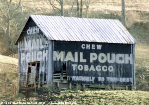
*GONE (burned)* US Rt. 22 (Cadiz-Piedmont Rd.) southwest of US Rt. 250/OH Rt. 9 intersection by about 2.75 miles. The barn was on the left side of the road headed southwest. The MP sign faced southwest. One side. Unknown color. Greatly faded prior to the fire.
*GONE (Destroyed by fire, razed and removed)* US Rt. 250 (Cadiz - Dennison Rd.) northwest of US Rt 22 by 3.1 miles.
The barn was on the right side of the highway headed northwest. The MP sign faced south. One end. Black.
*GONE* US Rt. 250 east of Cadiz by 1.5 miles. One end. Black. Greatly faded.
*GONE* (razed and removed) Along the north side of Old Hopedale Rd (TH-5) east of the US-22 intersection by 0.6 mile. The barn was on the left side of the road headed east toward Hopedale. The photo shows the Mail Pouch sign on the east end of the barn. Because of the proximity of the barn to the road and because access to the barn was from the south side, it is most likely that there was also a Mail Pouch sign on the west end of the barn. Black Background.
*GONE* (faded away) Along the north side of Caiz-Dennison Rd (US-250) west of US-22 by sbout 3.6 miles. The barn is on the right side of the highway headed west from US-22. The Mail Pouch sign faced south. One end. Black Bacjground.
US Rt. 22 (Cadiz Piedmont Rd.), east of OH Rt. 331, in Piedmont, by about 2.0 miles to Co. Hwy. 34 (Kirkpatrick Rd./Moorefield Rd.). Bear left onto Co. Hwy. 34 and travel approximately 1200'. The barn is on the right side of the road headed east. Two ends. One side. Greatly faded and whitewashed over.
*GONE*(razed and removed) Along the north side of the Jewett Hopedale (OH-1510 east of the intersection with Jewett Germano Rd (OH-9), in Jewett, by 0.3 mile. The barn was on the left side of the road headed east from Jewett. One Mail Pouch sign on the south side of the barn; and, one Mail Pouch sign on the east end of the barn. Black Backgrounds.
Harrison Co. (Only ID) One side. Black.
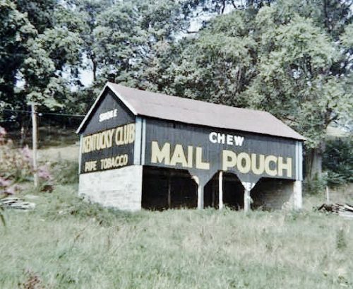
US-250 (Cadiz-Dennison Rd.), west of US-22 by about 3.7 miles. The barn is on the right side of the highway headed west. The Mail Pouch sign on the side faces south. The Kentucky Club sign on the end faces west. Black backgrounds.
US Rt. 22 (Cadiz-Piedmont Rd.), southwest of US Rt. 250 by about 5.5 miles. The barn is on the left side of the road headed south, just past the intersection with Slater Rd. One end. One side. Black.
*GONE* (razed and removed)* OH Rt. 151 (Jewett-Hopedale Rd.) north of US Rt. 22 (Cadiz-Steubenville Rd.) by about 1.25 miles. The Log cabin was on the left side of the highway headed north. The MP sign used to face east.
OH Rt. 9 (S. Main St.), in Cadiz, south of US Rt. 250 (Market St.) by about 350'. The building is on the left side of the street headed southwest. The MP sign faces southwest. One side. Two-story brick building. Probably originally Black Backgound. Greatly faded.
OH Rt. 9/OH Rt. 151 (E. Main St.), in Jewett. The building is on the south side of the street. One side. Original Black Background. Greatly faded.


