- [01] Adams Co, OH (18)
- [02] Allen Co, OH (2)
- [03] Ashland Co, OH (14)
- [04] Ashtabula Co, OH (11)
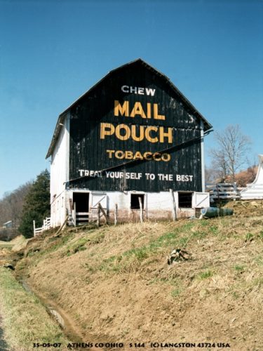
- [05] Athens Co, OH (20)
- [06] Auglaize Co, OH (5)
- [07] Belmont Co, OH (24)
- [08] Brown Co, OH (32)
- [09] Butler Co, OH (8)
- [10] Carroll Co, OH (22)
- [11] Champaign Co, OH (9)
- [12] Clark Co, OH (3)
- [13] Clermont Co, OH (10)
- [14] Clinton Co, OH (4)
- [15] Columbiana Co, OH (19)
- [16] Coshocton Co, OH (14)
- [17] Crawford Co, OH (13)
- [18] Cuyahoga Co, OH (15)
- [19] Darke Co, OH (8)
- [20] Defiance Co, OH (7)
- [21] Delaware Co, OH (10)
- [22] Erie Co, OH (4)
- [23] Fairfield Co, OH (9)
- [24] Fayette Co, OH (3)
- [25] Franklin Co, OH (12)
- [26] Fulton Co, OH (4)
- [27] Gallia Co, OH (9)
- [28] Geauga Co, OH (10)
- [29] Greene Co, OH (1)
- [30] Guernsey Co, OH (34)
- [31] Hamilton Co, OH (6)
- [32] Hancock Co, OH (5)
- [33] Hardin Co, OH (5)
- [34] Harrison Co, OH (15)
- [35] Henry Co, OH (4)
- [36] Highland Co, OH (15)
- [37] Hocking Co, OH (7)
- [38] Holmes Co, OH (12)
- [39] Huron Co, OH (15)
- [40] Jackson Co, OH (8)
- [41] Jefferson Co, OH (11)
- [42] Knox Co, OH (13)
- [43] Lake Co, OH (2)
- [44] Lawrence Co, OH (9)
- [45] Licking Co, OH (17)
- [46] Logan Co, OH (5)
- [47] Lorain Co, OH (13)
- [48] Lucas Co, OH (5)
- [49] Madison Co, OH (6)
- [50] Mahoning Co, OH (13)
- [51] Marion Co, OH (5)
- [52] Medina Co, OH (9)
- [53] Meigs Co, OH (15)
- [54] Mercer Co, OH (3)
- [55] Miami Co, OH (4)
- [56] Monroe Co, OH (28)
- [57] Montgomery Co, OH (11)
- [58] Morgan Co, OH (20)
- [59] Morrow Co, OH (9)
- [60] Muskingum Co, OH (24)
- [61] Noble Co, OH (15)
- [62] Ottawa Co, OH (8)
- [63] Paulding Co, OH (6)
- [64] Perry Co, OH (8)
- [65] Pickaway Co, OH (7)
- [66] Pike Co, OH (9)
- [67] Portage Co, OH (8)
- [68] Preble Co, OH (9)
- [69] Putnam Co, OH (9)
- [70] Richland Co, OH (11)
- [71] Ross Co, OH (7)
- [72] Sandusky Co, OH (8)
- [73] Scioto Co, OH (16)
- [74] Seneca Co, OH (16)
- [75] Shelby Co, OH (5)
- [76] Stark Co, OH (16)
- [77] Summit Co, OH (5)
- [78] Trumbull Co, OH (3)
- [79] Tuscarawas Co, OH (15)
- [80] Union Co, OH (9)
- [81] Van Wert Co, OH (5)
- [82] Vinton Co, OH (9)
- [83] Warren Co, OH (3)
- [84] Washington Co, OH (34)
- [85] Wayne Co, OH (20)
- [86] Williams Co, OH (4)
- [87] Wood Co, OH (5)
- [88] Wyandot Co, OH (10)
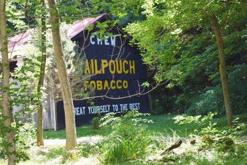
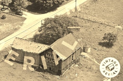
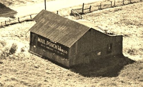
*GONE* (razed and removed)US-20, in Saybrook, southwest of the intersection with OH-45 by about 1.1 miles. The barn was on the right side of the highway headed southwest. The Mail Pouch sign faced southwest. One side. Black background.
*GONE* (razed and removed) Along OH-7 south if the intersection with US-6, in Andover, by 2.8 miles. The barn was on the right side of the highway headed south. The Mail Pouch sign faced north. One end. Black background.
*GONE* (razed and removed) Along the northwest side of N Ridge Rd E (US-20) northeast of the OH-534 intersection, in Geneva, by 2.3 miles. The barn was on the left side of the highway headed northeast. The Mail Pouch sign faced east. One end. Black Background.
Old US Rt. 33, south of US Rt. 50 by about 5.0 miles. South of County Rd. 44 (Shade Rd.), in Shade;, by about .67 mile. The barn is on the left side of old US Rt. 33 headed south. The MP sign faces south. One side. Black.
US Rt. 50/ OH Rt. 32, west of Guysville by about 2.5 miles. The barn is on the right side of the highway headed west. Two sides. Black.
*GONE (fallen)* Along OH Rt. 550, northeast of US Rt. 33 intersection by about 3.0 miles. The barn was on the right side of the highway headed northeast. The Mail Pouch sign was on the northeast end of the barn One end. Black background.
OH-144, northwest of OH-124, in Hockingport, by about 1.2 miles. The barn is on the right side of OH-144 headed northwest. Two ends. Black backgrounds.
*GONE* (razed and removed to Wood Co., West Virginia, as MPB 48-54-01). Reported to have been originally located along US Rt. 50 west of Belpre, near Coolville. Onr end. Black background.
*GONE* (razed and removed) The barn was located along the south side of Bishopville Rd (OH-78) east of the intersection with OH Rt 13 (Broad St.), just north of Glouster, by 0.8 mile. The barn was on the right side of the highway headed east. The Mail Pouch sign faced west. One end. Black backround.
*GONE* (razed and removed) OH Rt. 550 northeast of US Rt. 33 intersection by 0.7 miles, north of Athens. The barn was on the right side of the highway headed northeast. Two ends. Black.
*GONE* (painted over after the barn repair) Along W Belpre Pike (Twp Hwy 63 - old OH-7) southwest of US Rt. 50 (SW of Torch) by 0.6 miles. The barn is on the left side of the Pike headed west. The Mail Pouch sign was on the west end of the barn. One end. Black background.
Co. Rd. (Federal Rd.) west of Little Hocking by about 4.6 miles. Just barely past the Washington County line. One side. Black.
*GONE* (razed and removed) Along OH Rt. 13 north of the intersection with US Rt. 33 by about 4.0 miles. Just past the intersection with Co. Rte. 93, which takes you into Millfield. The barn was on the right side of the highway headed north. The MP sign faced west. One side. Black.
US Rt. 50/OH Rt. 32 (James A Rhodes Hwy) east of the US Rt. 50/US Rt. 33 interchange, southeast of Athens, by about 6.8 miles. North side of the highway. Actually along the section of US Rt. 50 which was abandoned years ago. The MP sign faces west. One end. Black.
*GONE* OH Rt. 550 west of OH Rt. 555 intersection, in Bartlett, by 2.7 miles. The barn is on the right side of the highway headed west. The MP sign faced east. One side. Black.
*GONE* OH Rt. 7 southwest of the US Rt. 50 merge point south of Coolville, by about 0.9 mile. The barn was on the right side of the highway headed southwest, and backed up on CR 468 (Old State Rd.). The MP sign faced northeast. One end. Black.
Along Hanning Lane, off of OH Rt. 682 (S. Plains Rd.), northwest of the Richland Ave. bridge (at Athens), by 2.3 miles. The barn is on the right side of the road headed northwest. The MP sign faces south. One end. black.
*GONE* (razed and removed) Along Old State Rte 33 south of the US Rt. 33 interchange by about 7.0 miles, just north of Shade. The barn was on the right side of the highway headed south. There was a Mail Pouch sign on the north and south ends of the barn. Black backgrounds.
*GONE* (razed and removed) Along the east side of OH-7 south of Cemetery St. (TH-56), in Coolville, by 2.1 miles. The barn was on the left side of the highway headed south from Coolville. The Mail Pouch sign faced north. One side. Black Background.
*GONE* (razed and removed. New barn in same location). Along OH-67 (Plank Pike Rd. east of US Rt. 33 intersection by about 0.5 mile. The barn was on the left side of the highway headed east toward Wapakoneta. The Mail Pouch sign was on the west side of the barn.
