- [01] Adams Co, OH (18)
- [02] Allen Co, OH (2)
- [03] Ashland Co, OH (14)
- [04] Ashtabula Co, OH (11)
- [05] Athens Co, OH (20)
- [06] Auglaize Co, OH (5)
- [07] Belmont Co, OH (24)
- [08] Brown Co, OH (32)
- [09] Butler Co, OH (8)
- [10] Carroll Co, OH (22)
- [11] Champaign Co, OH (9)
- [12] Clark Co, OH (3)
- [13] Clermont Co, OH (10)
- [14] Clinton Co, OH (4)
- [15] Columbiana Co, OH (19)
- [16] Coshocton Co, OH (14)
- [17] Crawford Co, OH (13)
- [18] Cuyahoga Co, OH (15)
- [19] Darke Co, OH (8)
- [20] Defiance Co, OH (7)
- [21] Delaware Co, OH (10)
- [22] Erie Co, OH (4)
- [23] Fairfield Co, OH (9)
- [24] Fayette Co, OH (3)
- [25] Franklin Co, OH (12)
- [26] Fulton Co, OH (4)
- [27] Gallia Co, OH (9)
- [28] Geauga Co, OH (10)
- [29] Greene Co, OH (1)
- [30] Guernsey Co, OH (34)
- [31] Hamilton Co, OH (6)
- [32] Hancock Co, OH (5)
- [33] Hardin Co, OH (5)
- [34] Harrison Co, OH (15)
- [35] Henry Co, OH (4)
- [36] Highland Co, OH (15)
- [37] Hocking Co, OH (7)
- [38] Holmes Co, OH (12)
- [39] Huron Co, OH (15)
- [40] Jackson Co, OH (8)
- [41] Jefferson Co, OH (11)
- [42] Knox Co, OH (13)
- [43] Lake Co, OH (2)
- [44] Lawrence Co, OH (9)
- [45] Licking Co, OH (17)
- [46] Logan Co, OH (5)
- [47] Lorain Co, OH (13)
- [48] Lucas Co, OH (5)
- [49] Madison Co, OH (6)
- [50] Mahoning Co, OH (13)
- [51] Marion Co, OH (5)
- [52] Medina Co, OH (9)
- [53] Meigs Co, OH (15)
- [54] Mercer Co, OH (3)
- [55] Miami Co, OH (4)
- [56] Monroe Co, OH (28)
- [57] Montgomery Co, OH (11)
- [58] Morgan Co, OH (20)
- [59] Morrow Co, OH (9)
- [60] Muskingum Co, OH (24)
- [61] Noble Co, OH (15)
- [62] Ottawa Co, OH (8)
- [63] Paulding Co, OH (6)
- [64] Perry Co, OH (8)
- [65] Pickaway Co, OH (7)
- [66] Pike Co, OH (9)
- [67] Portage Co, OH (8)
- [68] Preble Co, OH (9)
- [69] Putnam Co, OH (9)
- [70] Richland Co, OH (11)
- [71] Ross Co, OH (7)
- [72] Sandusky Co, OH (8)
- [73] Scioto Co, OH (16)
- [74] Seneca Co, OH (16)
- [75] Shelby Co, OH (5)
- [76] Stark Co, OH (16)
- [77] Summit Co, OH (5)
- [78] Trumbull Co, OH (3)
- [79] Tuscarawas Co, OH (15)
- [80] Union Co, OH (9)
- [81] Van Wert Co, OH (5)
- [82] Vinton Co, OH (9)
- [83] Warren Co, OH (3)
- [84] Washington Co, OH (34)
- [85] Wayne Co, OH (20)
- [86] Williams Co, OH (4)
- [87] Wood Co, OH (5)
- [88] Wyandot Co, OH (10)
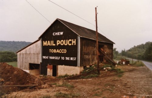
OH Rt. 550, east of OH Rt. 555 by about 2.2 miles. The barn is on the left side of the highway headed east. The MP sign faces east. One end. Black.
*GONE (razed and removed)* OH Rt. 550 west of OH Rt. 339, in Barlow, by about 0.5 mile. The barn was on the right side of the highway headed west. The MP sign faced south. One side. Black.
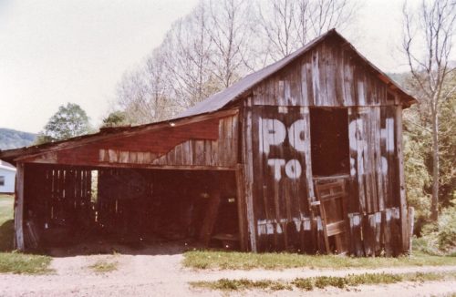
OH Rt. 60, south of OH Rt. 530, in Lowell, by about 2.6 miles. The ban is on the left side of the highway headed southeast. The MP sign faces northwest. One end. Black. Greatly faded. Also a Bicentennial barn.
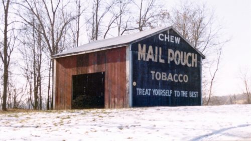
OH Rt. 60, south of OH Rt. 530 in Lowell, by about 3.0 miles. The barn is on the left side of the highway headed south. One end. One side. Black.
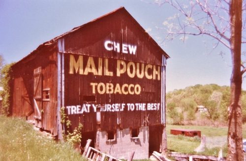
OH Rt. 821, northwest of OH Rt. 60 by about 2.0 miles. The barn is on the left side of the road headed northwest. The MP sign faces southeast. One end. Black.
*GONE (razed and removed)* OH Rt. 7, northeast of I-77 by about 10.7 miles. The barn was on the left side of the highway headed northeast. The MP sign faces southeast. One side. Black.
*GONE (fallen)* OH Rt. 26, east of I-77 by about 6.8 miles. The barn was on the right side of the highway headed east. the MP sign faced west. One end. Black.
OH-26, northeast of I-77 by about 8.5 miles. The barn is on the right side of the highway headed northeast. One end. One side. Black backgrounds.
OH Rt. 821, southeast of I-77 by about 1.4 miles. Two ends with distinct MP signs. One side with greatly faded MP sign. Black.
*GONE (razed and removed)*OH Rt. 550 west of OH Rt. 7 by about 1.5 miles. The barn was on the left side of the highway headed west, adjacent to the old Pinehurst Christian Church building. Two ends. One side. The north side was covered with a shed extension. Black backgrounds.
*GONE (fallen and removed)* OH Rt. 550, west of OH Rt. 339 by about 2.5 miles. This barn was on the right side of the highway headed west. The MP sign faced east. One end. Black.
OH Rt. 821 northeast of OH Rt. 60 by about 1.75 miles. The barn is on the right side of the highway headed northeast. Between I-77 and Oh Rt. 821. One end. Black.
OH Rt. 821 (Old Plank Rd.), east of Walnut St., in Whipple, by about 1500' The barn is on the right side of the highway headed east. One side & one end. Black.
OH Rt. 7 north of Co. Rd./Twp. Rd. 51 (Brigg's Hill Rd.) by about 1.3 miles. The barn is on the left side of the highway headed north and is very difficult to see due to the tank farm. One end. One side. Original Black backgrounds. Greatly faded.
*GONE* (razed and removed) Along the north side of OH-550 west of the intersection with OH-555, in Bartlett, by 2.7 miles. The barn was on the right side of the highway headed west from barteltt. The Mail Pouch sign faced east. One side. Black background.
*GONE (fallen)* OH Rt. 83, northwest of OH Rt. 60 by about 1.5 miles. The barn was on the left side of the highway headed northwest. The MP sign faced northwest. One end. Black.
*GONE* (fallen) OH Rt. 821 north of OH Rt. 530 by about 2.6 miles. The barn was on the right side of the highway headed north. The Mail Pouch sign faced south. The barn was quite a distance off the road, up on a hill in the trees and was difficult to see. One end. Black background.
*GONE* (razed and removed) OH Rt. 550 west of OH Rt. 7 by 0.9 mile. The barn was on the left side of the highway headed west just before entering Pinehurst. Two ends. Black.
Muskingum River Rd. (Rt 32) southeast of the intersection with Rt.60 (New Bridge St.), by 1.5 miles. The barn is on the left side of the highway headed southeast. The Mail Pouch sign faces west. One side. Black.
*GONE (razed and removed)* OH Rt. 26 southwest of OH Rt. 260 by about 5.0 miles. The barn was on the right side of the highway headed southwest. The MP sign faced east. One end. Black.
