- [01] Adams Co, OH (18)
- [02] Allen Co, OH (2)
- [03] Ashland Co, OH (14)
- [04] Ashtabula Co, OH (11)
- [05] Athens Co, OH (20)
- [06] Auglaize Co, OH (5)
- [07] Belmont Co, OH (24)
- [08] Brown Co, OH (32)
- [09] Butler Co, OH (8)
- [10] Carroll Co, OH (22)
- [11] Champaign Co, OH (9)
- [12] Clark Co, OH (3)
- [13] Clermont Co, OH (10)
- [14] Clinton Co, OH (4)
- [15] Columbiana Co, OH (19)
- [16] Coshocton Co, OH (14)
- [17] Crawford Co, OH (13)
- [18] Cuyahoga Co, OH (15)
- [19] Darke Co, OH (8)
- [20] Defiance Co, OH (7)
- [21] Delaware Co, OH (10)
- [22] Erie Co, OH (4)
- [23] Fairfield Co, OH (9)
- [24] Fayette Co, OH (3)
- [25] Franklin Co, OH (12)
- [26] Fulton Co, OH (4)
- [27] Gallia Co, OH (9)
- [28] Geauga Co, OH (10)
- [29] Greene Co, OH (1)
- [30] Guernsey Co, OH (34)
- [31] Hamilton Co, OH (6)
- [32] Hancock Co, OH (5)
- [33] Hardin Co, OH (5)
- [34] Harrison Co, OH (15)
- [35] Henry Co, OH (4)
- [36] Highland Co, OH (15)
- [37] Hocking Co, OH (7)
- [38] Holmes Co, OH (12)
- [39] Huron Co, OH (15)
- [40] Jackson Co, OH (8)
- [41] Jefferson Co, OH (11)
- [42] Knox Co, OH (13)
- [43] Lake Co, OH (2)
- [44] Lawrence Co, OH (9)
- [45] Licking Co, OH (17)
- [46] Logan Co, OH (5)
- [47] Lorain Co, OH (13)
- [48] Lucas Co, OH (5)
- [49] Madison Co, OH (6)
- [50] Mahoning Co, OH (13)
- [51] Marion Co, OH (5)
- [52] Medina Co, OH (9)
- [53] Meigs Co, OH (15)
- [54] Mercer Co, OH (3)
- [55] Miami Co, OH (4)
- [56] Monroe Co, OH (28)
- [57] Montgomery Co, OH (11)
- [58] Morgan Co, OH (20)
- [59] Morrow Co, OH (9)
- [60] Muskingum Co, OH (24)
- [61] Noble Co, OH (15)
- [62] Ottawa Co, OH (8)
- [63] Paulding Co, OH (6)
- [64] Perry Co, OH (8)
- [65] Pickaway Co, OH (7)
- [66] Pike Co, OH (9)
- [67] Portage Co, OH (8)
- [68] Preble Co, OH (9)
- [69] Putnam Co, OH (9)
- [70] Richland Co, OH (11)
- [71] Ross Co, OH (7)
- [72] Sandusky Co, OH (8)
- [73] Scioto Co, OH (16)
- [74] Seneca Co, OH (16)
- [75] Shelby Co, OH (5)
- [76] Stark Co, OH (16)
- [77] Summit Co, OH (5)
- [78] Trumbull Co, OH (3)
- [79] Tuscarawas Co, OH (15)
- [80] Union Co, OH (9)
- [81] Van Wert Co, OH (5)
- [82] Vinton Co, OH (9)
- [83] Warren Co, OH (3)
- [84] Washington Co, OH (34)
- [85] Wayne Co, OH (20)
- [86] Williams Co, OH (4)
- [87] Wood Co, OH (5)
- [88] Wyandot Co, OH (10)
US Rt. 35 north of OH Rt. 93, north of Jackson, by about 7.0 miles to Co. Rd. 70 (Savageville School Rd.). Turn right onto Co. Rd. 70 and travel about 800'. The barn is high in a field on the right side of the road. The MP sign faces southwest. One end. Black. Greatly faded.
US Rt. 35 north of OH Rt. 93, north of Jackson, on the right side of the highway headed north. Just before the barn there is Co. Rd. 71 (Lloyd Bridges Rd.) to the right. Make the right turn onto CO.Rd. 71. The barn is on the left side of the road approximately 200' from US Rt. 35. The MP sign faces west. One side. Black.
*GONE (razed and removed)* Along the northeast side of OH-139 north of the OH-139/OH-279 Junction by 1.8 miles. The barn was on the right side of the highway headed northeast. The Mail Pouch sign faced southwest. On end. Black Background.
*GONE* (razed and removed) Along the northeast side of OH-93 south of OH-124, in Jackson, by 5.8 miles. The barn was on the left side of the highway headed southeast from Jackson. Directly across the hgihway from the Camba Rd (TH-15) intersection. The Mail Pouch sign faced southeast. One end. Black background.
*GONE* (painted over) Along the west side of OH-152 (Main St) west of Wood St. intersection, in Smithfield, by 1.0 mile. The barn is on the right side of the highway, headed west from Smithfield, in the distance, completly hidden by trees. The Mail Pouch sign faced east. One side. Black Background.
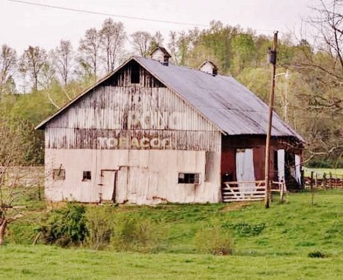
OH-152, north of Pine Valley by about 1.7 miles. The barn is on the left side of the highway headed north. One end. One side. White Back Ground. This was originally a standard Black Background barn with a Mail Pouch sign on the southeast side of the barn (see Photo 2).
OH Rt. 152 south of Smithfield-Adena Rd. (CR-10) intersection, in Smithfield, by 1.8 miles. On the right side of the highway headed south. The Mail Pouch sign is on the south side of the barn. One side. Original Black Background.
*GONE* (painted over) US Rt. 36/OH Rt. 3 (Columbus Rd.) past the intersection with Co. Rd. 1 headed east out of Mt. Liberty. The barn is on the right side of the highway headed east. The MP sign faced east. One end. Original Black background.
US-62 (Millersburg Rd.) east of Danville by about 2.0 miles. At Mickley Rd. (CR-88). On the right side of the highway headed east. There were three Mail Pouch signs on the barn. One on each end and one on the west side. All original black back ground. Only the sign on the north end remains improperly repainted with a red back ground. The signs on the south end and the west side have been painted over.
*GONE* (fallen) US Rt. 36/ OH Rt. 3 (Columbus Rd.) just east of the Delaware Co. line. The barn was on the right side of the highway headed northeast from Delaware County. Two ends. Black.
US Rt. 36/OH Rt. 3 (Columbus Rd.) northeast of the Delaware Co. line by about 5.2 miles. The barn is on the right side of the highway headed northeast. The MP sign faces northeast. One end. Black. Greatly faded.
*GONE (razed and removed)* OH Rt. 229 (Newcastle Rd.) east of US Rt. 62 by about 1.2 miles. The barn was on the left side of the highway headed east. The MP sign faced east. One end. Black.
*GONE (fallen and removed)* OH Rt. 13 (Newark Rd.) south of US Rt.36, in Mt. Vernon, by about 3.5 miles. The barn was on the right side of the highway headed south. One end. One side. Red.
*GONE* OH Rt. 36 west of Mt. Vernon. Unknown location. See 'Other Information' above.
*GONE*(razed and removed) The barn was along the south side of Millersburg Rd, west of the intersection with Market St, in Martinsburg, by 0.5 miles. The barn was on the left side of the highway headed west on Millersburg Rd. The Mail Pouch sign faced north. One end. Black Background.
*GONE* (razed and removed) The barn was located along the southeast side of Wooster Rd, northeast of the intersection with Main St, In Mount Vernon, by 10.8 miles. The barn was on the right side of the highway headed northeast from Mount Vernon. Two Mail Pouch signs. One on the west end; and, one on the north side. Black Background.
*GONE* (painted over and now apparently new vertical siding) US Rt 20 (N. Ridge Rd.) west of the Lake Co./Ashtabula Co. line by 2.0 miles. The barn is on the left side of the highway headed west. The Mail Pouch sign faced west. One end.
*GONE (fallen and removed)* OH Rt. 7 south of OH Rt. 217 by about 2.0 miles. Just south of Athalia. The barn was on the right side of the highway headed south. The MP sign faced south. One end. Black.
OH Rt. 141, north of OH Rt. 775 by about 3.6 miles. The barn is on the right side of the highway headed north. Two ends (South end *GONE - boarded over*) North end remains; however is fading. Black.
*GONE (fallen and removed)* OH-141, north of OH-775 by about 2.9 miles. The barn was on the left side of the highway headed north. Two sides. Black backgrounds.
