- [01] Adams Co, PA (2)
- [02] Allegheny Co, PA (32)
- [03] Armstrong Co, PA (13)
- [04] Beaver Co, PA (12)
- [05] Bedford Co, PA (18)
- [06] Berks Co, PA (10)
- [07] Blair Co, PA (4)
- [08] Bradford Co, PA (1)
- [10] Butler Co, PA (19)
- [11] Cambria Co, PA (16)
- [13] Carbon Co, PA (1)
- [14] Centre Co, PA (12)
- [16] Clarion Co, PA (13)
- [17] Clearfield Co, PA (11)
- [18] Clinton Co, PA (6)
- [20] Crawford Co, PA (15)
- [21] Cumberland Co, PA (5)
- [22] Dauphin Co, PA (8)
- [24] Elk Co, PA (2)
- [25] Erie Co, PA (11)
- [26] Fayette Co, PA (29)
- [27] Forest Co, PA (3)
- [28] Franklin Co, PA (4)
- [29] Fulton Co, PA (10)
- [30] Greene Co, PA (29)
- [31] Huntingdon Co, PA (10)
- [32] Indiana Co, PA (14)
- [33] Jefferson Co, PA (11)
- [34] Juniata Co, PA (5)
- [36] Lancaster Co, PA (6)
- [37] Lawrence Co, PA (12)
- [39] Lehigh Co, PA (8)
- [40] Luzerne Co, PA (1)
- [41] Lycoming Co, PA (1)
- [42] McKean Co, PA (8)
- [43] Mercer Co, PA (17)
- [44] Mifflin Co, PA (7)
- [45] Monroe Co, PA (5)
- [46] Montgomery Co, PA (1)
- [47] Montour Co, PA (0)
- [48] Northampton Co, PA (5)
- [49] Northumberland Co, PA (1)
- [50] Perry Co, PA (5)
- [51] Philadelphia Co, PA (1)
- [54] Schuylkill Co, PA (2)
- [56] Somerset Co, PA (22)
- [59] Tioga Co, PA (1)
- [61] Venango Co, PA (7)
- [62] Warren Co, PA (2)
- [63] Washington Co, PA (29)
- [64] Wayne Co, PA (2)
- [65] Westmoreland Co, PA (24)
- [67] York Co, PA (8)
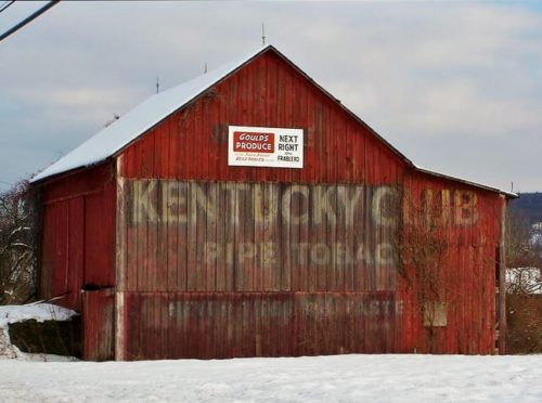
US Rt. 209 east of PA Rt. 715, in Brodheadsville, by about 0.7 mile. The barn is on the right side of the highway headed east. The KC sign faces west. One end. Red.
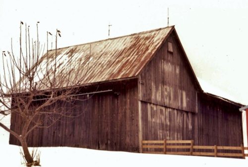
(This sign may be totally faded away) Along the northwest side of Guys Mill Rd. (PA-27) east of PA-77 (Hickory St.), in Meadville, by about 13.8 miles; and, west of PA-8 (Spring St.) in Titusville, by about 12.5 miles. The barn is on the north side of the highway. The Melo Crown sign faces northeast. One end. Black Background. Greatly faded.
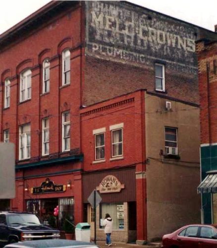
Along the west side of S. Broad St. (PA-173/PA-208, in Grove City, north of College Ave. intersection by about 190'. The three-story brick building is on the left side of S. Broad St. headed north from College Ave.The Melo Crown sign faces north. Three-story brick building. Black Background. Greatly faded.
Along the south side of US-30 (Chambersburg Rd./Lincoln Hwy.) at intersection with PA-234 (Buchanan Valley Rd.). Two ends. Black backgrounds.
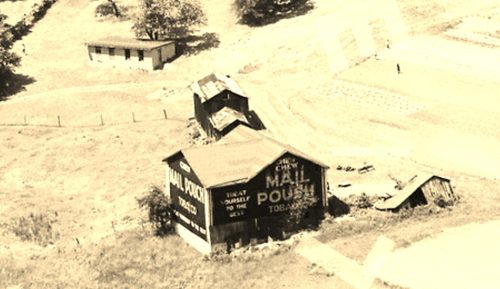
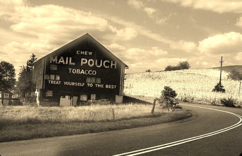
*GONE (razed and removed)* Along the nothwest side of US-30 (Lincoln Hwy.) northeast of the US-15 cloverleaf intersection (east of Gettysburg) by about 3.4 miles. The barn was on the left side of the highway headed northeast. The Mail Pouch sign faced southwest. One side. Black background.
At 511 Wallace Road in Wexford. One end. Partially covered by addition/awning. The Mail Pouch sign faces east. One end. Black.
*GONE (faded away)* Bull Creek Rd. northwest of PA Rt. 28 (Allegheny Valley Expressway), by about 3.2 miles. The barn is on the left side of the road headed northwest. The Mail Pouch sign faced east. One end. Black background.
*GONE (fallen down)* Along the northwest side of PA-28/PA-66 (Alexander H. Lindsay Memorial Hwy.), north of US-422 by about 3.4 miles. The barn was on the left side of the highway headed northeast. One end - faced southeast. One side - faced northeast. Black backgrounds.
*GONE* (fallen) Along the northeast side of PA-66 (River Rd.) northwest of PA-56 (Dime Rd./1st St.), in Vandergrift, by about 3.7 miles. Just past PA-2057 (Airport Rd.). The barn is on the right side of the highway headed north. The Mail Pouch sign faced southeast One end. Black background.
*GONE* (still standing but boards reversed so sign is no longer visible) Along the northeast side of PA-66 north of 3rd St., in Leechburg, by about 8.8 miles. About 0.2 mile north of the intersection of PA-66 with Crooked Creek Dam Road. The barn is on the right side of the highway headed northwest. The sign faced northwest. Black background.
*GONE* In the vicinity of the Jefferson St. & Main St. intersection, in North Vandergrift. Appears to be a barn building. At least two and possibly 3 or 4 Mail Pouch signs on this building . Black Backgrounds.
*GONE* (razed and removed)* Along the southwest side of Benjamin Franklin Hwy. (US-422) northwest of the Salt Work St. intersection, in Elderton, by about 2.6 miles. The barn was on the left side of the highway headed northwest from Elderton. The Mail Pouch sign faced southeast. One end. Black background.
*GONE* (painted over) Along the south side of Freeport Rd. (TH-3017) northeast of the PA-28 (Allegheny Valley Expressway) interchange by about 3.3 miles. The barn is on the right side of the road headed east. There was a Mail Pouch sign on each end of the barn. Two ends. Black backgrounds.
*GONE * (razed and removed) PA-65 (Mercer Rd./65th Infantry Division Memorial Hwy.) south of PA-588 intersection by about 1.4 miles. The barn was on the right side of the highway headed south from PA-588. The Mail Pouch sign faced south. One end. Black background.
*GONE* (razed and removed) 233 Glen Eden Rd., in Rochester. The barn was northwest of the PA-989 intersection by 0.7 miles. The barn was on the right side of the highway headed northwest. The Mail Pouch sign faced southeast. One end. Red background.
*GONE* PA-18, near Raccoon State Park, south of US-30 intersection, in Harshaville, by 4.2 miles. The barn was on the left side of the highway headed south from Harshaville. The Mail Pouch sign faced north. One end. Black background.
*GONE* (razed and removed) PA-18 (Frankfort Rd.) south of Shippingport Rd./Green Garden Rd. intersection by 1.0 mile. The barn was on the right side of the road headed south. The Mail Pouch sign faced northeast. One end. Black background.
*GONE* (razed and removed) Along the west side of Frankfort Rd. (PA-18) north of Shippingport Rd./Green Garden Rd. intersection by about 1.5 miles. The barn was on the left side of the road headed north. The Mail Pouch sign faced east. One side. Black background.
*GONE* (razed and removed) Along the northeast side of Darlington Rd. southeast of the PA-51 (Constitution Blvd.) intersection by 0.6 mile. The barn was on the left side of the road headed southeast. The Mail Pouch sign faced southwest toward PA-51. One end. Black background.
US-220 (Bedford Valley Rd.) south of US-30, in Bedford) by about 11.7 miles. The barn is on the right side of the highway headed south. The Mail Pouch sign faces south. One end. Black background. Greatly faded.
