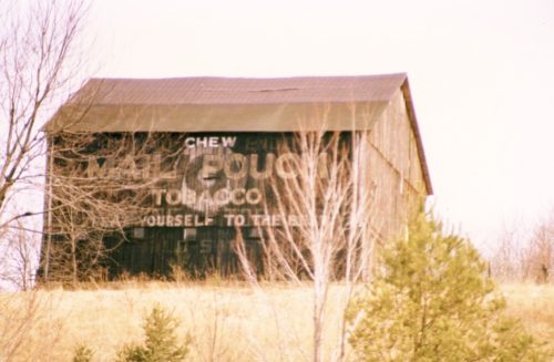
PA Rt. 36 (Colonel Drake Hwy.) northwest of PA Rt. 53 (Gallitzin Rd./W. Main St.), in Ashville, by about 1.1 mile. The barn is on the right side of the highway headed northwest. The MP sign faces southeast. One end. Black background.
PA Rt. 36 (Colonel Drake Hwy.) northwest of PA Rt. 53 (Gallitzin Rd./W. Main St.), in Ashville, by about 5.0 miles. The barn is on the left side of the highway headed north, and almost directly across from the intersection with Sr 1023. The MP sign on the end faces east. The MP sign on the side faces north. Black. Faded.
PA Rt. 36 (Colonel Drake Hwy.) northwest of PA Rt. 53 (Gallitzin Rd./W. Main St.), in Ashville, by about 7.3 miles. The barn is on the left side of the highway headed northwest. MP end face southeast and northwest. The MP side faces northeast. Black. Faded.
*GONE (razed and removed & replaced with a new barn)* US-219 (Plank Rd.), at the intersection with PA-553 (Ridge Rd.). The barn was south of Carroll St., in Carrollton, by about 1.8 miles. The barn was on the left side of the highway headed southwest. Two ends. Black backgrounds.
PA Rt. 53 (Portage St.) south of PA Rt. 160 (Man St./Evergreen Rd.), in Wilmore, by about 0.9 mile. The barn is on the right side of the highway headed southwest. The Mail Pouch end faces east. The Mail Pouch side faces south. Red Background.
PA Rt. 2014 (Old US Rt. 22/Admiral Peary Highway), east of PA Rt. 164 (Munster Rd.) intersection, in Munster; and west of US Rt. 22 intersection, in Cresson, by about 3.8 miles. The MP barn is on the south side of the highway. The MP sign faces west. One side. Black.
*GONE (barn razed)* US Rt. 422 (Benjamin Franklin Hwy.) southeast of PA Rt. 271 (Duman Rd.), in Belsano, by about 0.6 mile . The barn is on the left side of the highway headed southeast toward Ebensburg. Hard to see because it is very close to an elevated overpass and the trees. (just east of the overpass). The MP sign faces northwest. One side. Black.
*GONE* Admiral Peary Hwy. (C Rt. 2014), east of the Munster Rd. intersection, in Munster by about 1.4 miles. The barn was on the north side of the highway (on the left, headed east). The Mail Pouch sign faced southwest. One end. Black background.
*GONE (razed and removed) US Rt. 22 southwest of the US Rt. 22/US Rt. 219 Cloverleaf intersection by about 1.6 miles. The barn was on the left side of US Rt 22 headed southwest from the intersection. The Mail Pouch sign faced northeast. One end. Black background.
*GONE (razed and removed)* Off of Sutton Rd. Backed up on Fogle Rd. East of Main St. in Ashville by about 0.7 mile. Take PA Rt 36 (Liberty St.) east out of Ashville 0.5 mile to Sutton Rd. Bear left onto Sutton Rd. The barn was on the left. The Mail Pouch sign faced west and was visible from PA Rt. 36. One end. Black background.
*GONE (fallen)* US Rt. 422 (Benjamin Franklin Hwy.) northwest of the US Rt. 219 intersection, west of Ebensburg, by about 4.5 miles. The barn was on the south side of the highway (on the left side headed northwest from US Rt. 219). The Mail Pouch sign faced north. One end. Black background.
*GONE (razed and removed)* US Rt. 219 (Plank Rd.) south of Carroll St. intersection, in Carrolltown by about 2.6 miles. The Mail Pouch barn was on the west side of the highway (right side headed south from Carrolltown). The Mail Pouch sign faced east toward US Rt. 219. One side. Black background.
Along the north side of Forest Hills Rd. (PA-160) southwest of the intersection with Center St., in Salix, by 1.2 miles. The barn was on the right side of Forest Hills Rd. headed southwest from Salix. The Mail Pouch sign faced west. One end. Black background.
*GONE* US Rt. 219 (Theatre Rd.) northwest of Carroll St., in Carrolltown, by 3.6 miles. The barn was on the ridge along the east side of US Rt. 219. The Mail Pouch sign which faced west was visible from US Rt. 219. One side. Black background.
*GONE (torn down)* On PA Rt. 36 in downtown Patton. Side of wooden building.
Main St., in Johnstown, southeast of the intersection with Market St., by about 150'. The three story masonry building is on the left side of the street headed southeast. The OWL sign faces northwest. One side. Three story masonry building. Green background.


