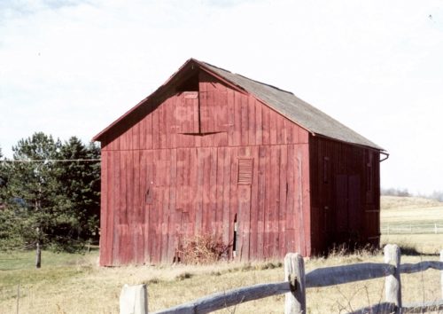
*GONE (torn down in 2006)* PA Rt. 985 (Somerset Pike), south of US Rt. 30 (Lincoln Hwy.) intersection, in Jennerstown, by about 2.8 miles. The barn was on the right side of the highway headed south. Two ends. Red. House now stands where barn was.
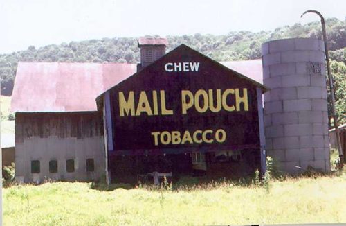
PA-985 (Somerset Pike), north of US-30 (Lincoln Hwy.) intersection, in Jennerstown, by about 2.4 miles. The barn is on the left side of the highway headed north the Mail Pouch sign faces northeast. One side. Red background.
*GONE (fallen)* Greenwood Drive, just off of PA Rt. 160. Take PA Rt. 160 north from US Rt. 33 about 3.5 miles to School Road. Make a right onto School Road and then an immediate left onto Greenwood Drive. Barn was on the right. One side. Black.
*GONE* (razed and removed) TR-799 (Old Lincoln Highway), west of US-30 by about 0.5 mile. The barn was on the right side of the highway headed west and directly across from the Cemetery Rd. intersection. The Mail Pouch sign faced east. One side. Black background.
PA-160, south of PA-56 by 4.5 miles. Havego Road/Coolspring Drive intersect PA-160 about 1200' north of this barn. Barn is on right side headed south. One end. Black background.
*GONE (razed and removed)* PA Rt. 523 (Listonburg Road) southeast of PA Rt. 523 (Oden St.)/PA Rt. 281 (Casselman St.) interchange, in Confluence, by about 2.5 miles. The barn was on the right side of the highway headed southeast. the MP sign faced southeast. One side. Black.
*GONE* (fallen) USRt. 30 (Lincoln Hwy) east of PA Rt. 281 (E Main St), in Stoystown, by about 1.6 miles. The barn was on the right side of the highway headed southeast. Two ends. One (Black Background) end faced north toward US Rt. 30 (Lincoln Hwy) and the other (Red Background) end faced south toward T-799 (old Lincoln Hwy).
PA-403 (Whistler Rd.), north of US-30 by about 6.5 miles. Front section of barn has fallen off and is gone, so part of sign is missing. Just south of intersection with Blough Road. Barn is on right side of the highway headed northeast from US-30. The Mail Pouch sign faces southwest. One end. Black background.
*GONE* PA Rt. 985 (Somerset Pike), north of Thomas Mills on the west side of the road, at the intersection with Bowser Lane. North side of Bowser Lane, just west off of Rt. 985. Two ends. Black.
*GONE* Ross Rd. (T627) northeast of PA Rt. 281 (Stoystown Rd.) by about 0.1 mile. One end. Black.
*GONE (razed and removed)* PA Rt. 31 (Glades Pike) southeast of PA Rt. 281 (Pleasant Ave.), in somerset, by about 4.6 miles. (PA Rt. 31 is N. Main St. in Somerset). The barn is on the left side of the Pike headed southeast. The Mail Pouch sign faced southeast. One side. Black.
*GONE* PA Rt. 985 (Somerset Pike) northeast of US Rt. 30 (Lincoln Hwy.), in Jennerstown, by about 4.7 miles. Just before the Roaring Run Rd. intersection. The barn was on the left side of the highway headed northeast. The MP sign faced northeast. One end. Black.
*GONE* (razed and removed) Along the southeast side of PA-403 (Whistler Rd.), in Kantner, northeast of US-30 (Lincoln Hwy) by 0.6 mile. The barn/garage was on the right side of Whistler Rd. headed northeast from Kantner. The Mail Pouch sign faced northeast. One end. Black background.
*GONE* (razed and removed) Along the west side of US-219 (Mason Dixon Hwy.), south of Ord St., in Salisbury, by about 2.1 miles and about 280' north of the PA/MD state line. The barn was on the right side of the highway headed south. The Mail Pouch sign faced north. Torn down for access to an industrial site. One side. Black background.
*GONE (painted over)* PA Rt. 281 (New Centerville Rd.) southwest of PA Rt. 31 (E. Main St.) intersection, in Somerset, by about 6.3 miles. The barn is on the left side of the highway headed southwest. Two ends. Red backgrounds.
*GONE (barn razed)* PA Rt. 31 (Glades Pike) west of the Center Ave. intersection, in Somerset, by 3.5 miles. The barn was on the right side of the highway headed east toward Somerset. The MP sign faced west. Black background.
*GONE* (razed and removed) PA-653 (Bridge St.) southeast of PA-281, intersection, in New Centerville, by about 2.0 miles. The barn was on the right side of the highway headed southeast. Two ends. Original Black Background The barn had been painted red and the old Mail Pouch signs were bleeding through.
*GONE* (razed and removed) Along the east side of PA-523 (Listonburg Rd.), just south of Harnedsville by 1.3 miles. Northeast of US-40 intersection (just east of Addison), by 3.7 miles. The barn was on the right side of the road headed northwest. The Mail Pouch sign faced northwest. One end. Black background.
*GONE (razed and removed)* Along the southwest side of US-30 (Lincoln Highway) northwest of PA-160 intersection by 0.8 miles. The barn was on the left side of the highway headed northwest. The Mail Pouch sign faced northwest. One end. Black background.
PA-281 (Kingwood Drive), northeast of PA-281 (Casselman St.)/PA-523 (Oden St.) intersection, in Confluence, by about 3.1 miles. The barn is on the right side of the highway headed northeast. Two ends. Black backgrounds.


