- [09] Bay Co, MI (1)
- [11] Berrien Co, MI (2)
- [12] Branch Co, MI (8)
- [13] Calhoun Co, MI (10)
- [14] Cass Co, MI (3)
- [15] Charlevoix Co, MI (0)
- [23] Eaton Co, MI (2)
- [24] Emmet Co, MI (0)
- [25] Genesee Co, MI (2)
- [29] Gratiot Co, MI (2)
- [30] Hillsdale Co, MI (6)
- [33] Ingham Co, MI (2)
- [34] Ionia Co, MI (1)
- [37] Isabella Co, MI (2)
- [38] Jackson Co, MI (4)
- [39] Kalamazoo Co, MI (1)
- [44] Lapeer Co, MI (2)
- [45] Leelanau Co, MI (1)
- [46] Lenawee Co, MI (7)
- [47] Livingston Co, MI (1)
- [58] Monroe Co, MI (8)
- [62] Newaygo Co, MI (1)
- [63] Oakland Co, MI (1)
- [70] Ottawa Co, MI (0)
- [73] Saginaw Co, MI (3)
- [74] Saint Clair Co, MI (3)
- [75] Saint Joseph Co, MI (1)
- [76] Sanilac Co, MI (1)
- [78] Shiawassee Co, MI (3)
- [79] Tuscola Co, MI (1)
- [80] Van Buren Co, MI (2)
- [81] Washtenaw Co, MI (7)
- [82] Wayne Co, MI (2)
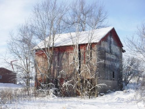
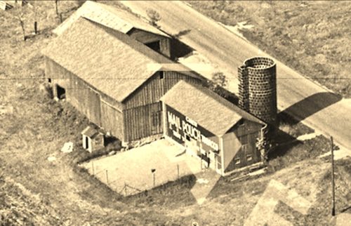
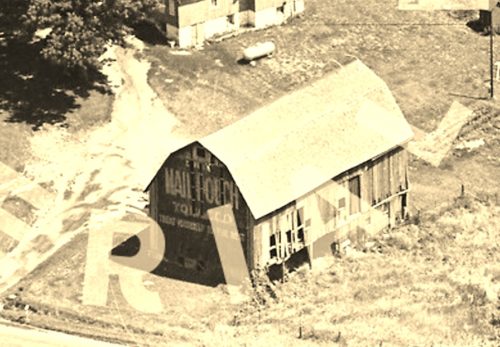
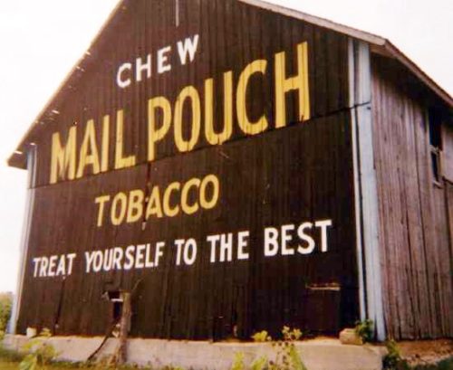
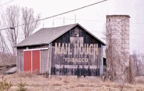
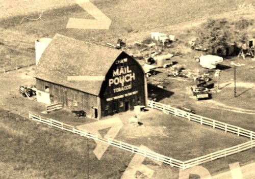
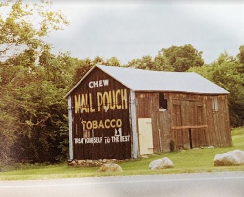
*GONE* Along the south side of E. Michigan Ave. east of the Kalamazoo Ave. traffic circle, in Marshall, by 3.8 miles. The barn was on the right side of E. Marshall Ave. headed east out of Marshall. Mail Pouch sign on east and west side of the barn. Black backgrounds.
*GONE* (razed and removed) Along the east side of 28 Mile Rd (MI-99) south of the Erie St. intersection, in Albion, by 5.1 miles. (note that 28 Mile Rd. becomes S. Superior St. on the southern outskirts of Albion.) The barn was on the left side of 28 Mile Rd. headed south out of Albion. The Mail Pouch sign faced south. One end. Black background.
*GONE* (razed and removed) Along the north side of MI-62 west of the State St. Intersection, in Cassopolis, by about 4.4 miles. MI-62 becomes N. Broadway St. just as you enter Cassopolis from the north. The barn was on the right side of MI-62 heading west. The Mail Pouch sign faced west. One end. Black background.
*GONE* (razed and removed) Along the south side of US-12 east of the intersection with MI-62 (on the northern edge of Edwardsburg) by 0.5 mile. The barn was on the right side of US-12 headed east from MI-62. The Mail Pouch sign faced west. One end. Black background.
*GONE* Along the southeast side of Lansing Rd. northeast of the merge point with Lawrence Ave., in Charlotte, by 4.9 miles. The barn was on the right side of Lansing Rd. headed northeast from Charlotte. The Mail Pouch sign faced north. One end. Black background.
*GONE* (razed and removed) Along the north siad of W. Corunna Rd. (MI-21) east of MI-13 by about 3.1 miles. The barn was on the left side of the highway headed east. One Mail Pouch end faced south. One Mail Pouch side faced west. Original Black background.
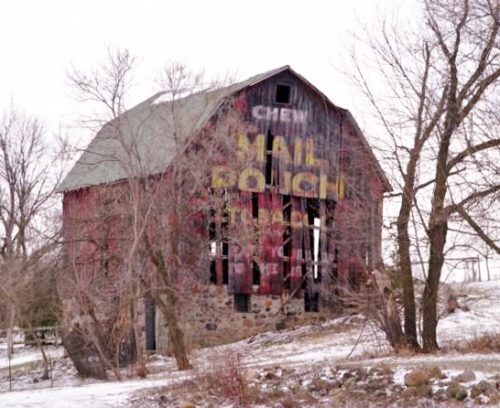
*GONE* (razed and removed) Along the west side of S. Bagley Rd. (old US hwy 27), south of the interection with E. Washington Rd. (west of Ithaca) by 1.1 miles. The barn was on the right side of S. Bagley Rd. headed south from E. Washington Rd. Mail Pouch sign is facing south. One end shown (see 'other information'). Red Background.
*GONE* (fallen and removed) Along the southeast side of E. Chicago Rd. (US-12) northeast of the US-12/MI-99 split, in Jonesville, by about 7.2 miles. The barn was on the right side of the highway headed northeast. The Mail Pouch sign faced southwest. One end. Black background.
*GONE* (Mail Pouch sign removed - see 'other information') Along the west side of W. Carleton Rd. (MI-99) southeast of US-12 (W. Chicago Rd.) by about 2.3 miles. The barn was on the right side of the highway headed southeast. The Mail Pouch sign faced north. One end. Original black had been over painted red.
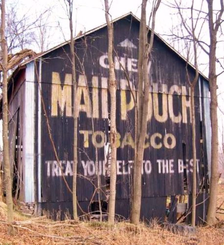
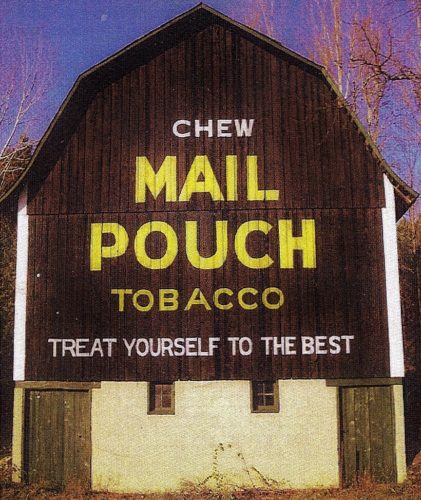
Along the east side of S. Hillsdale Rd. at the southwest corner of S. Hillsdale Rd. & Lilac Rd. intersection, south of Bacon St., in Hillsdale, by about 6.8 miles. The barn is on the right side of the road headed south. The Mail Pouch sign faces south. One side. Black background. An extension along the southside of the barn shields the Mail Pouch sign; however, it is visible.
*UNKNOWN* (see "Other Information') Along the east side of S. Hillsdale Rd. south of Bacon St., in Hillsdale, by about 4.0 miles. The barn is/was on the left side of the road headed south. The Mail Pouch sign faces south. One end. Black background.
*GONE* (razed and removed) Along the southwest side of e. Chigago Rd. (US-12) east of the Moscow Rd. intersection, in Moscow, by 2.1 miles. the barn was on the right side of E. Chicago Rd.headed east from Moscow.
*GONE* (razed and removed) Along the west side of S. Meridian Rd. (US-127) south of the intersection with W.Main St./Hudson Rd. (MI-34), in Hudson, by 5.9 miles. The barn was on the right side of S. Meridian Rd. headed south from Hudson. There was a Mail Pouch sign on each end of the barn. Black backgrounds.
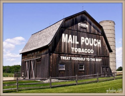
Along the west side of S. Shepherd Rd. south of E. Wright Ave., in Shepherd, by about 1.9 miles. From E. Wright Ave, turn south onto Chippewa St. About 1.1 miles south of E. Wright Ave., Chippewa St becomes S. Shepherd Rd. The barn is another 0.8 mile south of this point. The barn is on the right side of the road headed south, just north of E. Fremont Rd. The Mail Pouch sign faces north. One end. Black background. The barn and the Mail Pouch sign have been restored.
*GONE* (razed and removed. Along the west side of N. Chippewa Rd. south of E. Saginaw Rd. by about 0.1 mile. To access the barn site from Coleman; from 5th St., in Coleman, take Railway St. northwest about 2.3 miles to N. Chippewa Rd. Make left onto N. Chippewa Rd. The barn was on the right side of N. Chippewa Rd. headed south fro Saginaw Rd. The Mail Pouch sign faced east. One end. Black background.
*GONE (fallen & removed)* Along the north side of Spring Arbor Rd (MI-60) east of N Main St interection, in Concord, by 2.1 miles. The barn was on the left side of the highway headed east from Concord. Mail Pouch sign on the west side and Mail Pough sign on the south end. Black Backgrounds.
Along the northwest side of I-94 west of the US-131 overpass (south of Kalamazoo), by about 4.3 miles. The barn is off behind trees on the right side of the highway headed southwest. Very difficult to see when the trees are in foliage. The Mail Pouch sign faces east. See driving instructions to the barn provided by Mark Comstock in 'Other Information'. One end. Black background. Greatly faded.
*GONE* (fallen) Along the west side of N. Van Dyke Rd.(MI-53) north of Armstrong Rd, in Goodland by about 1.2 miles. The barn was on the left side of the highway headed north. the Mail Pouch sign faced north. One end. Black background.
Along the north side of Hemingway Lake Rd., east of 11th St. ( south of Otter Lake) by about 0.7 mile. The barn is on the left side of the road headed east. The Mail Pouch sign faces south. One end. Black background.
Along the wesst side of S. Lake Shore Dr., South of MI-204 (Philip St.), in Lake Leelanau, by about 4.9 miles. From MI-204 (Philip St.) turn south onto St. Mary's St. which becomes S. Lake Shore Dr. The barn is on the right side of the road headed south. The Mail Pouch sign faces east. One end. Black background.
