- [01] Barbour Co, WV (9)
- [02] Berkeley Co, WV (2)
- [03] Boone Co, WV (4)
- [04] Braxton Co, WV (7)
- [05] Brooke Co, WV (2)
- [06] Cabell Co, WV (8)
- [07] Calhoun Co, WV (6)
- [09] Doddridge Co, WV (3)
- [10] Fayette Co, WV (4)
- [11] Gilmer Co, WV (2)
- [13] Greenbrier Co, WV (5)
- [14] Hampshire Co, WV (7)
- [15] Hancock Co, WV (1)
- [16] Hardy Co, WV (0)
- [17] Harrison Co, WV (7)
- [18] Jackson Co, WV (12)
- [20] Kanawha Co, WV (6)
- [21] Lewis Co, WV (5)
- [22] Lincoln Co, WV (8)
- [23] Logan Co, WV (0)
- [24] Marion Co, WV (16)
- [25] Marshall Co, WV (14)
- [26] Mason Co, WV (12)
- [29] Mineral Co, WV (5)
- [31] Monongalia Co, WV (8)
- [32] Monroe Co, WV (1)
- [33] Morgan Co, WV (1)
- [34] Nicholas Co, WV (5)
- [35] Ohio Co, WV (16)
- [37] Pleasants Co, WV (3)
- [38] Pocahontas Co, WV (3)
- [39] Preston Co, WV (6)
- [40] Putnam Co, WV (4)
- [42] Randolph Co, WV (11)
- [43] Ritchie Co, WV (8)
- [44] Roane Co, WV (6)
- [46] Taylor Co, WV (14)
- [47] Tucker Co, WV (1)
- [48] Tyler Co, WV (4)
- [49] Upshur Co, WV (5)
- [50] Wayne Co, WV (10)
- [51] Webster Co, WV (4)
- [52] Wetzel Co, WV (4)
- [53] Wirt Co, WV (5)
- [54] Wood Co, WV (15)
*GONE* (razed and removed) Along the southwest side of Waynesburg Pike Rd. (US-250), northwest of intersection with WV-891 by 6.0 miles. The barn was on the left side of the highway headed northwest. The Mail Pouch sign face north. One end. Black background.
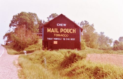
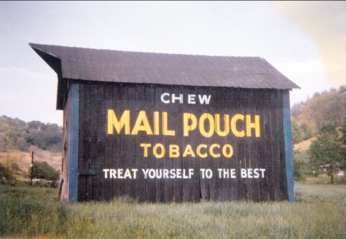
Along the northeast side of WV-62 (Charleston Rd.) southeast of WV-2 (Ripley Rd.) by about 6.2 miles. The barn is on the left side of the highway headed southeast. The Mail Pouch sign faces southeast. One end. Black background.
*GONE* (fallen and removed) Along the west side of Huntington Rd. (WV-2) south of US-35 by about 11.4 miles. The barn was on the right side of the highway headed south. The Mail Pouch sign faced northeast. One end. Black background.
Along the west side of Huntington Rd. (WV-2) south of US-35 by about 9.1 miles. The barn is on the right side of the highway headed south. The Mail Pouch sign faces east. One side. Black background.
*GONE* (raised and removed) Along the east side of WV-62 (Charleston Rd.) north of the Allen St. (cr 1/1), in Buffalo, by 5.4 miles. South of the MPB/MCB 48-26-09 site by 0.3 mile. The barn was on the right side of the highway headed north. The Mail Pouch sign faced west. One side. Original Black background on a barn that was subsequently painted red and the original Mail Pouch sign bled through the red overpaint.
Along the east side of Kanawha Valley Rd. (US-35/WV-817) south of WV-2 by 17.6 miles. The barn is on the left side of the highway headed south. Two ends. Black backgrounds.
*GONE* (razed and removed) Along the southwest side of Evans Rd. (WV-87) southeast of the intersection with WV-2 by 5.2 miles, The barn was on the right side of Evans Rd. headed southeast. The Mail Pouch sign faced northeast. One side. Black background.
*GONE* (razed and removed) Along the south side of Fairview St, in Piedmont, just west of Oak St. The Mail Pouch signs faced north. One end. Black backgrounds.
*GONE* (razed and removed) Along the north side of Northwestern Turnpike (US-50) just west of WV-93 (Lane Dale Rd.) intersection by 0.2 miles, and west of CR-50/5 intersection, in Hartsmanville, by 6.0 miles. The barn was on the right side of the highwayheaded west from Hartsmanville. The Mail Pouch sign faced west. One end. Black background.
*GONE* (razed and removed) Along the north side of Northwestern Turnpike (US-50) west of the US-50/US-220 split by 0.7 mile. The barn was on the right side of the Northwest Turnpike headed west. The Mail Pouch sign faced east. One side. Black background.
Along the southeast side of Mason-Dixon Hwy. (WV-7), west of WV-218 by about 4.1 miles. The barn is on the left side of the highway headed southwest. Two ends. Black backgrounds.
*GONE* (fallen and removed)Along the north side of Mason-Dixon Hwy. (WV-7) west of I-79 by about 8.1 miles. The barn was on the right side of the road headed west. Two ends. Black backgrounds.
*GONE* (razed and removed) Along the southeast side of Mason Dixon Hwy. (WV-7) northeast of the US-250 intersection intersection by 4.4 miles miles. The barn was on the right side of the highway headed northeast from US-250. Two sides. black backgrounds.
WV-3 (Wayside Creamery Rd/Wolf Creek Rd) northwest of US-219, in Pickaway, by about 450'. The barn is on the right side of the highway headed northwest. The Mail Pouch sign faces west. One end. Black. Greatly faded.
*GONE* (painted over) Along the southeast side of Martinsburg Rd. (WV-9) east of US-522 intersection, in Berkeley Springs, by 4.3 miles. The barn is on the right side of the highway headed northeast. The Mail Pouch sign faced northeast. One end. Original black background.
*GONE* (razed and removed) Along the southwest side of Scenic Highway (WV-55) east of US-19, by 4.0 miles. The barn was on the right side of the highway headed east. Two ends. black backgrounds.
*GONE* (razed & removed) Along the south side of Scenic Hwy (WV-55) east of US-19 by about 1.1 miles. The barn was on the right side of the highway headed east. The Mail Pouch sign faced east. One side. Black Background.
*GONE* (razed & removed) Along the east side of Turnpike Rd. (WV-39) west of WV-41 (Main St..) in Summersville by about 6.9 miles. West of CR-19/17 by about 1.2 miles. The barn was on the left side of the highway headed south. The Mail Pouch sign faced north. One side. Black background.
*GONE* (razed and removed) Along the east side of WV-41 south of US-19 by about 0.5 mile. From US-19 exit onto old US-19 headed east. Make first right turn onto WV-41. The barn was on the left side of the highway headed south. The Mail Pouch sign faced west. One side. Black Background.
*GONE* (razed & removed) Along the northwest side of Turnpike Rd. (WV-39) west of WV-41 (Main St..) in Summersville by about 7.9 miles. West of CR-19/17 by about 2.2 miles. The barn was on the right side of the highway headed west. The Mail Pouch sign faced east. One side. Black Background.


