County
Sides Painted
1
Color
Black
Structure
Barn
Unique Characteristics
None
Still Standing
No
Credits
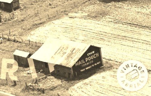
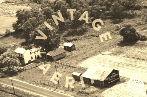
Photos 1 & 2 by unknown VA # 70-NCL-22 (1973) courtesy of Vintage Aerial
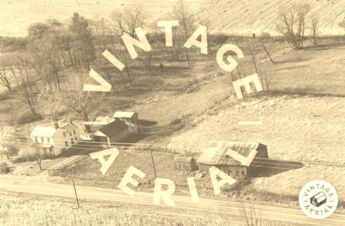
Photo 3 by unknown VA # 105-RCL-2 courtesy of Vintage Aerial
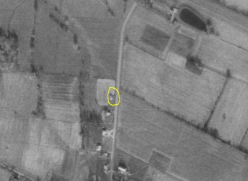
Photo 4 by unknown ODOT # 143-320-83 (Apr. 1, 1977) courtesy of Ohio Dept. of Transportation
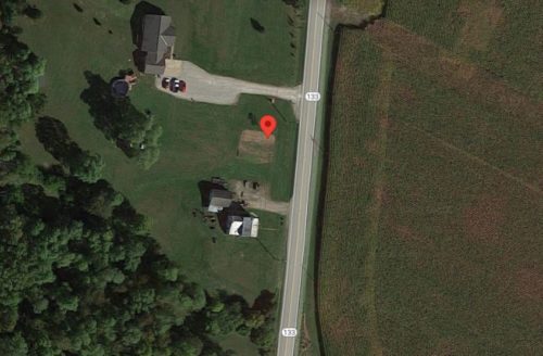
Photo 5 Google satellite image (ca. 2020).
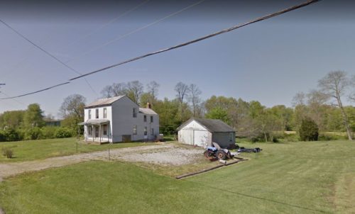
Photo 6 Google street view (May 2018).
Other Information
Photo 1 is an enlarged inset view from Photo 2.
The Ohio Dept of Transportation aerial photos were used to determine the location of where this barn once stood. Photo 4 is a 1977 ODOT aerial photo with the barn circled in 'Yellow'.
In Photo 6 (Google street view) the house and the garage shown in Photos 2 & 3 are still remaining and visible.
Where to find it
*GONE* (razed and removed) This barn was along OH Rt. 133 south of the OH Rt. 125 (Plane St. ) intersection, in Bethel, by 2.2 miles. The barn was on the right side of the highway headed south. The MP sign was on the north end of the barn One end. Black background.
Address
2285 OH-133
City
Bethel
State
OH
Zipcode
45106
Country
USA
Latitude
N 38° 56.0326'
Longitude
W -84° 05.6682'
lat
38.933877
lng
-84.094471
