Other Information
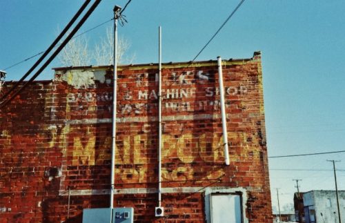
Ohio Dept of Transportation aerial photo archives were used to confirm the location of the building with the Mail Pouch sign. The building is circled in yellow. The two buildings shown at the right in Photos 1 & 2 (down the street) are circled in red. Rotating this photo and maginifying reveals a very blurred image of the Mail Pouch sign.
Photo 4 (US Geological Survey image) shows the building (circled in yellow) and the two buildings at the right, in Photos 1 & 2, circled in red.
Photo 5 (Google satellite image) the location where the building with th Mail Pouch sign once stood is noted by the red pin. This pin was used to determine the address and the coordinates. The location of the two buildings down the street (at the right in Photos 1 & 2) is noted by the red circle. It appears that the building closest to the intersection has been razed and removed.
Where to find it *GONE* (razed and removed) Northeast corner of OH-114 (Main St.) & Harrison St. intersection, in Haviland. West of the US-127 intersection by 0.5 miles. The Mail Pouch sign faced west. One side. Brick building. Original Black Back ground.


