Credits
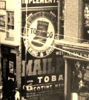
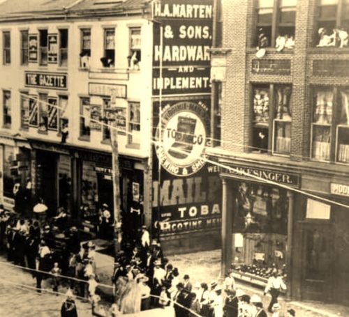
Photos 1 & 2 by unknown (1908 - Post Card) submitted by Jason Scott.
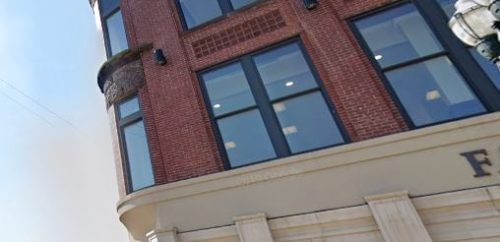
Photo 3 Google street view (Aug. 2019).
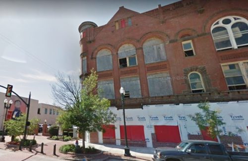
Photo 4 Google street view (July 2015).
Photo 5 Google street view (Aug. 2016).
Photo 7 Google satellite image.
Other Information
Photo 1 is an enlarged inset view from Photo 2.
The building to the right of the building with the Mail Pouch sign is the Fairfield County Municipal Court Building. The building with the Mail Pouch sign was demolished sometime in the 1960's (Per ODOT aerial photos). The building was demolished to provide parking for the Municapal Court building.
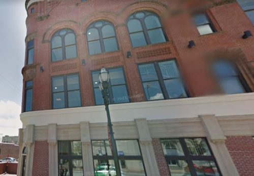
Photo 3 is a close view of the detail at the window in the Municipal Court building which is clearly visible in Photo 2; as is the construction to the left of the window the base of the round turret.
The building was renovated from ground level to the first level and that explains the difference in architectural detail between the ground and first floor. Photo 4 a Google street view shows this work taking place in July 2015; and, Photo 5 Google street view shows that this work was complete by Aug. 2016.
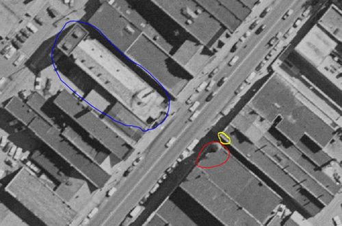
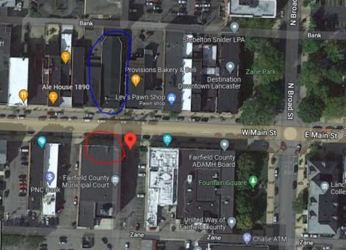
Photo 5 is an ODOT aerial photo image taken on April 30, 1957 clearly showing the building adjacent to the Municipal Court building. The yellow circle on that view is the location of the Mail Pouch sign. The red circle is the Municipal Court building and the building across the street, which still exists, is circled in blue. This is done to coordinate with Photo 6 a Google satellite image. In Photo 6 the red pin is the location of the yellow circle on Photo 5, the red and blue circles coordinate buildings in each of the two photos. The red pin was used to develop the address and coordinations.
Where to find it *GONE (razed and removed)* Along the south side of W. Main St. west of the intersection with Broad St., in Lancaster, by 450'. The building was on the left side of Main St. headed west from Broad St. One side. Black Background.
