Credits
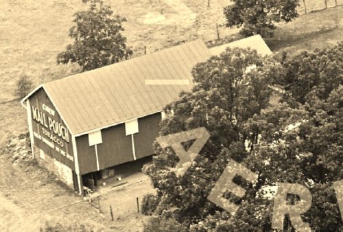
Photos 1 & 2 by unknown VA # 53-CYO-33 (1963) courtesy of
Vintage AerialPhoto 3 by Kim Jensen.
Photos 4-6 by Lonnie Schnauffer (Aug. 2003).
Photo 7 by unknown.
Photo 8 Google street view (Apr. 2012).
Photo 9 Bing Map's bird's eye view.
Photo 10 Google street view (Nov. 2021).
Photo 11 Google satellite image.
Where to find it *GONE* (either covered over or old siding replaced with new). 4950 N. Susquehanna Trail (PA Rt. 297), approximately 1.5 miles north of the PA Rt. 921 (Canal Road) and PA Rt. 295 intersection. South of I-83 by about 1 mile. One end.


