Credits
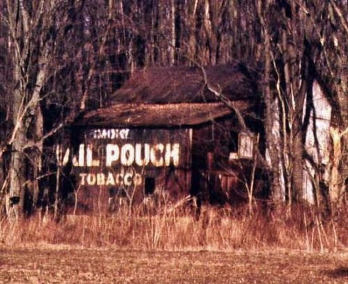
Photo 1 by Rick Campbell.
Photo 3 by unknown.
Photos 4 & 5 by Gyla Schnauffer (Oct. 2001).
Photos 6-8 by Bill Eichelberger (Oct. 23, 2014).
Photo 9 by Chuck Thibaut (Nov. 1, 2017).
Photo 10 by Tom Fritsch (May 7, 2021).
Photo 11 Google street view (Nov. 2021).
Photo 15 Google satellite image.
Other Information
Photo 2 is an ODOT aerial photo, dated 1962 showing that the Mail Pouch sign was on the end of the barn as of that date and based on the condition of the sign may have been on since at least the mid 1950's, and may have been a repaint.
Photo 14 is an ODOT aerial photo dated 1959 showing that the site was farm land with few trees at that date. The Mail Pouch barn is circled in yellow and the house and small building at the highway circled in red are long gone and were in the location now covered with the group of trees near the highway and clearly shown in Photo 15.
Photo 15 (Google satellite image) the location of the Mail Pouch barn is noted by the red pin. This pin was used to determine the address and the coordinates. The red circle is the location where the house and small building once stood.
Where to find it Along the east side of OH-61 north of OH-288 by 0.25 mile. The barn is on the right side of the highway headed north. The Mail Pouch sign faces west and is back in the trees and difficult to see. One side. Black Background.


