MPB 35-07-10

Photo 1
Sides Painted
1
Color
Red
Structure
Barn
Unique Characteristics
None
Still Standing
No
Credits

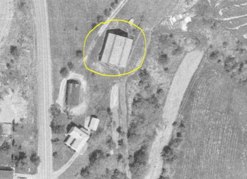
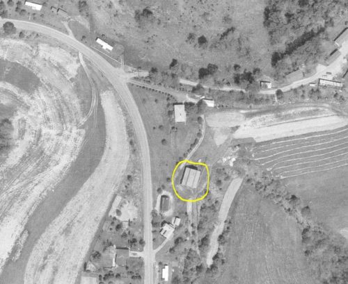
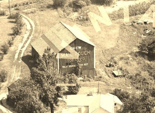
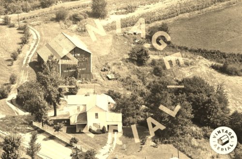
Photos 1 & 2 by unknown Va # 17-KBE-18 (1971) courtesy of Vintage Aerial

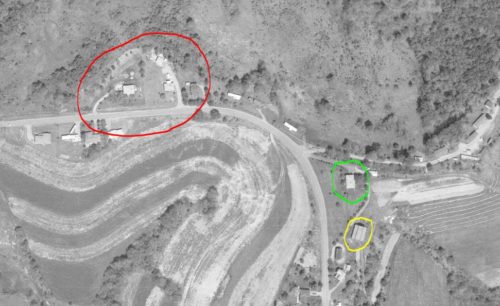
Photos 3-5 by unknown ODOT # 6028-16-1975 (Apr. 15, 1977) courtsy of Ohio Dept. of Transportation

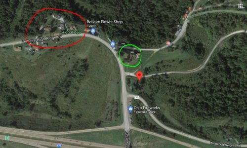
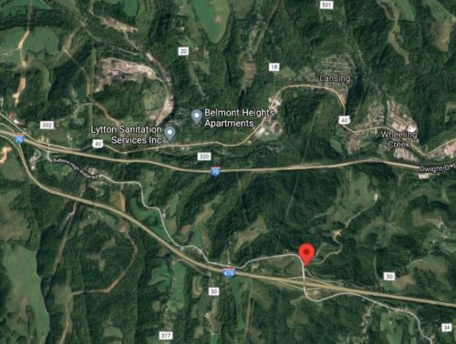
Photos 6 & 7 Google satellite images (ca. 2020).
Other Information

The entire farm site in Photo 1 was removed to allow for the construction of the I-480 interchange.

The Photos 3-5 are ODOT aerial photos which are used to confirm the location of the Mail Pouch barn. The barn has been circled in yellow in these photos. Photo 5 (ODOT aerial photo) and Photo 6 (Google satellite image ca. 2020) are provided at approximately the same scale to allow for comparison and show similar feature in each view to help tie down the barns location. In the two photos, similar features are circled in 'red' and 'lime'. In Photos 6 & 7 the red 'Google' pin is the approximate loaction of where the barn was locatied.
Where to find it

*GONE* (razed and removed) The barn was long Bellaire High Ridge Rd (Co Rd 214) southeast of the intersecition with US Rt.4 (near I-70) by about 2.8 miles. The barn was on the left side of the Road headed south. The Mail Pouch sign faced south. Red background.
Address
54998 Bellaire High Ridge Rd (Co Rd 214)
City
Bellaire
State
OH
Zipcode
43906
Country
USA
Latitude
N 40° 03.1181'
Longitude
W -80° 47.7074'
lat
40.051969
lng
-80.795124
  • Photo 2
  • Photo 3
  • Photo 4
  • Photo 5
  • Photo 6
  • Photo 7