Other Information
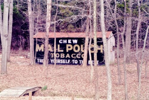
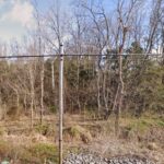
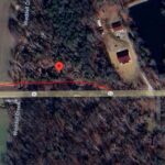
The initial location was provided by Tom Plimpton "west of Scottsburg, right side of the road, Mail Pouch sign faces south". Historic Aerials' imagery was used to locate the barn and the information provided is based on the research of the historic imagery. The sequence of available historic imagery runs - 1955, 1956, 1960, 1983, 1986, 1992, etc. Up to 1960 there is no barn noted. The area was primarily pasture with little folialge or trees. Based on the condition of the barn in Photo 1 (1988) it is clear that the barn was probably constructed during the 1960's-early 1970's. As noted the area at this time was lightly foliaged and the barn location would have been useful for equipment storage, etc. The amount of foliged increased until today (Photo 3) it is difficult to see much from IN-56 looking toward the barn site. The available Google street views begin in Aug. 2007 and the last available is March 2023. The review of the historic imagery (1983 & 1986) show the image of a barn roof. There is no other location west of Scottsburg that fits the information provided in Photo 1. Also note, in Photo 1, at the left forground there is clearly a footbridge crossing a small rill or creek. Looking at Photo 3 (Google satellite image) there is a rill or creek (red line) running right to left in front of the red pin (barn location) which further lends credibility to the barn location. The distance measurement tool was used to obtain the decimal coordinates for the barn. The coordinates were input to the Google map program and the red pin is the location of the barn.
Despite the analysis, explained above, to locate the barn, it is possible this was not the actual location.
Where to find it *Barn may be gone* Along the north side of IN-56 west of the I-65 interchange, in Scottsburg, by 4.6 miles. The barn is on the right side of the highway headed west. The Mail Pouch sign faces south. One side. Black background.


