MPB 14-10-02

Photo 1
Sides Painted
1
Color
Black
Structure
Barn
Unique Characteristics
None
Still Standing
No
Credits

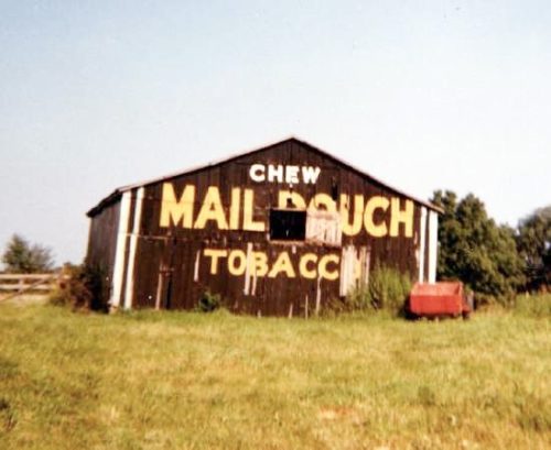
Photo 1 by Myron Huffman (ca. 1972).

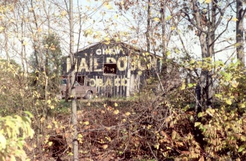
Photo 2 by Tom Plimpton (1983).

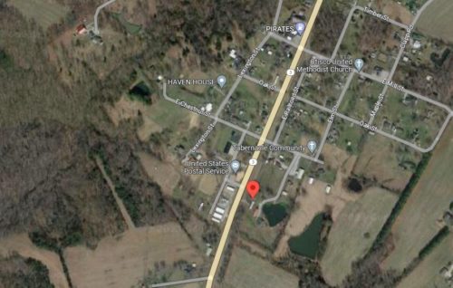
Photo 3 Google satellite image.
Other Information

Tom Plimpton's location information was "IN-3 just south of Otisco". The location selected for the entry is the only location that fits the available locating data. The Historic Aerials for the area jump from 1955 to 1983 (The year of Plimpton's photo). It is believed that the barn was erected late 1950's early 1960's. The 1955 Historical Aerial shows that the area where the barn was located was wooded in 1955. If partially cleared to allow for barn would account for the trees shown to the right of the barn in Photo 1. The 1983 photo was taken looking through a line of trees between IN-3 and the barn. This line of trees shows clearly in the 1983 Historic Aerial image. The line of trees is existing today. The 1983 Historic Aerial imagery was studied from Otisco to several miles south of Otisco and the barn (site) selected for the entry is the only candidate for the barn. Historic Aerials' distance measurement tool was used to obtain decimal coordinates. The coordinates were input to the Google map program and in Photo s the red pin is the location of the barn. Photo 3 (Google satellite image) the red pin is on a barn that has replaced the original barn and this pin was used to determine the address and the coordinates.
Where to find it

*GONE* Along the east side of W. Railroad St. (IN-3) southwest of E. Chestnut St, in Otisco, by 0.2 miles. The barn was on the left side of IN-3 headed southwest. The Mail Pouch sign faced northeast. One end. Black backgkround.
Address
611 W Railroad St (IN-3)
City
Otisco
State
IN
Zipcode
47163
Country
USA
Latitude
N 38° 32.3956'
Longitude
W -85° 40.0748'
lat
38.539926
lng
-85.667914
  • Photo 2
  • Photo 3