- [02] Alexander Co, IL (1)
- [06] Bureau Co, IL (2)
- [10] Champaign Co, IL (1)
- [101] Winnebago Co, IL (2)
- [12] Clark Co, IL (1)
- [15] Coles Co, IL (2)
- [16] Cook Co, IL (3)
- [18] Cumberland Co, IL (1)
- [23] Edgar Co, IL (2)
- [25] Effingham Co, IL (3)
- [26] Fayette Co, IL (4)
- [29] Fulton Co, IL (1)
- [32] Grundy Co, IL (1)
- [34] Hancock Co, IL (1)
- [38] Iroquois Co, IL (1)
- [41] Jefferson Co, IL (3)
- [43] Jo Daviess Co, IL (1)
- [45] Kane Co, IL (1)
- [47] Kendall Co, IL (1)
- [48] Knox Co, IL (2)
- [49] LaSalle Co, IL (1)
- [51] Lawrence Co, IL (6)
- [53] Livingston Co, IL (2)
- [54] Logan Co, IL (1)
- [56] Macoupin Co, IL (2)
- [57] Madison Co, IL (1)
- [58] Marion Co, IL (2)
- [62] McDonough Co, IL (1)
- [64] McLean Co, IL (2)
- [65] Menard Co, IL (1)
- [69] Morgan Co, IL (2)
- [80] Richland Co, IL (3)
- [81] Rock Island Co, IL (2)
- [82] Saint Clair Co, IL (1)
- [87] Shelby Co, IL (1)
- [93] Wabash Co, IL (1)
- [94] Warren Co, IL (1)
- [96] Wayne Co, IL (1)
- [99] Will Co, IL (1)
In the Big Swing Brewing Co. (formerly the Blue Cat Brew Pub), located at 113 18th St., in Rock Island. From IL Rt. 92 (1st Ave.) turn south onto 18th St. The Big Swing Brewing Co. is on the left side of the street headed south.
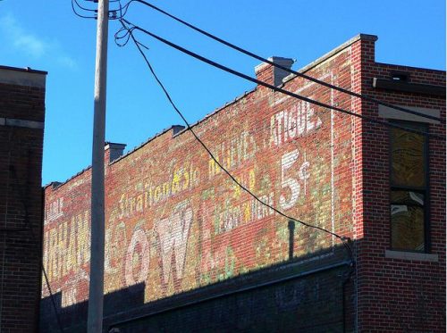
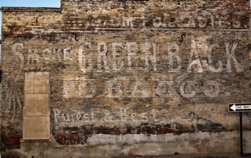
This BD sign is on a brick building along US Rt. 76 Bus. (N. Main St. ) , in Roseville. From IL Rt. 116, turn north onto US Rt. 67 Bus. (N. Main St.). The building with the BD sign is on the left side of the street headed north just before the E. Walnut St. intersection. The BD sign faces north. One side. Brown. Greatly faded.
This BD sign, with the Henry George Cigar over paint on the left end of BDS 13-48-02, is on North Prairie St. between E. Ferris St. & US Rt. 150 (E. Main St., in Galesburg. From US Rt. 150 (E. Main St.) turn north onto N. Prairie St. The building with the BD sign is on the left side of the street just before E. Ferris St.
From US Rt. 150 turn north onto S. Neil St. Bear right onto S. Walnut, which is one-way north. At that junction, S. Neil becomes one-way south. From S. Walnut, look up to the left to see BDS 13-10-01, which faces south. Continue on to E. University Ave. Make a left and right away the first left onto S. Neil St. It is difficult to see the BD sign from S. Neil, since the view is back to the left. One side. Brick building. Brown. Greatly faded.
414 Pulaski St. between S. Chicago St. & S. Kickapoo St., in Lincoln. The brick building is on the left side of the street headed southeast from S. Chicago St. toward S. Kickapoo St. The GT sign faces northwest on an alley. One side. Brick building. Original black faded out. Greatly faded.
*GONE (Faded away)* IL Rt. 1 north of I-70 by about 1.6 miles. The barn is on the right side of the road headed north. The MP sign on the barn faces north. One end. Black.
In Oakland on Rt. 133. At the corner of IL Rt. 133 and Oak St. The barn is located on Rutherford Home and compound in Oakland. The barn faces IL Rt. 133 and is between N. Oak St. and N. Pike St. Sign faces south toward IL Rt. 133.
*GONE* (Remodelled and painted over) Along the northwest sied of US 40 northeast of IL Rt. 130, in Greenup, by 3.5 miles. The barn is on the left side of the highway headed northeast from Grrenup. Two ends. Black backgrounds.
*GONE (fallen)* IL Rt. 1 north of I-70 by about 8.5 miles, on right side headed north, quite a distance out in the field. One end. One side. Greatly faded prior to falling.
On US Rt. 45, south of US Rt. 40, in Effingham by about 12 miles. Barn is on right side while driving south. Sign faces south. One side. Red. Greatly faded.
*GONE* (razed and removed) Along the northwest side of IL-37 southwest of the intersection with US-45 by 6.0 miles. The barn was on the right side of IL-37 headed southwest from US-45. The Mail Pouch sign faced northeast. One side. Black background.
*GONE* In the Altamont area.
*GONE* (razed and removed) Along the north side of I-70 (US-40) east of the US-51 intersection, in Vandalia, by 4.9 miles. The barn was on the left side of the highway headed east from Vandalia. Mail Pouch sign on the south end of the barn; and, Mail Pouch sign on the est side of the barn. Black backgrounds.
*GONE* (faded away - possibly fallen) Along the north side of IL-140 (CR-1250 N) southwest of N 440 St intersection, in Hagarstown, by 2.8 miles. The barn is on the right side of IL-140 headed southwest from Hagarstown. The Mail Pouch sign faced south. One end. Black background.
On Rt. 45 just south of Delrey. Sits back in field. One end. Black. From US Rt. 45/US Rt. 24 merge, just east of Gilman, continue on US Rt. 45 for about 8.0 miles. At about 2.0 miles after the merge, US Rt. 24 breaks off and turns west, while US Rt. 45 continues south. From the split, continue south of US Rt. 45 about 6.0 miles. The barn is on the left while headed south and is sheltered by a grove of trees. Sign faces south and is difficult to see, especially while the trees are in foliage. One end. Black.
*GONE* (razed and removed) Located along old U.S. Route 50, about 2 miles west of IL Rt. 1 in Lawrenceville. The barn was on the left side as you head west. Sign faced east. One end. Black background.
*GONE* Was on IL Rt. 1, 6.5 miles north of US Rt. 50 in Lawrenceville. The barn was on right side while headed north. In 2006 the barn was destroyed by high winds. A small shed building now occupies the space. Two ends.
*GONE* (fallen) Along IL Rt. 1 north of the State St. intersection, in Lawrenceville by about 9.0 miles. The barn was on the right side of the highway headed north. The Mail Pouch sign faced west. One end. Black background.
*GONE* (fallen) Along IL Rt. 1 north of the State St. intersection, in Lawrenceville by about 7.4 miles. The barn was on the right side of the highway headed north. The Mail Pouch sign faced west. One end. Black background.
*GONE* (razed and removed) IL Rt. 250 east of the N. Christy Ave. intersection, in Sumner, by 1.3 miles. The barn was on the right side of the highway headed east. The Mail Pouch sign faced west. One end (possibly 2). Black background.


