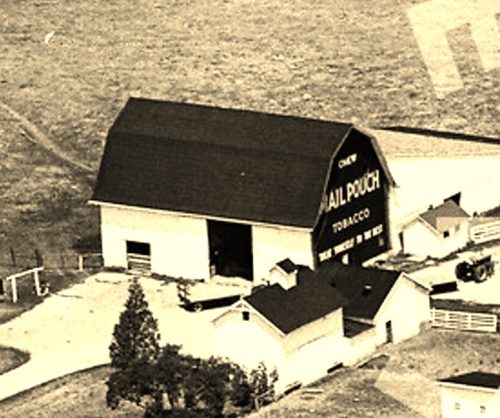
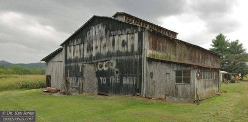
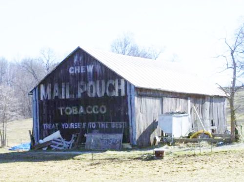
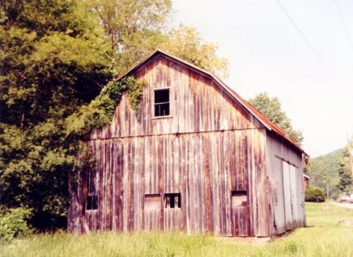
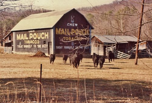
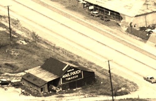
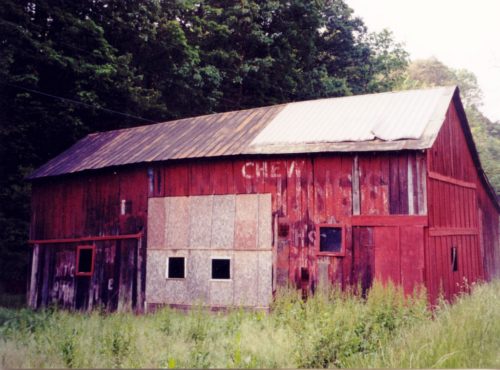
*GONE* (razed and removed) Along the northwest side of Park Ave W (OH-309) west of the intersection with OH-314 by 1.3 miles. The barn was on the right side of the highway headed west from OH-314. There were two Mail Pouch signs on the barn. One sign n the southwest side (Photo 1 & 2) and one sige on the southeast end (barely visible in Photo 3). Black Backgrounds.
*GONE* (razed and removed in 2000) Along the northeast side of the access road to the Primitive Camping Area at Malabar Farm State Park. The barn was just southeast of the intersection with Bromfield Rd (TH-438) by 185'. The barn was on the left side of the road headed to the Primitive Camping Area from Bromfield Rd. The Mail Pouch sign faced southwest. One side. Black Background.
*GONE* (razed and removed - new barn in same location) Along the southwest side of OH-98 southwest of the intersection with Plymouth St. (OH-61), in Plymouth, by 1.8 miles. The barn was on the left side of the highway headed southwest from Plymouth. The mail Pouch sign faced northeast. One end Black Background.
US-23/OH-104 south of US-35 (south of Chillicothe) by about 9.0 miles. The barn is on the right side of the highway headed south. Two ends. Black backgrounds. Gambrel roof with large air ventilator on the roof.
OH Rt. 207 northwest of OH Rt. 104 by about 2.2 miles. On the left side of the highway headed northwest. The barn is just past Co. Hwy. 111, which is the road to the Ross County Airport. The MP sign faces northeast. One side. Blackbackground. Faded and partially covered.
Orr Rd. north of intersection with US-23 by about 1.5 miles. The barn is on the left side of the highway headed north. The Mail Pouch sign faces north. One end. Black background.
*GONE* (faded away and covered up). OH Rt. 28 east of the OH Rt. 138 intersection (just east of Greenfield) by 7.1 miles. The barn is on the right side of the highway headed east. The Mail Pouch sign faced west. One end. Original black background.
*GONE* (razed and removed) Along OH Rt.159 north of the intersection with US Rt 23 (just north of Chillicothe), by about 1.9 miles. The barn was on the left side of the highway headed north. There were three Mail Pouch signs on the barn - North side; South side; and, East end. The backgrounds were black.
*GONE (razed and removed)* Along the east side of OH-590 (S. Main St.) north of the intersection with US-20 by 250'. The barn was on the right side of the street headed north on S. Main St. The Mail Pouch sign faced west. One side. Black Background.
*GONE* (painted over) Along the southeast side of OH-101 (E. Maple St.) northeast of US Rt. 20 in Clyde, by 6.3 miles. The barn is on the right side headed northeast. The Mail Pouch sign faced north. One end. Black background.
*GONE* (razed and removed) Along the north side of US-6 E, east of intersection with OH-510 by 1.3 miles. The barn was on the left side of the highway headed east. Two Mail Pouch signs, one on each end, facing east and west. Black backgrounds.
*GONE* (faded away) Along the northeast side of US-20 (W. State St.) southeast of OH-590 (S. Main St.) by 0.4 mile. The barn is on the left side of the highway headed southeast. The Mail Pouch sign faced southeast. One side. Black Background.
*GONE* (razed and Removed) Along the south side of US-6 (Grand Army of the Republic Hwy.) east of US-23 by 3.8 miles. The barn was on the right side of the highway headed east. The Mail Pouch sign faced east. One end. Black Background.
*GONE* (razed and removed) Along the northeast side of E. Main St. (US-20) southeast of intersection with OH-105 (Water St.), in Woodville, by 1.7 miles. The barn was on the left side of the highway headed southeast. The Mail Pouch sign faced southwest. One end. Black Background.
Along the southeast side of US-52 southwest of OH-125, in Friendship, by 6.8 miles. The barn is on the left side of the highway headed southwest from Friendship. Two ends. Black Backgrounds. The Mail Pouch sign facing east is faded; however, the Mail Pouch sign facing west is greatly faded.
Along the southeast side of OH-140 northeast of US-52 by 6.4 miles. The barn is on the right side of the highway headed northeast. The barn is directly across from TH-419 (Station Rd.) intersection with OH-140. The Mail Pouch sign faces north. One end. Black Background.
*GONE* (painted over) Along the southwest side of OH-73 west of OH-104 by 3.3 miles. The barn is on the left side of the highway headed west. The Mail Pouch sign faced southeast. One end. Black Background.
Along the northwest side of OH-73 west of OH-104 by 4.1 miles. The barn is on the right side of the highway headed west, at the intersection with TH-470 (Jacquay's Run Rd.). Mail Pouch sign on the southwest side; and, Mail Pouch sign on the southeast end. Black Backgrounds.
*GONE* (razed and removed) The barn was along the northwest side of US-52 (Ohio River Scenic Byway) northeast of the intersection with OH-125 just south of Friendship, by 3.6 miles. the barn was on the left side of the highway headed northeast. The Mail Pouch sign faced southwest. One end. Black Background.
Along the east side of OH-139 north of US-52 by abut 4.2 miles. The barn is on the right side of the highway headed north. The Mail Pouch sign faces north. One side. Black Background. Greatly faded.


