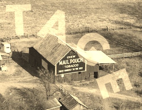
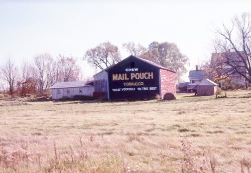
Along the east side of OH-49 north of the River St. intersection, in Antwerp, by 3.2 miles. The barn is on the right side of the highway headed north. The Mail Pouch sign faces south. One side. Mail Pouch sign original black background, the barn has been whitewashed; however, the Mail Pouch sign is bleeding through. Greatly faded.
Along the northeast side of OH-13 southeast of US-22, in Somerset, by 3.3 miles. The barn is on the left side of the highway headed southeast. Mail Pouch sign on the west end; and Mail Pouch signs on the north and south sides. Black Backgrounds.
*GONE* (razed and removed. There is a new barn in the same location) Along the northeast side of OH-13, southeast of Marietta Rd. (CR-11), in Moxahala, by 2.5 miles. The barn was on the left side of the highway headed southeast. Mail Pouch sign on the southwest side and on both the northwest and southeast ends. Black Backgounds.
*GONE (fallen and removed)* US Rt. 22, east of OH Rt. 204 by about 0.75 mile. The barn was on the left side of the highway headed southeast. One end. One side. Black with red shading.
OH Rt. 13 just south of US Rt. 22. One end. Red. Greatly faded.
*GONE* (partially razed and fallen) Along the north side of US-22 (OH-22) west of OH-345 intersection, in East Fultonham, by 2.4 miles. The barn remains are on the right side of the highway headed southwest. The Mail Pouch sign faced southeast. One side. Original Black Background.
*GONE* (painted over) Along the southwest side of OH-13 northwest of the intersection with Broadway St., in New Lexington, by 1.9 miles. The barn is on the left side of the highway headed northwest. The Mail Pouch sign faces southeast. One end. Black Background.
*GONE* (razed and removed) Along the east side of OH-104, north of the intersecion with OH-56 by 0.2 mile. The barn was on the right side of the highway headed north. The Mail Pouch sign faced south. One side. Black Background.
*GONE* (razed and removed) Along the northeast side of OH-56 west of OH-104 by 7.1 miles. The barn was on the right side of the highway headed northwest. The Mail Pouch sign faced northwest. One side. Black Background.
*GONE* (razed and removed) Along the southeast side of US-62 north of OH-56 intersection, in Mt. Sterling by 3.5 miles. The Mail Pouch barn was on the right side of the highway headed northeast from Mt. Sterling. The Mail Pouch sign faced southwest. One end. Black Background.
*GONE* (painted over) Along the southeast side of US-62 (OH-3) northeast of the OH-56 intersection, in Mt. Sterling, by 4.6 miles. The barn is on the right side of the highway headed northeast. There was a Mail Pouch sign on the northwest end; and, a Mail Pouch sign on the southwest side. Black Backgrounds.
*GONE* (razed and removed) Along the east side of US-23/OH-104 (Corridor C) northeast of the High St. intersection, in Waverly, by 3.7 miles. (Just south of the Ross Co. line by about 1000'). The barn was on the right side of the highway headed northeast from Waverly. The Mail Pouch sign faced southwest. One end. Black Background.
Along the north side of OH-32/OH-124 (James A. Rhodes Appalachian Hwy.), east of US-23 by 5.0 miles. The barn is on the left side of the highway headed east from US-23. Prior to ca. 1990 the were two Mail Pouch signs on the barn one on the east side and one on the west side. After ca. 1990 the two original Mail Pouch signs were removed and relocated to an interior wall. From the date till today there has only been a Mail Pouch sign on the east side of the barn (see 'Other Information'). Black Backgrounds. Grealy faded.
Along the northeast side of OH-220 north of OH-32 by 2.3 miles. The barn is on the right side of the highway headed northwest from OH-32. Two Mail Pouch signs. One sign on the southeast end; and, one sign on the southwest side. Black Backgrounds. Greatly faded.
Along the southwest side of OH-220 north of OH-32 by 2.7 miles. The barn is on the left side of the highway headed northwest. Two ends. One side. Black Background. One end (northwest) greatly faded.
*GONE* (fallen and removed) Along the south side of Beaver Pike (CR-57) west of OH-335 intersection, in Beaver, by 1.2 mile. The barn was on the left side of the Pike headed west from Beaver. The Mail Pouch sign faced east. One side. One side. Black Background.
*GONE* (fallen and partially removed) Along the southwest side of OH-124 east of OH-41 by 8.6 miles. The barn was on the right side of the highway headed east. Just west of Latham. Two ends. Black Backgrounds.
Along the west side of OH-124 east of OH-41 by 5.4 miles. The barn is on the left side of the highway headed east from OH-41. The Mail Pouch sign faces south. One end. Black Background.
Along the southeast side of OH-88 north of OH-14/OH-44 intersection by 2.0 miles. The barn is on the right side of the highway headed northeast from OH-14/OH-44. Two ends. Mail Pouch sign on the northeast end; and, Mail Pouch sign on the southwest end. Black Backgrounds.
*GONE* (fallen and removed) Along the east side of Cleveland-East Liverpool Rd (OH-14) south of US-224 by 0.6 mile. The barn was on the left side of the highway headed south from US-224. The Mail Pouch sign faced north. One end. Black Background.


