MPB 35-04-09

Photo 1
Sides Painted
1
Color
Black
Structure
Barn
Unique Characteristics
None
Still Standing
No
Credits

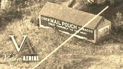
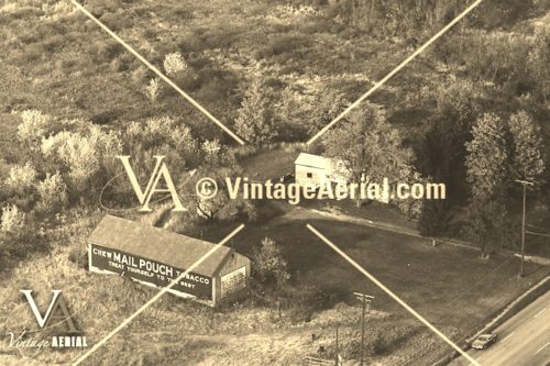
Photos 1 & 2 by unknown VA # 51-OAS-3 (1968) courtesy of Vintage Aerial

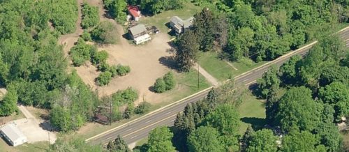
Photo 3 Bing Map's Bird's eye view.

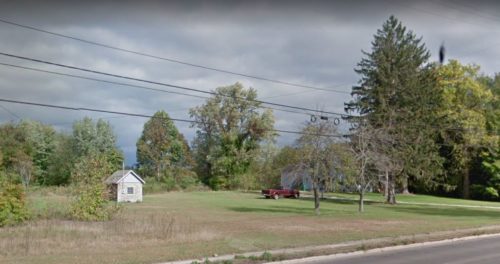
Photo 4 Google street view (Oct. 2018).

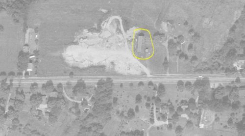
Photo 5 by unknown ODOT # 2334-1-8 (Aug.29, 1962) courtesy of Ohio Dept. of Transportaion

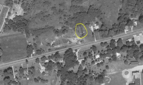
Photo 6 by unknown ODOT # 6068-4-1978 (Aug. 18, 1976) courtesy of Ohio Dept. of Transportation
Other Information

Photos 3 (Bing Map's bird's eye view) and 4 (Google street view) show the site where the barn once stood.

Photos 5 & 6 are ODOT aerial Photos. In the photos the small building to the right of to barn is visible. This small building is clearly shown as remaining, in Photo 3 (Google street view) and in Photo 2 (Bing Maps birdseye view) a portion of the small buildings roof is visible behind the brush toward the center of the view. This brush was subsequently removed. These photos helped to tie down the exact location of where the Mail Pouch barn once stood.
Where to find it

*GONE* (razed and removed)US-20, in Saybrook, southwest of the intersection with OH-45 by about 1.1 miles. The barn was on the right side of the highway headed southwest. The Mail Pouch sign faced southwest. One side. Black background.
Address
5861 N Ridge Rd W
City
Ashtabula
State
OH
Zipcode
44004
Country
USA
Latitude
N 41° 49.6246'
Longitude
W -80° 52.4641'
lat
41.827076
lng
-80.874401
  • Photo 2
  • Photo 3
  • Photo 4
  • Photo 5
  • Photo 6