BDS 14-18-03

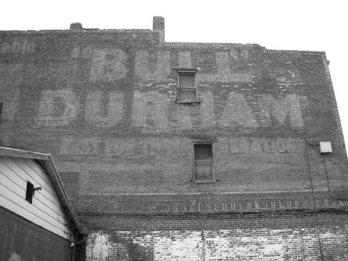
Photo 1
Sides Painted
1
Color
Black
Structure
Brick Building
Unique Characteristics
None
Still Standing
No
Credits

Photo 1 by unknown (Jan. 19, 2003).

Photo 2 by Matthew Trisler (Nov. 13, 2006).

Photo 3 by Chuck Bowden (Nov. 27, 2006).

Photo 4 Historic Aerial imagery (2005) courtesy of Historic Aerials

Photo 5 Google satellite image.
Other Information

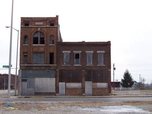
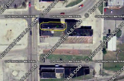
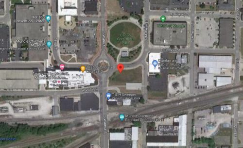
This building was located in the Old Haymond Block (built in 1904) along Walnut Street. The building was listed in the National Register of Historic Places Inventory Nomination Form, dated Sept. 1988). Photo 3 is a view of the front of the buildings facing Walnut Street. The building is clearly shown in the Historic Aerial imagery, dated 2005. The next imagery availabe was dated 2008 and the building was no longer existing, having been razed and removed to allow for the construction of the new W. Walnut St./E. Seymour St. traffic circle. Photo 4 is a view of the aerial imagery. The building is circled in yellow. A blue dot is visible and this was provided by the Historic Aerials distance measurement tool which notes the exact decimal coordinates of the building. The coordinates were then entered into the Google satellite image (Photo 5) and the building location is indicated by the red pin relative to the existing conditions of the site.
Where to find it

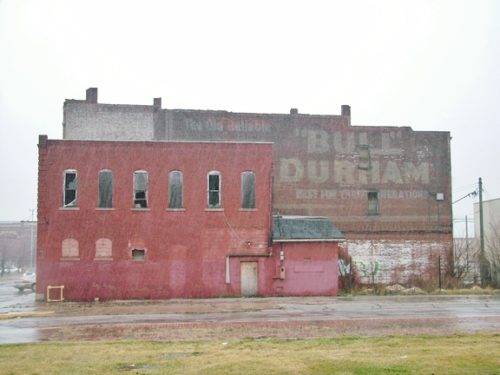
*GONE* (razed and removed before 2008) The building was located in what is now the southeast section of the S. Walnut St./E. Seymour St. traffic circle, in Muncie. The Bull Durham sign faced south. The original backgound color was Black.
Address
614 S. Walnut St
City
Muncie
State
IN
Zipcode
47305
Country
USA
Latitude
N 40° 11.3567'
Longitude
W -85° 23.1684'
lat
40.189278
lng
-85.386140
  • Photo 2
  • Photo 3
  • Photo 4
  • Photo 5