County
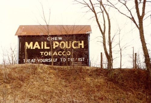
Sides Painted
1
Color
Black
Structure
Barn
Unique Characteristics
None
Still Standing
No
Credits
Photo 1 by Dave and Mary Ann shaver (Feb. 16, 1987).
Photo 2 Google satellite image.
Other Information
Satellite imagery was used to determine the exact decimal coordinates of the barn. These coordinates were entered into the Google map program and the red pin is the exact location of where the Mail Pouch barn once stood. The pin was used to determine the address and provide the location information.
Where to find it
*GONE* (razed and removed) Along the east side of US-50 northwest of the US-50/OH-32 (James A. Rhodes Appalachian Hwy.) junction by 2.0 miles. The barn was on the right side of the highway headed northwest from the junction. The Mail Pouch sign faced west. One side. Black background.
Address
33940 Brooks Rd
City
Albany
State
OH
Zipcode
45710
Country
USA
Latitude
N 39° 13.1445'
Longitude
W -82° 16.2074'
lat
39.219075
lng
-82.270123

