Other Information
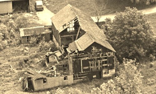
Photo 1 is an enlarged inset view from Photo 2.
The red pin on Photo 4 (Google satellite image) is the location of the Mail Pouch barn in the photo above. The barn, house, garage and driveways are all very clear on Photo 3 (Ohio Dept. of Transportation aerial photo # ODOT 146-3401-43, dated Apr. 26, 1970). The only other photo of the site was ODOT # 8006-18-446, dated Mar. 31, 1986. In this photo the house, garage and driveways are clearly visible; however, the barn had fallen and only the foundation is visible by that date. The exact location was determined by setting the scale of the Google satellite image to the scale of the ODOT aerial photo and measuring from the Munn Rd. intersection to the center of the barn.
In Photo 3 the barn is circled in yellow, the house in Photo 2 is circled in red and the building (now a Veterinarian), at the southwest corner of the Kinsman Rd/Munn Rd intersection is circled in lime.
Where to find it *GONE* (razed and removed) Along the north side of Kinsman Rd. (OH-87) east of the intersection with OH-306, in Russell Center, by 4.7 miles. The barn was on the left side of Kinsman Rd. headed east from Russell Center. The Mail Pouch sign faced west. One end. Black background.


