County
Sides Painted
1
Color
Black
Structure
Barn
Unique Characteristics
None
Still Standing
No
Credits
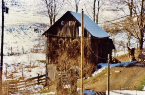
Photos 1 & 2 by Larry Zinn (Dec. 1987 - contributed by Butch Moon).
Photo 3 by unknown VA # 92-TER-28 (1984) courtesy of Vintage Aerial
Photo 4 Google satellite image.
Other Information
Historic Aerials imagery (1982) was used to positively locate this barn. The distance measurement tool was used which provided the decimal coordinates centered on the barn The decimal coordinates we input to the Google map program and the red pin, on Photo 4, is the location where the barn was once located. This pin was used to determine the address and provide the site location directions. The buildings on the site have all been razed and remove and the site is cleared. The barn would have been visible from the US-19 hair pin turn. Today, because of tree and shrub growth, it would be very difficult, if not impossible, to see the barn from US-19.
Where to find it
*GONE* (razed and removed) US Rt. 19 (Mt. Morris Rd.) southeast of PA Rt. 21 (E. Roy Furman Hwy.) intersection, in Morrisville, by 7.0 miles. The barn was on the right side of the highway (in the hairpin turn) headed south. The Mail Pouch sign faced east. One end. Black background.
Address
1435 Mt Morris Rd (US-19)
City
Waynesburg
State
PA
Zipcode
15370
Country
USA
Latitude
N 39° 49.3252'
Longitude
W -80° 07.6837'
lat
39.822087
lng
-80.128062


