MPB 38-30-23

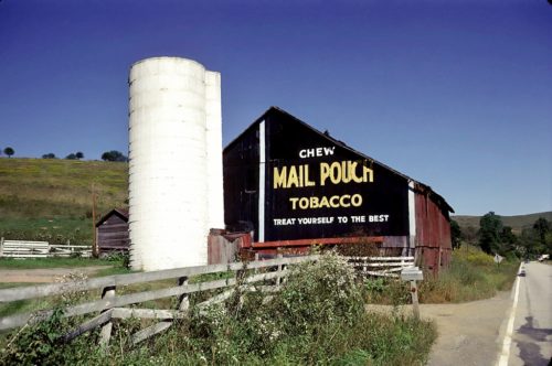
Photo 1
Sides Painted
2
Color
Black
Structure
Barn
Unique Characteristics
None
Still Standing
No
Credits

Photo 1 by Fred Yenerall (1978) (Submitted by Judy Thomas).

Photo 2 by unknown VA # 1-FGR-9 (1975) courtesy of Vintage Aerial

Photo 3 by unknown (May 24, 1939) courtesy of Penn Pilot

Photo 4 by unknown (Aug. 18, 1958) courtesy of Penn Pilot

Photo 5 by unknown (Oct. 4, 1967) courtesy of Penn Pilot

Photo 6 Google street view (Oct. 2013).
Other Information

The Penn Pilot program was used to determine the exact location of where this barn once stood. The barn is highlighted in yellow in photos 3-5. 

Where to find it

*GONE (razed and removed)* Rt. 21 (W. Roy Furman Hwy.) east of Church St. intersection, in Rogersville, by 1.3 miles. The barn was on the left side of the highway headed northeast. The silo remains as of October 2018. Two ends. Black background.
Address
3600 W. Roy Furman Hwy (PA-18)
City
Sycamore
State
PA
Zipcode
15364
Country
USA
Latitude
N 39° 52.82'
Longitude
W -80° 15.20'
lat
39.88032065
lng
-80.25323114
  • Photo 2
  • Photo 3
  • Photo 4
  • Photo 5
  • Photo 6