Other Information
The barn is cleraly visible in Historic Aerials' imagery (1957). The distance measurement tool was used to obtain the decimal coordinates. The coordinates were input to the Google map program and the red pin on Photo 6 is the location where the barn once stood. The coordinates were used to determine the address for the entry.
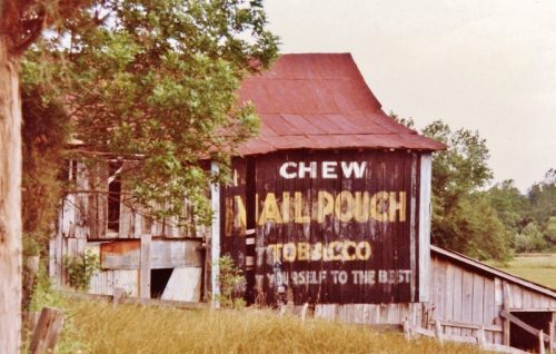
Photos 1 & 2 are views of the northwest side of the barn.
Photos 3 & 4 are views of the southeast side of the barn.
Where to find it *GONE* (fallen and removed) Along the southwest side of Charleston Rd. (WV-62) southeast of WV-869 (Buffalo Bridge) intersection by 1.7 miles. The barn was on the right side of the highway headed southeast. Two sides. Black backgrounds.


