Credits
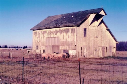
Photo 1 by Tom Plimpton (1988).
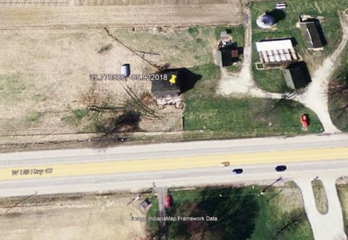
Photo 3 Image IndianaMap Frame Work Image (Feb. 28, 2005).
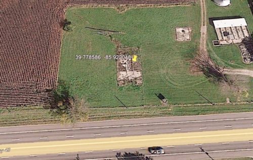
Photo 4 Historic Google satellite image (Sept. 28, 2014).
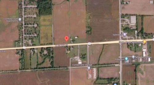
Photo 5 Google satellite image.
Other Information
Historic Aerials' imagery (1971) was used to initially locate this barn. Based on Tom Plimpton's location information that the barn was along US-40 just west of Mt. Comfort Rd. (N 600 W). The only candidate for the barn was located and the distance measurement tool was ussed to obtain the decimal coordinates for the barn. The coordinates were input to the Google map program and the red pin on Photo 5 is the exact location where the barn was located. This pin was used to determine the address for the barn.
Note in Photo 1 to the left of the barn the Eastway Court Appartments are visible in the distance.
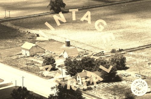
Using the location data the Vintage Aerial photos were searched to see if a Vintage Aerial photo was available. See Photo 2.
This was a ca.1950's era barn which had been painted white and the Mail Pouch sign was covered. It is not apparent in Photo 2 (1975) that the Mail Pouch sign had started to bleed through; however, obviously by 1988 Photo 1, the sign was now faintly visible.
Additional hsitoric aerial imagery shows that the barn had fallen by June 2008; The barn rubble had been cleared; however, the foundation was still visible by Sept. 2014. A view dated Oct, 2015 indicates that the barn foundtaion had been removed and all subsequent photos of the area show the former location of the barn was now plowed field.
Where to find it *GONE* (fallen and removed) Along the north side of National Rd. (US-40) west of State St. (IN-9), in Greenfield, by 8.1 miles. The barn was on the right side of the highway headed west from Greenfield. The Mail Pouch sign faced south. One side. Black background.
