Other Information
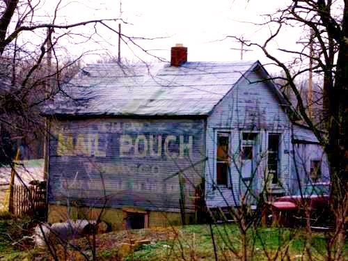
Photo 3 has been rotated and magnified to provide a better view of the northwest end of the house for comparison with the details of the end of the house in Photo 1 and to confirm the house location.
Photo 4 the Mail Pouch house is circled in yellow.
Photo 5 (Google satellite image) the location where the house stood is noted by the red pin. The pin was used to determine the address and the coordinates.
Photo 6 is a 1969 aerial photo which is provided to show that the back of the house, with the Mail Pouch sign, was clearly visible when travelling southwest on US-22. This view would not be available today due to the tree and shrub growth which would block the view from US-22.
Where to find it *GONE* (razed and removed) Directly east of the US-22 & OH-56 intersection, west of the Scioto St. intersection, in Circleville, by 1.4 miles. The house was on the left side of US-22 headed southwest from Circleville. The Mail Pouch sign faced northeast. One side. Original black background.


