Other Information
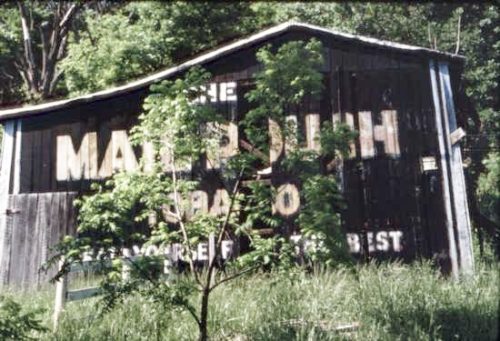
Barbara Rust Brown reported that shortly after the photograph was taken, in 1992, the barn was torn down.
The Ohio Dept. of Transportation aerial photo archives were used to determine the location of this barn. In Photo 2 the barn is circled in yellow and the house, which still remains, is circled in red. In Photo 3 a closer view barely shows the Mail Pouch sign on the south end of the barn. Photo 4 shows the barn circled in yellow, the existing house circled in red; and, the fence, which is visible in Photo 1 is circled in lime.
Photo 5 (Google satellite image) is provided for coordination with Photos 2 & 4. The barn circled in yellow in Photos 2 & 4 is represented by the red pin in Photo 5. The house, for reference is circled in red in all three photos. The red pin was used to determine the address and coordinates.
Where to find it *GONE (razed and removed)* The barn was along the north side of OH Rt. 141 west of the intersection with OH-7, just west of Gallipolis, by 0.8 mile. The barn was on the right side of the highway headed west from Gallipolis. The Mail Pouch sign faced south. One end. Black Background.


