Other Information
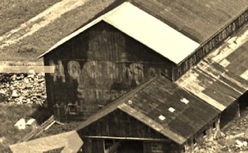
Photos 1 & 3 are enlarged inset view fom Photo 2. In Photo 1 the Mail Pouch sign is visible under later advertising. Photo 3 can be comparred with 1. The 'MAIL POUCH' letters are traced in yellow.
The southwest Mail Pouch end is presented for viewing from the RR tracks. The southeast side has been covered with an addition. It is possible that originally, when the Mail Pouch sign was prominent on the southwest end, there was also a Mail Pouch sign on the southeast side which would have been clearly visible from Black Oak Rd.
The barn and the site are clearly visible on Historic Aerials iamgery (1962). The distance measurement tool was used and the decimal coordiantes for the barn were obtained. The coordinates wer input to the Google map program and on Photo 4 the red pin is the exact location where the barn once stood. The coordinates were used to determine the address.
Where to find it *GONE* (razed and removed) Along the southwest side of Black Oak Rd. southeast of the Barree Rd (T4004) intersection, in Barree, by 0.4 mile. The barn was on the right side of Black Oak Rd. headed southeast out of Barree. The Mail Pouch sign on the end faced southwest. Black background.


