Other Information
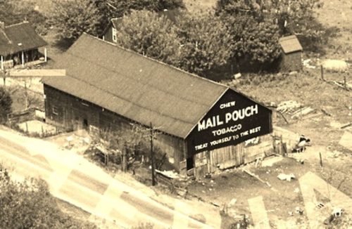
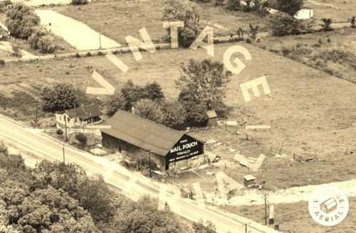
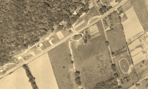
The Ohio Dept of Transportation aerial photos were searched to locate this barn. The area today is significantly changed since the days of the barn and it would have been almost impossible to located the barn without the ODOT aerial photos.
Photo 1 is an enlarged inset view from Photo 2.
In Photo 3 the barn is circled in 'Yellow' and the house, visible to the left of the barn in Photos 1 & 2, is circled in 'Red'.
Where to find it *GONE* (razed and removed) The barn was located along the southeast side of US-52 (Ohio River Scenic Byway) southwest of OH-125, in Friendship, by 2.5 miles. The barn was on the left side of the highway headed southwest from Friendship. The Mail Pouch sign faced southwest. One end. Black Background.


