- [01] Barbour Co, WV (9)
- [02] Berkeley Co, WV (2)
- [03] Boone Co, WV (4)
- [04] Braxton Co, WV (7)
- [05] Brooke Co, WV (2)
- [06] Cabell Co, WV (8)
- [07] Calhoun Co, WV (6)
- [09] Doddridge Co, WV (3)
- [10] Fayette Co, WV (4)
- [11] Gilmer Co, WV (2)
- [13] Greenbrier Co, WV (5)
- [14] Hampshire Co, WV (7)
- [15] Hancock Co, WV (1)
- [16] Hardy Co, WV (0)
- [17] Harrison Co, WV (7)
- [18] Jackson Co, WV (12)
- [20] Kanawha Co, WV (6)
- [21] Lewis Co, WV (5)
- [22] Lincoln Co, WV (8)
- [23] Logan Co, WV (0)
- [24] Marion Co, WV (16)
- [25] Marshall Co, WV (14)
- [26] Mason Co, WV (12)
- [29] Mineral Co, WV (5)
- [31] Monongalia Co, WV (8)
- [32] Monroe Co, WV (1)
- [33] Morgan Co, WV (1)
- [34] Nicholas Co, WV (5)
- [35] Ohio Co, WV (16)
- [37] Pleasants Co, WV (3)
- [38] Pocahontas Co, WV (3)
- [39] Preston Co, WV (6)
- [40] Putnam Co, WV (4)
- [42] Randolph Co, WV (11)
- [43] Ritchie Co, WV (8)
- [44] Roane Co, WV (6)
- [46] Taylor Co, WV (14)
- [47] Tucker Co, WV (1)
- [48] Tyler Co, WV (4)
- [49] Upshur Co, WV (5)
- [50] Wayne Co, WV (10)
- [51] Webster Co, WV (4)
- [52] Wetzel Co, WV (4)
- [53] Wirt Co, WV (5)
- [54] Wood Co, WV (15)
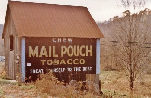
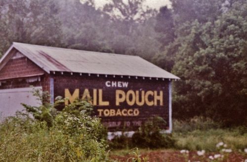
*GONE (fallen and removed)* Along the northwest side of Clarksburg Rd. (US-119/WV-20) northeast of US-33 by about 3.9 miles. The barn was on the left side of Clarksburg Rd. headed northeast. The Mail Pouch sign faced northeast. One side. Black background.
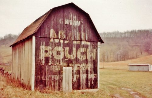
Along the west side of Old Elkins Rd. (CR-151/old US-33) southeast of US-33/US-48 by about 3.6 miles. Take exit off of US-33/US-48 at Upper Childers Run Rd. south to intersection with Old Elkins Rd. Follow Old Elkins Rd. to the barn on the right side of Old Elkins Rd. headed south. The Mail Pouch sign faces North. One end. Black background. Greatly faded.
*GONE* Along the North side of Old Elkins Rd. (CR-151/old US-33) southeast of US-33/US-48 by about 4.4 miles. Take exit off of US-33/US-48 at Upper Childers Run Rd. south to intersection with Old Elkins Rd. Follow Old Elkins Rd. to the building on the left side of Old Elkins Rd. headed southeast. The Mail Pouch sign faced southeast. One side. Black background.
*GONE* (razed and removed) Along the north side of Weston Rd. (US-33/US-48/US-119) west of WV-20/US-119 (N. Locust St.) intersection, in Buckhannon, by about 1.5 miles. The barn was on the right side of the highway headed west. The Mail Pouch sign (which was greatly faded) faced east. One end. Black background.
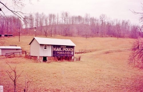
Along the northeast side of WV-152 north of US-52 by about 5.5 miles. Just south of Missouri Branch. The barn is on the right side of the highway headed northwest. The Mail Pouch sign faces southeast. One side. Black background.
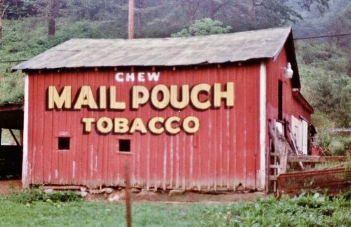
Along the east side of WV-152 north of US-52 by about 6.5 miles. The barn fronts on CH-52/73. The barn is on the right side of the highway headed north. The Mail Pouch sign faces west. One side. Red background.
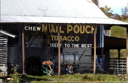
Along the northeast side of WV-75 southeast of US-52 by about 1.3 miles. The barn is on the left side of the highway headed southeast. The Mail Pouch sign faces southeast. One side. Black background. Very difficult to see because of a roof overhang.
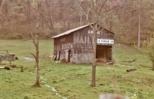
Along the south side of WV-75 southeast of US-52 by about 2.7 miles. The barn is on the right side of the highway headed southeast. Mail Pouch end faces north. Mail Pouch side faces east. Black backgrounds. Greatly faded.
*GONE* (faded away) Along the northeast side of WV-75 west of WV-152 by about 4.3 miles. The barn is on the right side of the highway headed northwest. The Mail Pouch end faced southeast. The Mail Pouch sign faced southwest. Red backgrounds.
Along the southeast side of 8th St. Rd. (CH-11), in Huntington, east of WV-152 (5th St, Rd.) by about 1.0 mile. The barn is on the right side of the street headed northeast. The barn is behind two house and another structure and is very difficult to see. The Mail Pouch sign faces southwest. One end. Black background. Greatly faded.
*GONE* (razed and removed) Along the west side of WV-152 north of the 'turnaround' in Radnor, by 1.5 miles. The barn was on the left side of WV-152 headed north. The Mail Pouch signs faced north and south. Two sides. Red backgrounds.
*GONE* (razed and removed) Along the west side of WV-152 south of WV-37 junction by 1.3 miles. The barn was on the right side of WV-152 headed south from WV-37. The Mail Pouch sign faced south. One side. Black background.
*GONE* (razed and removed) Along the northwest side of Fort Gay Rd. (WV-37) west of WV-152 by 2.3 miles. The barn was on the right side of Fort Gay Rd (WV-37) headed west. The Mail Pouch sign faced northeast. One end. Black background.
*GONE* (fallen and removed) Along the southeast side of Mountain Valley Pkwy. (WV-20), in Hacker Valley, southwest of the intersection with School Loop Rd./Valley Dr. intersection by about 430'. The barn was on the left side of the Mountain Valley Pkw. headed southwest. Mail Pouch end sign faced southwest. Mail Pouch side sign faced northwest. Black backgrounds.
Along the east side of Mountain Parkway (Cleveland Rd./WV-20) north of Park Rd. (entrance to Holly River State Park) by about 2.0 miles. North of Hacker Valley by about 3.5 miles. The barn is on the right side of the highway headed north. The Mail Pouch sign faces north. One end. Black background. Same site as MPB 48-51-03.
Along the east side of Mountain Pkwy (Cleveland Rd./WV-20) north of Park Rd. (entrance to Holly River State Park) by about 2.0 miles. North of Hacker Valley by about 3.5 miles. The barn is on the right side of the highway headed north. The Mail Pouch barn is up along the driveway to the house. The Mail Pouch sign faces south. Black background. Same site as MPB 48-51-02.
*GONE* (razed and removed) Along the east side of Hornet Hwy. (US-250) just south of the Marshall Co. line by 0.2 mile. The barn was on the left side of Hornet Hwy. (US-250) headed south. The Mail Pouch end faced west. The Mail Pouch side faced north. Black backgrounds.
*GONE* (Painted over and then boarded over) Along the northwest side of Energy Hwy (WV-2) southwest of WV-7, in New Martinsville, by about 1.7 miles. The barn is on the right side of the highway headed southwest. The Mail Pouch sign faced northeast. One end. Black background.
Along the east side of Hornet Highway (US-250), south of the WV-7 intersection, by 1.0 mile. Just south of the intersection with Rogue Run Road. The barn is along the left side of Hornet Hwy (US-250) headed south from WV-7. Mail Pouch end faces southwest. Mail Pouch side faces northwest. Original black backgrounds.
*GONE* (razed and removed) Along the west side of Energy Hwy (WV-2) north of WV-7 intersection at the New Martinsville Bridge, by 4.7 miles. The barn was along the left side of Energy Hwy (WV-2), in the town of Proctor, headed north away from the bridge. The Mail Pouch end faced north. The Mail Pouch side face east. Black backgrounds.
