- [01] Adams Co, OH (18)
- [02] Allen Co, OH (2)
- [03] Ashland Co, OH (14)
- [04] Ashtabula Co, OH (11)
- [05] Athens Co, OH (20)
- [06] Auglaize Co, OH (5)
- [07] Belmont Co, OH (24)
- [08] Brown Co, OH (32)
- [09] Butler Co, OH (8)
- [10] Carroll Co, OH (22)
- [11] Champaign Co, OH (9)
- [12] Clark Co, OH (3)
- [13] Clermont Co, OH (10)
- [14] Clinton Co, OH (4)
- [15] Columbiana Co, OH (19)
- [16] Coshocton Co, OH (14)
- [17] Crawford Co, OH (13)
- [18] Cuyahoga Co, OH (15)
- [19] Darke Co, OH (8)
- [20] Defiance Co, OH (7)
- [21] Delaware Co, OH (10)
- [22] Erie Co, OH (4)
- [23] Fairfield Co, OH (9)
- [24] Fayette Co, OH (3)
- [25] Franklin Co, OH (12)
- [26] Fulton Co, OH (4)
- [27] Gallia Co, OH (9)
- [28] Geauga Co, OH (10)
- [29] Greene Co, OH (1)
- [30] Guernsey Co, OH (34)
- [31] Hamilton Co, OH (6)
- [32] Hancock Co, OH (5)
- [33] Hardin Co, OH (5)
- [34] Harrison Co, OH (15)
- [35] Henry Co, OH (4)
- [36] Highland Co, OH (15)
- [37] Hocking Co, OH (7)
- [38] Holmes Co, OH (12)
- [39] Huron Co, OH (15)
- [40] Jackson Co, OH (7)
- [41] Jefferson Co, OH (11)
- [42] Knox Co, OH (13)
- [43] Lake Co, OH (2)
- [44] Lawrence Co, OH (9)
- [45] Licking Co, OH (17)
- [46] Logan Co, OH (5)
- [47] Lorain Co, OH (13)
- [48] Lucas Co, OH (5)
- [49] Madison Co, OH (6)
- [50] Mahoning Co, OH (13)
- [51] Marion Co, OH (5)
- [52] Medina Co, OH (9)
- [53] Meigs Co, OH (15)
- [54] Mercer Co, OH (3)
- [55] Miami Co, OH (4)
- [56] Monroe Co, OH (28)
- [57] Montgomery Co, OH (11)
- [58] Morgan Co, OH (20)
- [59] Morrow Co, OH (9)
- [60] Muskingum Co, OH (24)
- [61] Noble Co, OH (15)
- [62] Ottawa Co, OH (8)
- [63] Paulding Co, OH (6)
- [64] Perry Co, OH (8)
- [65] Pickaway Co, OH (7)
- [66] Pike Co, OH (9)
- [67] Portage Co, OH (8)
- [68] Preble Co, OH (9)
- [69] Putnam Co, OH (9)
- [70] Richland Co, OH (11)
- [71] Ross Co, OH (7)
- [72] Sandusky Co, OH (8)
- [73] Scioto Co, OH (16)
- [74] Seneca Co, OH (16)
- [75] Shelby Co, OH (5)
- [76] Stark Co, OH (16)
- [77] Summit Co, OH (5)
- [78] Trumbull Co, OH (3)
- [79] Tuscarawas Co, OH (15)
- [80] Union Co, OH (9)
- [81] Van Wert Co, OH (5)
- [82] Vinton Co, OH (9)
- [83] Warren Co, OH (3)
- [84] Washington Co, OH (34)
- [85] Wayne Co, OH (20)
- [86] Williams Co, OH (4)
- [87] Wood Co, OH (5)
- [88] Wyandot Co, OH (10)
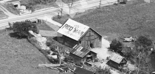
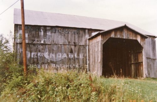
*GONE* (faded away) old Seven Rd., just south of OH Rt. 7, south of OH Rt. 681 by about 2.3 miles. The barn is on the right side of the road headed south. One side. Red Man Tobacco sign faced south. Unknown Background color.
*GONE* (razed and removed) old Seven Rd., just south of OH Rt. 7, south of OH Rt. 681, in Tuppers Plains, by about 2.3 miles. The barn was on the left side of old Seven Rd. headed south. One side. Back Gound color unknown.
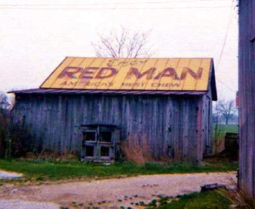
*GONE* (roof has been replaced) Along the east side of OH-73 (on the Brown Bros Lumber Co. property) north of OH-348 (Walnut St.), in Otway, by 1.7 miles. The barn is on the right side of the highway headed north. The Red Man Tobacco signs faced north and south. Unique sign painted on the roof of the barn. Yellow Background.
*GONE* (painted over) Along the east side of Stone Creek Rd SW (CH-21) north of the intersection with E. Jefferson St. (OH-751) by 0.5 mile. The barn is on the right side of the road headed north from Stone Creek. The Red Man Tobacco sign faced south. One end. Yellow Background.
*GONE* US Rt. 30 (Old Lincoln Hwy.) east of OH Rt. 231 by about 0.5 mile. The barn was on the right side of the highway headed west. Roof. Yellow background.
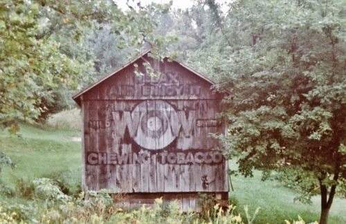
*GONE* (razed and removed) OH-78 McConnelsville Rd.), west of I-77 (exit 25) by 3.7 miles. The barn was on the left side of the highway headed west. The WOW sign faced northwest. One end. Black Background.
*GONE* (painted over) Along the east side of Hunkadora Rd. (CR-40), west of the intersection with OH-821 (Marietta Rd.) by 0.4 mile and across from the intersection with CR-517 (Pine Lake Rd.). The barn is on the right side of Hunkadora Rd. headed north, shortly after passing under I-77. The WOW sign faced south. One side. Painted over.
