- [01] Adams Co, OH (18)
- [02] Allen Co, OH (2)
- [03] Ashland Co, OH (14)
- [04] Ashtabula Co, OH (11)
- [05] Athens Co, OH (20)
- [06] Auglaize Co, OH (5)
- [07] Belmont Co, OH (24)
- [08] Brown Co, OH (32)
- [09] Butler Co, OH (8)
- [10] Carroll Co, OH (22)
- [11] Champaign Co, OH (9)
- [12] Clark Co, OH (3)
- [13] Clermont Co, OH (10)
- [14] Clinton Co, OH (4)
- [15] Columbiana Co, OH (19)
- [16] Coshocton Co, OH (14)
- [17] Crawford Co, OH (13)
- [18] Cuyahoga Co, OH (15)
- [19] Darke Co, OH (8)
- [20] Defiance Co, OH (7)
- [21] Delaware Co, OH (10)
- [22] Erie Co, OH (4)
- [23] Fairfield Co, OH (9)
- [24] Fayette Co, OH (3)
- [25] Franklin Co, OH (12)
- [26] Fulton Co, OH (4)
- [27] Gallia Co, OH (9)
- [28] Geauga Co, OH (10)
- [29] Greene Co, OH (1)
- [30] Guernsey Co, OH (34)
- [31] Hamilton Co, OH (6)
- [32] Hancock Co, OH (5)
- [33] Hardin Co, OH (5)
- [34] Harrison Co, OH (15)
- [35] Henry Co, OH (4)
- [36] Highland Co, OH (15)
- [37] Hocking Co, OH (7)
- [38] Holmes Co, OH (12)
- [39] Huron Co, OH (15)
- [40] Jackson Co, OH (7)
- [41] Jefferson Co, OH (11)
- [42] Knox Co, OH (13)
- [43] Lake Co, OH (2)
- [44] Lawrence Co, OH (9)
- [45] Licking Co, OH (17)
- [46] Logan Co, OH (5)
- [47] Lorain Co, OH (13)
- [48] Lucas Co, OH (5)
- [49] Madison Co, OH (6)
- [50] Mahoning Co, OH (13)
- [51] Marion Co, OH (5)
- [52] Medina Co, OH (9)
- [53] Meigs Co, OH (15)
- [54] Mercer Co, OH (3)
- [55] Miami Co, OH (4)
- [56] Monroe Co, OH (28)
- [57] Montgomery Co, OH (11)
- [58] Morgan Co, OH (20)
- [59] Morrow Co, OH (9)
- [60] Muskingum Co, OH (24)
- [61] Noble Co, OH (15)
- [62] Ottawa Co, OH (8)
- [63] Paulding Co, OH (6)
- [64] Perry Co, OH (8)
- [65] Pickaway Co, OH (7)
- [66] Pike Co, OH (9)
- [67] Portage Co, OH (8)
- [68] Preble Co, OH (9)
- [69] Putnam Co, OH (9)
- [70] Richland Co, OH (11)
- [71] Ross Co, OH (7)
- [72] Sandusky Co, OH (8)
- [73] Scioto Co, OH (16)
- [74] Seneca Co, OH (16)
- [75] Shelby Co, OH (5)
- [76] Stark Co, OH (16)
- [77] Summit Co, OH (5)
- [78] Trumbull Co, OH (3)
- [79] Tuscarawas Co, OH (15)
- [80] Union Co, OH (9)
- [81] Van Wert Co, OH (5)
- [82] Vinton Co, OH (9)
- [83] Warren Co, OH (3)
- [84] Washington Co, OH (34)
- [85] Wayne Co, OH (20)
- [86] Williams Co, OH (4)
- [87] Wood Co, OH (5)
- [88] Wyandot Co, OH (10)
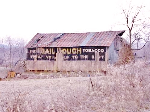
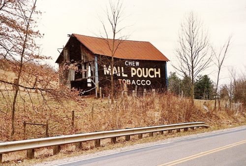
*GONE* (raised and removed) Along the southwest side of Northwest Parkway (CH-133/old US-33) northwest of US-36 intersection, in Marysville, by 3.5 miles. The barn was on the left side of the parkway headed northwest from Marysville. The mail Pouch sign faced southeast. One side. Black Background.
*GONE* (faded away) Along the south side of US-42 north of Main St. (OH-161), in Plain City, by 3.0 miles. The barn is on the right side of the highway headed east. The Mail Pouch sign faced east. One side. Original black background.
*GONE* (razed and removed) Along the south side of OH-37 south of Park St. , in Magnetic Springs,. by 0.7 mile. The barn was on the right side of OH-37 headed east. The Mail Pouch sign faced north. One end. Red background.
*GONE* (razed and removed) Along the northeast side of the Industrial Parkway southeast of the intersection with US-42, by 3.2 miles. The barn was on the left side of the highway headed southeast. The Mail Pouch sign faced southeast. One end. Black background.
*GONE* (razed and removed) Along the northeast side of the Industrial Parkway northwest of the intersection with US-42 by 5. 2 miles. The barn was on the right side of the highway headed northwest. The Mail Pouch sign faced southeast. One end. Black background.
*GONE* (razed and removed) Along the north side of US-224 west of the intersection with Franklin St., in Ottoville, by 5.5 miles. the barn was on the right side of the highway headed west from Ottoville. The Mail Pouch sign faced east. One end. Red background.
*GONE* (faded away) Along the east side of OH-116 north of OH-117 intersection by 0.1 mile. The barn is on the right side of the highway headed north. There was a Mail Pouch sign on eash end (north & south)) of the barn. Black backgrounds.
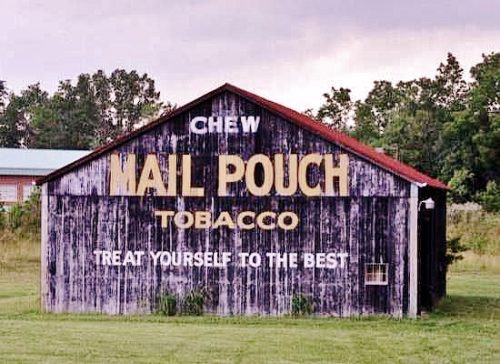
Along the north side of US-50 east of OH-327 by 0.5 mile. The barn is on the left side of the highway headed east. The MP sign faces south. One end. Black background. Originally greatly faded but restored.
*GONE* (fallen) Along the southeast side of CH-7 (Old McArthur Rd.) northeast of US Rt. 50 by 0.4 mile. The barn was on the right side of the road headed northeast. The Mail Pouch sign faced northeast. One side. Black background.
*GONE* (painted over) Along the northwest side of US-50 just south of OH-671. The barn is on the right side of the highway headed south.The Mail Pouch side faced east; and. the Mail Pouch end faced north. One side and one end. Black backgrounds. Painted red and is now a 'Quilt' barn.
*GONE* (razed and removed) Along the wrest side of OH-93 north Main St. (US-50) intersection, in McArthur by 4.6 miles, The barn was on the left side of the highway headed north. The Mail Pouch sign faced south. One end. Black background.
*GONE* (razed and removed) Along the west side of US-50 northwest of the US-50/OH-32 (James A. Rhodes Appalachian Hwy.) junction by 2.3 miles. The barn was on the left side of the highway headed northwest from the junction. The Mail Pouch sign faced east. One side. Black background.
*GONE* (razed and removed) Along the east side of US-50 northwest of the US-50/OH-32 (James A. Rhodes Appalachian Hwy.) junction by 2.0 miles. The barn was on the right side of the highway headed northwest from the junction. The Mail Pouch sign faced west. One side. Black background.
*GONE* (razed and removed) Along the north side of US-50 northwest of the US-50/OH-32 (James A. Rhodes Appalachian Hwy.) junction by 4.2 miles. The barn was on the right side of the highway headed west. The Mail Pouch sign faced west. One end. Black background.
*GONE* (painted over and subsequently the barn was razed and removed) Along the south side of US-50 northwst of the intersection with Main St. (OH-93), in McArthur, by 7.4 miles. The barn was on the left side of the highway headed west. The Mail Pouch sign faced southeast. One end. Black background.
*Gone (razed and removed)* US Rt. 42 northeast of OH Rt. 73, in Waynesville, by about 1.5 miles. The barn is on the left side of the highway headed northeast. The MP sign faces northeast. One end. Red. Greatly faded on a barn in very poor condition.
*GONE (Painted over)* Off of King Ave. across from King Mills Elementary School. One end. Black.
*GONE* (painted over) Along the northwest side of US-42 W northeast of the Broadway St. (OH-48) intersection, in Lebanon, by 5.7 miles. The barn is on the left side of the highway headed northeast. The Mail Pouch sign faced south. One end. Black background.
OH-7, north of St. Mary's Bridge by about 7.8 miles. The barn is on the left side of the highway headed northeast. The Mail Pouch sign faces northeast. One end. Black background.
*GONE (fallen and removed)* OH Rt. 550 southeast of OH Rt. 555 by about 1.8 miles. The barn was on the right side of the highway headed southeast. The MP sign faced southeast. One side. Black.
