- [01] Adams Co, OH (18)
- [02] Allen Co, OH (2)
- [03] Ashland Co, OH (14)
- [04] Ashtabula Co, OH (11)
- [05] Athens Co, OH (20)
- [06] Auglaize Co, OH (5)
- [07] Belmont Co, OH (24)
- [08] Brown Co, OH (32)
- [09] Butler Co, OH (8)
- [10] Carroll Co, OH (22)
- [11] Champaign Co, OH (9)
- [12] Clark Co, OH (3)
- [13] Clermont Co, OH (10)
- [14] Clinton Co, OH (4)
- [15] Columbiana Co, OH (19)
- [16] Coshocton Co, OH (14)
- [17] Crawford Co, OH (13)
- [18] Cuyahoga Co, OH (15)
- [19] Darke Co, OH (8)
- [20] Defiance Co, OH (7)
- [21] Delaware Co, OH (10)
- [22] Erie Co, OH (4)
- [23] Fairfield Co, OH (9)
- [24] Fayette Co, OH (3)
- [25] Franklin Co, OH (12)
- [26] Fulton Co, OH (4)
- [27] Gallia Co, OH (9)
- [28] Geauga Co, OH (10)
- [29] Greene Co, OH (1)
- [30] Guernsey Co, OH (34)
- [31] Hamilton Co, OH (6)
- [32] Hancock Co, OH (5)
- [33] Hardin Co, OH (5)
- [34] Harrison Co, OH (15)
- [35] Henry Co, OH (4)
- [36] Highland Co, OH (15)
- [37] Hocking Co, OH (7)
- [38] Holmes Co, OH (12)
- [39] Huron Co, OH (15)
- [40] Jackson Co, OH (7)
- [41] Jefferson Co, OH (11)
- [42] Knox Co, OH (13)
- [43] Lake Co, OH (2)
- [44] Lawrence Co, OH (9)
- [45] Licking Co, OH (17)
- [46] Logan Co, OH (5)
- [47] Lorain Co, OH (13)
- [48] Lucas Co, OH (5)
- [49] Madison Co, OH (6)
- [50] Mahoning Co, OH (13)
- [51] Marion Co, OH (5)
- [52] Medina Co, OH (9)
- [53] Meigs Co, OH (15)
- [54] Mercer Co, OH (3)
- [55] Miami Co, OH (4)
- [56] Monroe Co, OH (28)
- [57] Montgomery Co, OH (11)
- [58] Morgan Co, OH (20)
- [59] Morrow Co, OH (9)
- [60] Muskingum Co, OH (24)
- [61] Noble Co, OH (15)
- [62] Ottawa Co, OH (8)
- [63] Paulding Co, OH (6)
- [64] Perry Co, OH (8)
- [65] Pickaway Co, OH (7)
- [66] Pike Co, OH (9)
- [67] Portage Co, OH (8)
- [68] Preble Co, OH (9)
- [69] Putnam Co, OH (9)
- [70] Richland Co, OH (11)
- [71] Ross Co, OH (7)
- [72] Sandusky Co, OH (8)
- [73] Scioto Co, OH (16)
- [74] Seneca Co, OH (16)
- [75] Shelby Co, OH (5)
- [76] Stark Co, OH (16)
- [77] Summit Co, OH (5)
- [78] Trumbull Co, OH (3)
- [79] Tuscarawas Co, OH (15)
- [80] Union Co, OH (9)
- [81] Van Wert Co, OH (5)
- [82] Vinton Co, OH (9)
- [83] Warren Co, OH (3)
- [84] Washington Co, OH (34)
- [85] Wayne Co, OH (20)
- [86] Williams Co, OH (4)
- [87] Wood Co, OH (5)
- [88] Wyandot Co, OH (10)
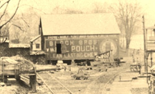
*GONE* (razed and removed) Along the southeast side of 4th St. northeast of the intersection with Main St., in Malta, by 200'. The Barn was on the right side of the street headed northeast from Main St. The Mail Pouch sign faced southeast. One side. Unique sig. Black Background.
*GONE* (razed and removed) Along the east side of US-42 (Gilead St.) south of the High St. intersection (OH-95), in Mt. Gilead by 1.3 miles. The barn was on the left side of the highway headed south from Mt. Gilead. The Mail Pouch sign faced south. One end. Black Background.
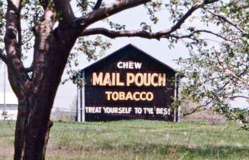
Along the west side of US-42 southwest of OH-529 (Marion St.) intersection, in Cardinton, by 4.0 miles. The barn is on the right side of the highway headed southwest from Cardinton. The Mail Pouch sign faces southwest and is very difficult to see due to the trees. One end, Black Background.
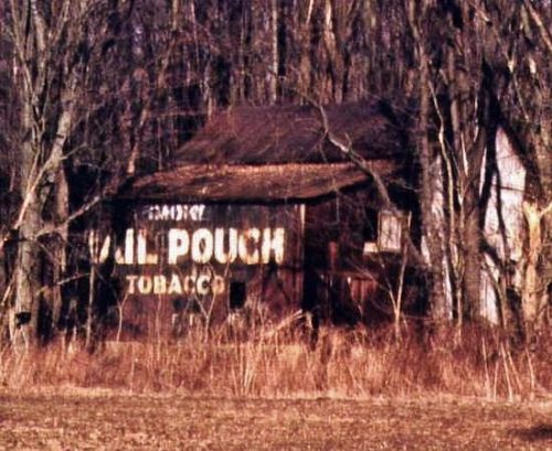
Along the east side of OH-61 north of OH-288 by 0.25 mile. The barn is on the right side of the highway headed north. The Mail Pouch sign faces west and is back in the trees and difficult to see. One side. Black Background.
*GONE* (razed and removed) Along the west side of OH-61 north of the High St. (OH-95) intersecction, in Mt. Gilead, by 5.1 miles. The barn was on the left side of the highway headed north from Mt. Gilead. The Mail Pouch sign faced north. One end. Black Background.
*GONE* (fallen) Along the north side of US-42 east of OH-61 (Main St.) intersection, in Mt. Gilead, by 2.7 miles. The barn was on the left side of the highway headed east from Mt. Gilead. The Mail Pouch sign faced east. One end. Black Background.
Along the north side of US-42 east of Main St. (OH-61), in Mt. Gilead, by 2.9 miles. The barn is on the left side of the highway headed east from Mt. Gilead. . The Mail Pouch sign faces west. One end. Black Background. Greatly faded.
*GONE* (razed and removed) Along the southeast side of US-42 southwest of Marion St. (OH-529) intersection, in Cardington, by 1.6 miles. The barn was on the left side of the highway headed southwest from Cardington. The Mail Pouch sign faced southwest. One end. Red Background.
US-40, east of OH-668 by about 7.1 miles. West of Zaneville by about 3.0 miles. The barn is on the right side of the highway headed west from Zanesville. Two ends. Black backgrounds.
*GONE* (razed and removed) Along the southwest side of OH-146 (Chandlersville Rd.), northwest of Claysville Rd. (OH-313) intersection, in Chandlersville, by 2.3 miles. The barn was on the left side of the road headed northwest. Two sides (NW & SE); and, one end (NE). Black Background.
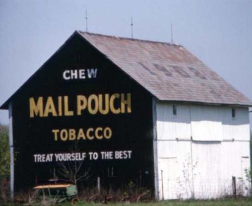
Along the north side of US-22/US-40 (E. Pike), west of OH-83, in New Concord, by1.5 miles. The barn is on the right side of the highway headed west. The Mail Pouch sign faces east. One end. Black Background.
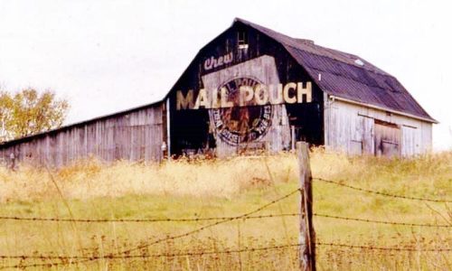
Along the south side of US-22/US-40 (E. Pike), west of OH-83, in New Concord, by 3.5 miles. The barn is on the left side of the highway headed west. The Mail Pouch sign faces east. One end. Black Background with unique Mail Pouch sign.
Along the northwest side of Marne Rd. southwest of OH Rt. 586 (Blackrun Rd.) by 0.5 mile. The barn is on the right side of the road headed southwest. The Mail Pouch sign faces southwest. One end. Black Background.
*GONE* (razed and removed) Along the northeast side of Friendship Dr. (OH-83) north of the US-22 intersection, in New Concord, by 5.4 miles. The barn was on the left side of the highway headed north. Two Mail Pouch signs: One on the south end; and, one on the west side. Black Backgrounds.
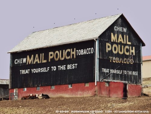
Along the northwest side of OH-555 (Center Rd.), south of the OH-555/OH-719 junction, in Zanesville, by 10.7 miles. The barn is on the right side of the highway headed southwest. Two Mail Pouch signs: Northeast end; and, southeast side. Black Backgrounds.
*GONE* Along the south side of Raiders Rd. west of OH-60 intersection by 2.0 miles. The barn was on the left side of Raiders Rd headed west from OH-60. The Mail Pouch sign faced east. One end. Black Background.
*GONE (fallen, demolished and hauled away)* Along the west side of OH-83 (Friendship Dr.), north of US-22 by 3.0 miles. The barn was on the left side of the highway headed north. Mail Pouch sign on the east end of the barn; and, Mail Pouch sign on the north side of the barn. Black Backgrounds.
*GONE* (razed and removed) Along the south side of Raiders Rd. (Old OH-16) east of OH-60 by 0.6 mile. The barn was on the right side of Raiders road headed east from OH-60. The Mail Pouch sign faced northeast. One end. Black Bacjground.
*GONE* (faded away) US-22/US-40 (E. Pike), southwest of I-70 by 1.4 miles. The barn is on the left side of the highway headed southwest. The Mail Pouch sign faced southwest. One end. Black Background.
*GONE* (razed and removed) Along the west side or Rose Hill Rd (CR-696) north of the Main St. intersection, in Roseville, by 1.3 miles. The barn was on the left side of the road headed north from Roseville. The Mail Pouch sign faced east. One end. Black Background.
