- [01] Adams Co, PA (2)
- [02] Allegheny Co, PA (32)
- [03] Armstrong Co, PA (13)
- [04] Beaver Co, PA (12)
- [05] Bedford Co, PA (18)
- [06] Berks Co, PA (10)
- [07] Blair Co, PA (4)
- [08] Bradford Co, PA (1)
- [10] Butler Co, PA (19)
- [11] Cambria Co, PA (16)
- [13] Carbon Co, PA (1)
- [14] Centre Co, PA (12)
- [16] Clarion Co, PA (13)
- [17] Clearfield Co, PA (11)
- [18] Clinton Co, PA (6)
- [20] Crawford Co, PA (15)
- [21] Cumberland Co, PA (5)
- [22] Dauphin Co, PA (8)
- [24] Elk Co, PA (2)
- [25] Erie Co, PA (11)
- [26] Fayette Co, PA (29)
- [27] Forest Co, PA (3)
- [28] Franklin Co, PA (4)
- [29] Fulton Co, PA (10)
- [30] Greene Co, PA (29)
- [31] Huntingdon Co, PA (10)
- [32] Indiana Co, PA (14)
- [33] Jefferson Co, PA (11)
- [34] Juniata Co, PA (5)
- [36] Lancaster Co, PA (6)
- [37] Lawrence Co, PA (12)
- [39] Lehigh Co, PA (7)
- [40] Luzerne Co, PA (1)
- [41] Lycoming Co, PA (1)
- [42] McKean Co, PA (8)
- [43] Mercer Co, PA (17)
- [44] Mifflin Co, PA (7)
- [45] Monroe Co, PA (5)
- [46] Montgomery Co, PA (1)
- [47] Montour Co, PA (0)
- [48] Northampton Co, PA (5)
- [49] Northumberland Co, PA (1)
- [50] Perry Co, PA (5)
- [51] Philadelphia Co, PA (1)
- [54] Schuylkill Co, PA (2)
- [56] Somerset Co, PA (22)
- [59] Tioga Co, PA (1)
- [61] Venango Co, PA (7)
- [62] Warren Co, PA (2)
- [63] Washington Co, PA (29)
- [64] Wayne Co, PA (2)
- [65] Westmoreland Co, PA (24)
- [67] York Co, PA (8)
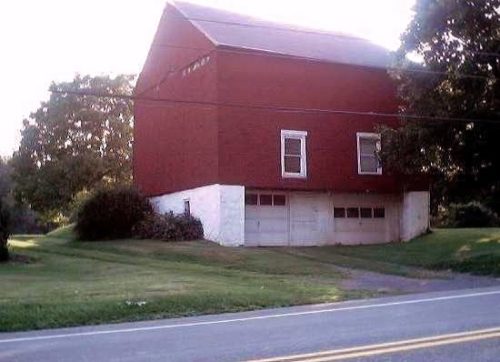
*GONE (covered over)* PA Rt. 309 north of US Rt. 22 (Lehigh Valley Thruway); west of Allentown, by about 3.5 miles. The barn is on the left side of the highway headed northwest. The MP sign faced southeast. One end. Black.
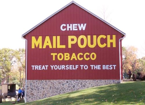
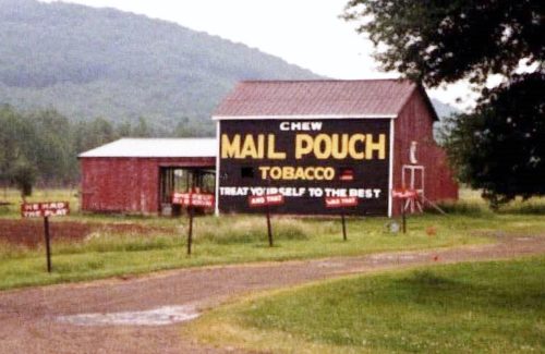
PA-143 (Kings Hwy.), at Ontelaunee Park west of New Tripoli by 0.5 miles. The entrance to the park is 0.5 miles west of the Madison St. (Rt. 4033)/Hoffman Ct. intersection in New Tripoli. After entering the park bear left. The barn is on the left side of the road. The Mail Pouch sign faces east. One end. Red background.
*GONE (painted over)* PA Rt. 100 south of PA Rt. 309 intersection, near Pleasant Corners, by 4.1 miles. The barn is on the left side of the highway headed south. The Mail Pouch sign faced west. One side. Black background.
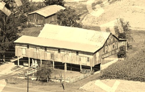
*GONE* (razed and removed) Along the north side of old US-22 west of the PA-863 intersection by 2.1 miles. The barn was on the right side of the highway headed west. The Mail Pouch sign facerd east. One end. Black background.
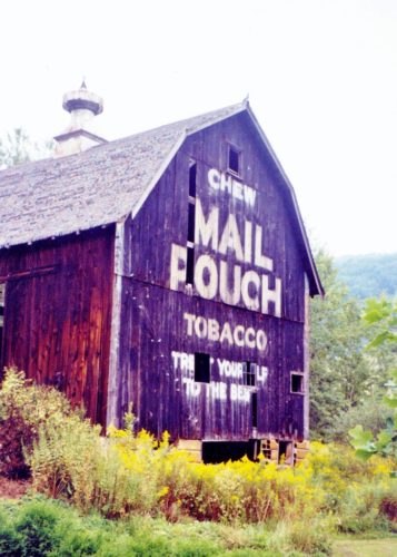
US Rt. 6 (GAR Hwy.) northeast of US Rt. 119 (Buffalo-Pittsburgh Hwy.) by about 9.6 miles. Just southwest of the PA Rt. 146 (Clermont Rd.) intersection. The barn is on the right side of the highway headed northeast. The MP sign faces northwest. One side. black.
*GONE (fallen)* PA Rt. 59 (Smethport Ormsby Road), west of US Rt. 6 (GAR Hwy.), in Smethport, by about 1.6 miles. The barn was on the right side of the highway headed west. The MP sign faced east. One end. Black.
*GONE (fallen)* US Rt 6 (Kane Lantz Corners Rd.) east of PA RT 321 intersection, in Kane by 4.1 miles. The barn was on the left side of US Rt. 6 headed east. The Mail Pouch sign faced southwest. One end. Black Background.
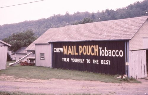
PA Rt. 155 (Port-Turtlepoint Rd.) northwest of US Rt. 6 (GAR Hwy.) intersection, in Port Allegheny, by about 4.5 miles. (In the village of Turtlepoint). The barn is on the left side of the highway headed northwest. The MP sign faces southeast. One end. Black.
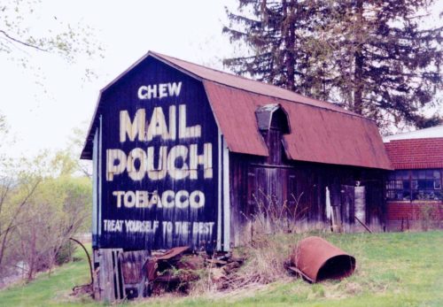
PA-58 (Wilson Ave.), southeast of E. Market St., in Mercer, by about 0.1 mile. The barn is on the right side of the highway headed southeast. One end - Mail Pouch sign faces east. One side - Mail Pouch sign covered over, faced north. Black.
*GONE* (razed and removed - silo remains) Along the northeast side of Greenville Mercer Rd. (PA-58) northwest of US-19 (Franklin St.) intersection, in Mercer, by about 3.9 miles. The barn was on the right side of the highway headed northwest. The Mail Pouch sign faced southeast. One end. Black Background.
Along the east side of Conneaut Lake Rd. (PA-18) south of US-322 (Liberty St.), in Hartstown, by about 5.2 miles. Just south of the Crawford Co./Mercer Co. line by 0.5 mile. The barn is on the left side of the highway headed south from Hartstown. The Mail Pouch sign faces north. One end. Black Background.
*GONE* (painted over) Along the east sisde of Sandy Lake Rd. (PA-173) north of US-62 (Franklin St.) intersection, in Sandy Lake, by about 6.1 miles. The barn is on the right side of the highway headed north. The Mail Pouch sign faced north. One end. Original Black Backgound.
*GONE* (razed and removed) Along the west side of Perry Hwy (US-19) north of Greenville-Sheakleyville Rd. (CH-4020) intersection, in Sheakleyville, by about 0.9 mile. The barn was on the left side of the highway headed north. The Mail Pouch sign faced north. One side. Black Background.
*GONE* (painted over) Along the southwest side of Mercer Rd. (PA-58) south of Main St., in Greenville, by about 2.6 miles. The barn is on the right side of the highway headed southeast. Mail Pouch sign faced northwest. One end. Black Background.
*GONE* (razed and removed) Along the northwest side of N. Hermitage Rd. (PA-18), north of the PA-18/PA-258 intersection, in Clark, by about 1.4 miles. The barn was on the left side of the highway headed northeast from Clark. 2 ends and 1 side painted. Black backgrounds.
*GONE* (razed and removed) Along the north side of Hadley Rd. (PA-358) east of the PA-58 (College Ave.) intersection, in Greenville, by about 2.0 miles. The barn was on the left side of the highway headed east out of Greenville. The Mail Pouch sign faced west. One end. Black background.
*GONE* (razed and removed) Along the west side of Perry Hwy. (US-19) north of the Franklin Rd. (US-62) intersection, in Mercer, by 3.6 miles. The barn was on the left side of the highway headed north from Mercer. 1 end and 1 side shown with Mail Pouch signs. Very possibly the south end was painted also since it presents well to the road. Black backgrounds.
*GONE* (razed and removed) Along the west side of N. Hermitage Rd. (PA-18) north of the PA-18/PA-258 intersection, in Clark, by 3.0 miles. The barn was on the left side of the highway travelling north from Clark. The Mail Pouch sign faced north. One end. black background.
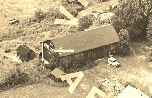
*GONE* (razed and removed) Along the southwest side of Greenville Sandy Lake Rd. (PA-358) southeast of I-79 exit 130 by 0.5 mile. The barn was on the right side of the highway headed southeast from I-79. The Mail Pouch sign faced northwest. The photo shows one end painted; however, the way the barn presents to the highway it is possible that both ends were painted. Black background.
*GONE* (razed and removed) Along the east side of Perry Hwy. (US-19) north of Franklin Rd. (US-62), in Mercer, by 13.2 miles. The barn was on the right side of US-19 headed north from Mercer. The Mail Pouch sign faced south. Because of the configuration of the barn to the highway, it is possible that there was a Mail Pouch sign on the north sidee of the barn. Black Background.
