County
Sides Painted
1
Color
Black
Structure
Brick Building
Unique Characteristics
Unique Sign
Still Standing
No
Credits
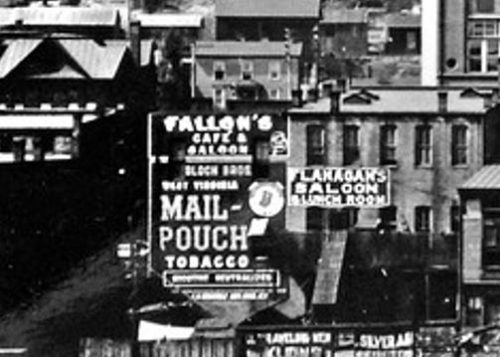
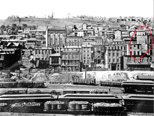
Photos 1 & 2 by unknown (ca. 1890's).
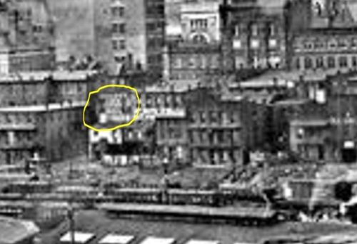
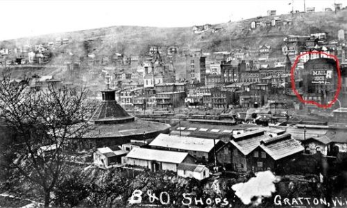
Photos 3 & 4 by unknown (ca. 1911).
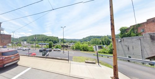
photo 5 Google street view (June 2021).
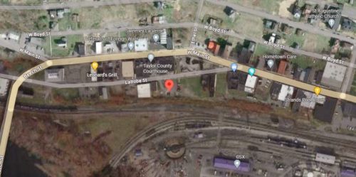
Photo 6 Google satellite image.
Other Information
The location of this Mail Pouch sign is based on the analysis below and refer also to the analysis for the location of MPS 48-43-12. Due to the many changes to Grafton over the years Old maps and Aerial views are difficult to interpret. After the Civil War Grafton and the immediate area became a major retail and industrial area. Coupled with that, the area became a primary RR Hub particularly for the Baltimore and Ohio RR (B & O). From around the turn of the century (1890’s – 1920’s) many buildings were constructed along Main St. and Latrobe St. Population growth began around 1890 at 3200 until it peaked, in 1920 at around 8500. Factory closings reversed the population growth trends (except for a brief increase during 1970 & 1980) until it has reached its current population of around 4600. The large RR presence actually added to the city woes. Situated in a valley during the day of coal fired steam locomotives created a significant air pollution problem. During the same time period Bloch Brothers began (in the 1890’s) sending their painters out to advertise their MAIL POUCH TOBACCO product. The idea has always been to get the signs in areas where they would get the most advertising value. The fact that there are so many Mail Pouch signs in Grafton is a testimony to the importance Bloch Brothers attached to Grafton as a significant advertising venue. It should be noted first that there are probably Mail Pouch signs in Grafton or the immediate area that are not recorded in the website; and, second, that R. J. Reynolds also produced plug tobacco and predated Bloch Brothers. We have noted two RJR tobacco signs on the Barnstormer’s website for Taylor Co, WV. In trying to locate this Mail Pouch sign the following resources have been consulted. 1) A 13 year span of Historic Aerial images from 1955 to 2020). 2) A 4 sheet map collection of Grafton, WV, dated 1895, created by Sanborn Fire Insurance C. 3) The old photographs presented and cross referenced. The resulting study reveals many buildings have existed and subsequently been razed and removed, over the years. No Aerial imagery or Grafton maps have been available to adequately trace the building history. To further complicate the investigation original named streets and alleys have simply disappeared!
Photo 1 is an enlarged inset view from Photo 2, and, Photo 3 is an enlarged inset view from Photo 4.
In Photo 2 & Photo 4 MPS 48-46-12 is circled in red at the right of the view.
Historic Aerials' imagery (1955) was used to help locate the building. The distance measurement tool was used to obtain the decimal coordinates for the building. The coordinates were input to the Google map program and the red pin on Photo 6 is the location where the building once stood. The coordinates were used to determine the address for the enrty.
Photo 5 is a Google street view looking in from Latrobe St. toward where the builidng once stood.
Dates of the photos were provided with the Photo.
Where to find it
*GONE* (razed and removed) Along the south side of Latrobe St. est of the intersection with Beech St. (US-119), in Grafton, by 0.1 mile. The building was on the right side of Latrobe St headed east from Beech St. The Mail Popuch sign faced south toward the B & O Rail yards. One end. Black background.
Address
112 Latrobe St
City
Grafton
State
WV
Zipcode
26354
Country
USA
Latitude
N 39° 20.4542'
Longitude
W -80° 01.3376'
lat
39.340904
lng
-80.022293
