Other Information
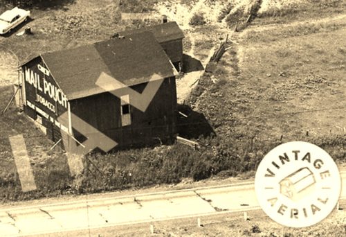
Photo 1 is an enlarged inset view from Photo 2.
The Penn Pilot program was used to determine the location of where this barn once stood. On photo 3 the barn is highlighted in yellow. The other two buildings near the barn, as shown in photo 2, are circled in red. The house, shown in photo 2 is hidden in the trees. The blue circle on photo 3 is the location of the house. Photo 4 (Google satellite image) shows the house circled in blue, and no longer concealed by the trees. Muskrat Run running horizontally and connecting directly into US-422, in Photo 3 now turns southeast and extends on down parallel to US-422 before connecting into the highway. Photo 5, (Google street view) shows the house which is still existing. In Photo 4 the red pin marks the location where the Mail Pouch barn once stood. The pin was used to determine the address and the coordinates.
Where to find it *GONE* (razed and removed)* Along the southwest side of Benjamin Franklin Hwy. (US-422) northwest of the Salt Work St. intersection, in Elderton, by about 2.6 miles. The barn was on the left side of the highway headed northwest from Elderton. The Mail Pouch sign faced southeast. One end. Black background.


