- [01] Adams Co, PA (2)
- [02] Allegheny Co, PA (32)
- [03] Armstrong Co, PA (13)
- [04] Beaver Co, PA (12)
- [05] Bedford Co, PA (18)
- [06] Berks Co, PA (10)
- [07] Blair Co, PA (4)
- [08] Bradford Co, PA (1)
- [10] Butler Co, PA (19)
- [11] Cambria Co, PA (16)
- [13] Carbon Co, PA (1)
- [14] Centre Co, PA (12)
- [16] Clarion Co, PA (13)
- [17] Clearfield Co, PA (11)
- [18] Clinton Co, PA (6)
- [20] Crawford Co, PA (15)
- [21] Cumberland Co, PA (5)
- [22] Dauphin Co, PA (8)
- [24] Elk Co, PA (2)
- [25] Erie Co, PA (11)
- [26] Fayette Co, PA (29)
- [27] Forest Co, PA (3)
- [28] Franklin Co, PA (4)
- [29] Fulton Co, PA (10)
- [30] Greene Co, PA (29)
- [31] Huntingdon Co, PA (10)
- [32] Indiana Co, PA (14)
- [33] Jefferson Co, PA (11)
- [34] Juniata Co, PA (5)
- [36] Lancaster Co, PA (6)
- [37] Lawrence Co, PA (12)
- [39] Lehigh Co, PA (7)
- [40] Luzerne Co, PA (1)
- [41] Lycoming Co, PA (1)
- [42] McKean Co, PA (8)
- [43] Mercer Co, PA (17)
- [44] Mifflin Co, PA (7)
- [45] Monroe Co, PA (5)
- [46] Montgomery Co, PA (1)
- [47] Montour Co, PA (0)
- [48] Northampton Co, PA (5)
- [49] Northumberland Co, PA (1)
- [50] Perry Co, PA (5)
- [51] Philadelphia Co, PA (1)
- [54] Schuylkill Co, PA (2)
- [56] Somerset Co, PA (22)
- [59] Tioga Co, PA (1)
- [61] Venango Co, PA (7)
- [62] Warren Co, PA (2)
- [63] Washington Co, PA (29)
- [64] Wayne Co, PA (2)
- [65] Westmoreland Co, PA (24)
- [67] York Co, PA (8)
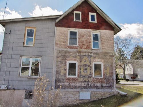
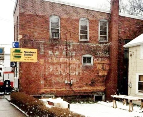
Southeast corner of Bressler St. & Frederick St. intersection, in Flemington. The brick house is 450' southeast of PA-150 on the right side of Bressler St. headed southeast. The Mail Pouch sign faces northeast. One end. Brickhouse. Original Black background. Greatly faded.
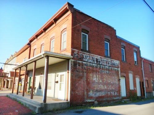
Southwest corner of Main St. & Maple Alley, in Mill Hall. The Mail Pouch sign faces northwest onto Maple Alley. One side. Two-story brick building. Original black background. Greatly faded.
*GONE (painted over)* Along the northwest side of S. Main Street (PA Rt. 86) in Cambridge Springs just southwest of the RR tracks. On brick building. The sign faced northeast. One end. Masonry building. Black.
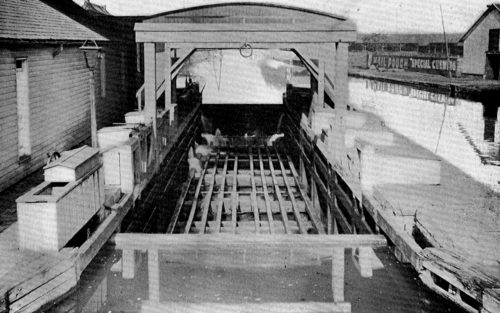
*GONE* Pennsylvania Canal Weigh Lock, in Harrisburg. One side. Black.
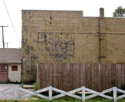
PA-255, north of intersection with PA-555 by about 1 mile. On PA-255 (Bennetts Valley Way), in Byrnedale. Going south on PA-155, the building is approximately 200 ft. south of the intersection with Cleveland Street. Building is on the right side. Sign faces northwest. Almost completely washed away.
*GONE (razed and removed)* US-6/PA-8 (S. Main St.), in Union City, south of High St. intersection by about 0.1 mile. The two-story brick building was on the right side of the street headed southwest. The Mail Pouch sign faced northeast. One side. Two-story brick building. Original Black background.
Main St. between Union Rd. & Market St., in Fayette City. The three story brick building is on the right side of the street headed northwest from Union Rd. toward Market. St. The MP sign faces southeast. One side. Three-story brick building. Black. greatly faded.
W. Church Street, in Fairchance, east of PA-857 (Morgantown St.) by 0.2 miles. The two-story brick building is on the left side of the street headed west, just past the Railroad St. intersection. There are two Mail Pouch signs on the building; the sign on the west side is in good condition while the one on the east side is very faded and difficult to see. Two sides. Two-story brick building. Original black backgrounds.
*GONE* (razed and removed) Southeast corner of Water St. & 12th St. intersection, in Brownsville (1217 Water St.). The MP sign faced east. One side. Two-story brick building. Original black background.
*GONE (painted over)* Connellsville St., in Dunbar, north of W. Railroad St. intersection by about 255'. The two-story brick building is on the right side of the street headed north from the intersection. One side. Two-story brick building.
Southwest corner of Main Street and PA Rt. 166, in Republic. The MP sign faces southeast. Black Bakground. One side. Brick building.
*GONE* (covered over) Northeast corner of US Rt. 119 (Penn St.) & Railroad Street, in Point Marion. The MP sign faced northwest. One side. Three-story brick building. Original Black background.
Southeast corner of N. Beeson Blvd. & E. Peter St., in Uniontown. The MP sign faces west. One side. Three-story masonry and brick building. Brown. Greatly faded.
*GONE* In Brownsville, on a building that fronted on Dunlap Creek where the creek drained into the Monongahela River. The MP sign faced east.
PA Rt. 51 (Morgantown St.), in Uniontown, southwest of the W. South St. intersection by about 60'. The three-story brick building is on the left side of the street headed southwest. The MP sign faces northeast. One side. Three-story brick building. Black. Greatly faded and partially covered.
*GONE* (razed and removed) Along the west side of King St. across from the Hill St. intersection, in Petersburg. The Mail Pouch sign faced south. One side. Black background.
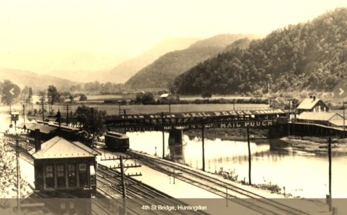
*GONE* (destroyed by fire and removed) S 4th St. spanning the Juniata River, in the location of the existing bridge. There were various Mail Pouch signs on both sides of the bridge. Generally black backgrounds.
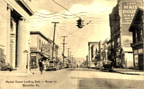
*GONE (razed and removed)* E. Market St. (old US Rt. 22), in Blairsville, east of S. Walnut St. by about 90'. The three-story brick building was on the right side of the street headed east. The MP sign faced west. One side. three-story brick building. Original Black background.
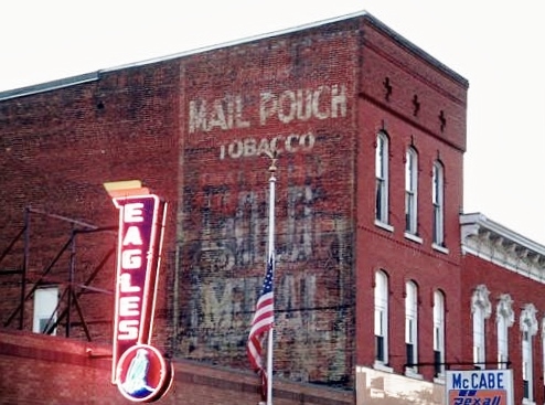
US Rt. 322 (E. Main St.) between S. 4th and S. 5th Streets, in Reynoldsville. Adjacent to the Eagles Club building. The three story brick building is on the right side of the street headed southeast from S. 4th St. The MP sign faces southeast. One side. Three-story brick building. Red brick. Greatly faded.
At the northwst corner of the S. Hess St./E. 4th St. intersection, in Quarryville. Used as tobacco warehouse in 1940's. Two ends of brick building. Original Black background. Greatly faded.
