- [01] Adams Co, PA (2)
- [02] Allegheny Co, PA (32)
- [03] Armstrong Co, PA (13)
- [04] Beaver Co, PA (12)
- [05] Bedford Co, PA (18)
- [06] Berks Co, PA (10)
- [07] Blair Co, PA (4)
- [08] Bradford Co, PA (1)
- [10] Butler Co, PA (19)
- [11] Cambria Co, PA (16)
- [13] Carbon Co, PA (1)
- [14] Centre Co, PA (12)
- [16] Clarion Co, PA (13)
- [17] Clearfield Co, PA (11)
- [18] Clinton Co, PA (6)
- [20] Crawford Co, PA (15)
- [21] Cumberland Co, PA (5)
- [22] Dauphin Co, PA (8)
- [24] Elk Co, PA (2)
- [25] Erie Co, PA (11)
- [26] Fayette Co, PA (29)
- [27] Forest Co, PA (3)
- [28] Franklin Co, PA (4)
- [29] Fulton Co, PA (10)
- [30] Greene Co, PA (29)
- [31] Huntingdon Co, PA (10)
- [32] Indiana Co, PA (14)
- [33] Jefferson Co, PA (11)
- [34] Juniata Co, PA (5)
- [36] Lancaster Co, PA (6)
- [37] Lawrence Co, PA (12)
- [39] Lehigh Co, PA (7)
- [40] Luzerne Co, PA (1)
- [41] Lycoming Co, PA (1)
- [42] McKean Co, PA (8)
- [43] Mercer Co, PA (17)
- [44] Mifflin Co, PA (7)
- [45] Monroe Co, PA (5)
- [46] Montgomery Co, PA (1)
- [47] Montour Co, PA (0)
- [48] Northampton Co, PA (5)
- [49] Northumberland Co, PA (1)
- [50] Perry Co, PA (5)
- [51] Philadelphia Co, PA (1)
- [54] Schuylkill Co, PA (2)
- [56] Somerset Co, PA (22)
- [59] Tioga Co, PA (1)
- [61] Venango Co, PA (7)
- [62] Warren Co, PA (2)
- [63] Washington Co, PA (29)
- [64] Wayne Co, PA (2)
- [65] Westmoreland Co, PA (24)
- [67] York Co, PA (8)
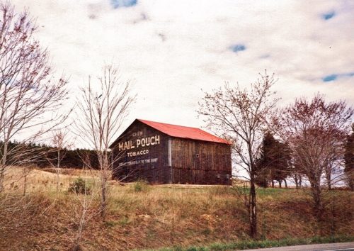
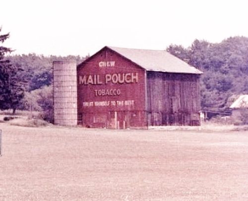
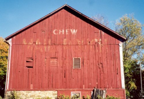
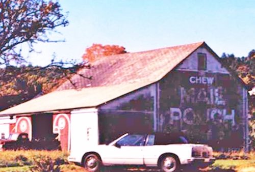
*GONE (painted over)* PA Rt. 36 (Colonel Drake Hwy.) northwest of US Rt. 119 (Buffalo-Pittsburgh Hwy.), in Punxsutawney, by about 5.5 miles. The barn is on the right side of the highway headed northwest. One end. Original Black painted over white.
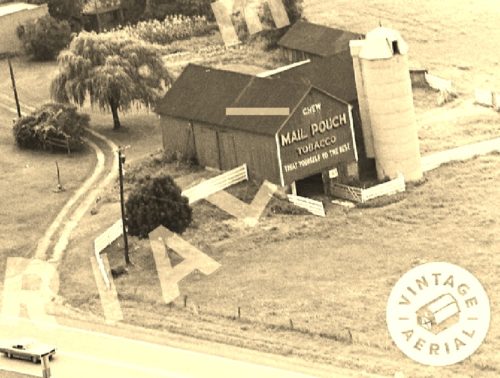
*GONE*(fallen and the site cleared) PA Rt. 36 northwest of PA Rt. 949 (Clear Creek Rd.) intersection, in Sigel, by about 3.1 miles. The barn was on the left side of the highway headed northwest. Just southeast of the PA Rt. 899 intersection by 0.1 mile. Two ends. Red.
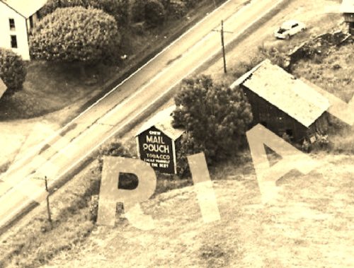
*GONE* (razed and removed) US Rt. 322 (W. Main St.) northwest of 4th St. intersection, in Reynoldsville, by about 2.9 miles. The barn was on the left side of the highway headed northwest. The Mail Pouch sign faced southeast. One side. Black.
*GONE (razed and removed)* PA Rt. 28 (Alexander H. Lindsay Memorial Highway) northeast of I-80 Exit. 81, by 1.8 miles. The barn was on the right side of the highway headed northeast. The Mail Pouch sign faced west. One end. Red.
*GONE* (razed and removed) Along the northeast side of US-322 southeast of White St., in Brookville, by 3.1 miles. The barn was on the left side of the highway headed southeast from Brookville. The Mil Pouh sign faced southeast. One side. Black background.
*GONE (razed and removed)* PA Rt. 75 southwest of Mill St. intersection, in East Waterford, by about 4.1 miles. The barn was on the right side of the highway headed southwest. The Mail Pouch sign faced northeast. One end. Black background.
*GONE (painted over)* This barn backs up on Smith Rd. just northeast of McAlisterville. The Mail Pouch sign faced northeast and was visible from PA Rt. 35. The Smith Rd. intersection with PA Rt. 35 is approximately 1.2 miles northeast of the PA Rt. 35 intersection with PA Rt. 235 (School St.), in McAlisterville. One end. Black background.
*GONE (razed and removed)* PA Rt. 75 northeast of the intersection with PA Rt. 850, in Honey Grove by about 0.2 mile. The barn was on the left side of the highway headed northeast. The Mail Pouch sign faced northeast. One end. Black background.
*GONE (painted over)* PA Rt. 35 southwest of S. Main St. intersection, in Mifflintown, by about 9.5 miles. The barn is on the right side of the highway headed southwest. The Mail Pouch sign faced southwest. One end. Black background.
US Rt. 322 (E. 28th Division Hwy./W. Main St.) northwest of PA Rt. 272 (Reading Rd.) intersection, in Ephrata, by about 6.3 miles. The barn is on the right side of the highway headed northwest. The MP sign faces northwest. One end. Red.
Hess Rd. south of PA Rt. 23 (E. Main St.), in Leola, by about 130'. The barn is on the right side of the road headed south The MP sign faces east. One end. Black sign on red barn.
*GONE* Lancaster Co, PA only photo information.
Stickle Road, south of PA Rt. 488 (Benjamin Franklin Hwy.) by about 0.3 miles. The barn is on the right side of the road headed south. One side. Black background.
*RELOCATED* 427 Countryview Rd. East of intersection with US-19 (Perry Highway) by 0.7 mile. Countryview Rd. intersection is south of PA-108 intersection, in Harlansburg, by 1.9 miles. The relocated barn is on the left side of Countryview Rd. headed east. The Mail Pouch sign side faces west and the Mail Pouch sign end faces south. Black backgrounds.
*GONE* (painted over) On US Rt. 19 (Perry Hwy.), north of intersection with PA Rt. 108 (Harlensburg Rd.) by 2.2 miles. The barn is on the right side of the highway headed north. The Mail Pouch sign faced north. Original Black background. One end.
*GONE* (faded away) PA Rt. 488 (Portersville Rd.) east of 2nd St. intersection, in Ellwood City, by about 2.5 miles. The barn is on the left side of the highway headed east and very difficult to see from the hgihway. The MP sign faces west. To access; from the 2nd St./Fountain Ave. (PA Rt. 488) intersection, in Ellwood City, head east. Fountain Ave.becomes Portersville Rd. Follow to the site. One end.
*GONE (painted over)* US Rt. 19 (Perry Hwy.) north of US Rt. 422 by 0.3 mile. The barn is on the left side of the highway headed northwest. The Mail Pouch sign faced northwest. One end. Red background.
(GONE (razed and removed)* US Rt. 19 (Perry Hwy.) south of PA Rt. 108 intersection in Harlansburg by 2.4 miles. The barn was on the right side of the highway headed south. The Mail Pouch sign faced north. One end. Black background.
*GONE (painted over)* US Rt. 19 (Perry Hwy.) north of PA Rt. 108 intersection, in Harlansburg, by 5.2 miles. The barn is on the right side of the highway headed north. The Mail Pouch sign faced north. One end. Red background.
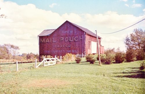
*GONE (Painted over)* On Limeport Pike (SR 2029), south of Local Rte. 39114 intersection, in Lanark, by about 2.7 miles. The barn is on the right side of the highway headed south. The Mail Pouch sign faced northeast.. Painted over with Ceresota Flour sign. Note in Photo 4 the word 'TOBACCO' is just beginning to bleed through below the word 'CERESOTA'. One end. Black Background.
