- [01] Barbour Co, WV (9)
- [02] Berkeley Co, WV (2)
- [03] Boone Co, WV (4)
- [04] Braxton Co, WV (7)
- [05] Brooke Co, WV (2)
- [06] Cabell Co, WV (8)
- [07] Calhoun Co, WV (6)
- [09] Doddridge Co, WV (3)
- [10] Fayette Co, WV (4)
- [11] Gilmer Co, WV (2)
- [13] Greenbrier Co, WV (5)
- [14] Hampshire Co, WV (7)
- [15] Hancock Co, WV (1)
- [16] Hardy Co, WV (0)
- [17] Harrison Co, WV (7)
- [18] Jackson Co, WV (12)
- [20] Kanawha Co, WV (6)
- [21] Lewis Co, WV (5)
- [22] Lincoln Co, WV (8)
- [23] Logan Co, WV (0)
- [24] Marion Co, WV (16)
- [25] Marshall Co, WV (14)
- [26] Mason Co, WV (12)
- [29] Mineral Co, WV (5)
- [31] Monongalia Co, WV (8)
- [32] Monroe Co, WV (1)
- [33] Morgan Co, WV (1)
- [34] Nicholas Co, WV (5)
- [35] Ohio Co, WV (16)
- [37] Pleasants Co, WV (3)
- [38] Pocahontas Co, WV (3)
- [39] Preston Co, WV (6)
- [40] Putnam Co, WV (4)
- [42] Randolph Co, WV (11)
- [43] Ritchie Co, WV (8)
- [44] Roane Co, WV (6)
- [46] Taylor Co, WV (14)
- [47] Tucker Co, WV (1)
- [48] Tyler Co, WV (4)
- [49] Upshur Co, WV (5)
- [50] Wayne Co, WV (10)
- [51] Webster Co, WV (4)
- [52] Wetzel Co, WV (4)
- [53] Wirt Co, WV (5)
- [54] Wood Co, WV (15)
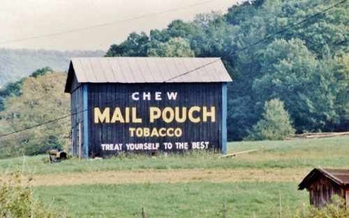
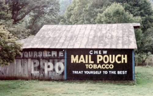
Along the southeast side of US-40 (National Hwy.) southwest of the PA State line by 2.5 miles. The garage is on the left side of the highway headed southwest. Two sides. Black backgrounds. (The signs have been covered with tarps)
*GONE* (razed and removed) Along the northwest side of US-40 (National Highway) west of the WV/PA state line by 4.4 miles. Just west of Valley Grove. The barn was on the right side of the highway headed southwest The Mail Pouch sign faced southwest. Black background.
*GONE* (razed and removed) Along the southeast side of S. Pleasants Hwy (WV-2) northeast of the I-77 interchange by 11.5 miles. The barn was on the right side of the highway headed northeast from I-77. The Mail Pouch sign faced northwest. One side. Black backbground.
*GONE* (fallen and removed) Along the southeast side of N. Pleasants Hwy (WV-2) northeast of Old Mill Rd. intersection, in St. Mary, by 3.8 miles. The barn was on the right side of the highway headed northeast from St. Mary. The Mail Pouch sign faced northwest. One side. Black background.
*GONE* Along the southwest side of Seneca Trail (US-219/WV-55) north of WV-39 intersection, in Marlinton, by 13.0 miles. South of Slatyfork. The barn was on the left side of the highway headed northwest. Two sides. Black backgrounds.
*GONE* Along the south side of Seneca Trail (US-219/WV-55) west of intersection with WV-66, in Big Spring, by 0.4 mile. The barn was on the left side of the highway headed west. The Mail Pouch sign faced west. One end. Black background.
*GONE* (fallen and removed) Along the southeast side of Seneca Trail (US-219) northeast of US-60 intersection, in Lewisburg, by 24.3 miles. The barn was on the right side of the highway headed northeast. The Mail Pouch sign faced northeast. One end. Black background.
Along the east side of N. Mountaineer Hwy (WV-92) north of US-50 by about 9.0 miles. The barn is on the right side of the highway headed north. Two ends. Black backgrounds. South end sign covered by a barn extension and only the word 'CHEW' is visible from the highway.
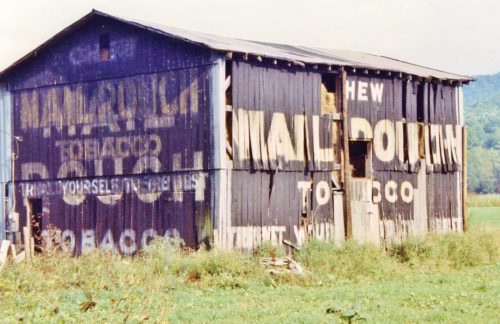
Along the north side of George Washington Hwy. (US-50) west of US-219 (Garrett Hwy.) by about 4.7 miles. The barn is on the right side of the highway headed west. Mail Pouch end faces east. Mail Pouch side faces south. Black backgrounds. Greatly faded.
Along the south side of George Washington Hwy. (US-50) west of WV-24 intersection by about 1.0 mile. The barn is on the left side of the highway headed west and is almost directly across from the Aurora Town sign. The Mail Pouch sign faces west. One end. Black background.
*GONE* (razed and removed) Along the southwest side of E. State Ave (WV-7) southeast of N. Main St. intersection, in Terra Alta, by 0.9 miles. The barn was on the right side of the highway headed southeast from Main St. Two ends. Black backgrounds.
*GONE* (razed and removed) Along the south side of Veteran's Memorial Hwy (WV-7) east of the WV-7/WV-92 junction, in Reedsville, by about 1.0 mile. The barn was on the right side of the highway headed east out of Reedsville. The Mail Pouch sign faced west. One side. Black background.
*GONE* (fallen and removed) Along the southwest side of Charleston Rd. (WV-62) southeast of WV-869 (Buffalo Bridge) intersection by 1.7 miles. The barn was on the right side of the highway headed southeast. Two sides. Black backgrounds.
Putnam County Park, in Eleanor. From WV-62 (Charleston Rd./Roosevelt Blvd.) take W. Fir St. east approximately 0.4 mile to Park Rd. (CR-35/17). Make left onto Park Rd. and follow, keeping left, 1.0 mile to road intersecting from the left. Make right onto the road. The barn is almost immediately on the right. The Mail Pouch sign faces southeast. One side. Black Background.
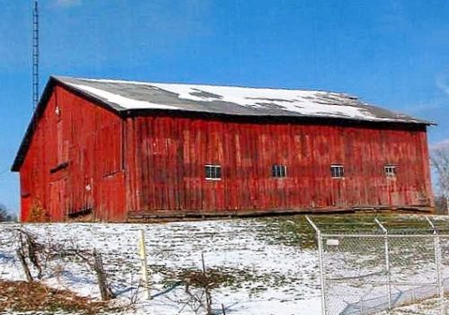
Along the northeast side of US-60 west of WV-34 intersection by 0.2 mile. The barn is on the right side of the highway headed northwest. The Mail Pouch sign faces southeast. One side. Original black background. Greatly faded with the original Mail Pouch sign bleeding through the red over-paint.
*GONE* (fallen and removed) Along the north side of US-60 east of WV-34 (Chamblin Rd.) intersection by 2.0 miles. The barn was on the left side of the highway headed east. The Mail Pouch sign faced southeast. One end. Black background.
US-219/WV-55 south of US-250/WV-92 by about 3.5 miles. The barn is on the right side of the highway headed south. The Mail Pouch sign faces southeast. One end. black background.
US Rt. 219/WV Rt. 55 south of US Rt. 250/WV Rt. 92 by about 6.2 miles. The barn is on the left side of the highway headed southwest. One end (MP sign faces northwest). One side (MP sign faces southwest). Black. Greatly faded.
US-219/WV-55 south of US-250 by about 8.7 miles. The barn is on the right side of the highway, on a hillside, in the distance, headed southeast. The Mail Pouch sign faces northwest. One side. Black background.
US Rt. 219/WV Rt. 44 north of the intersection with WV Rt. 15 by about 420'. The barn is on the left side of the highway headed north. The MP sign faces east. One side. Black.


