- [01] Adams Co, IN (4)
- [02] Allen Co, IN (9)
- [03] Bartholomew Co, IN (7)
- [04] Benton Co, IN (3)
- [05] Blackford Co, IN (5)
- [06] Boone Co, IN (6)
- [07] Brown Co, IN (5)
- [08] Carroll Co, IN (3)
- [09] Cass Co, IN (6)
- [10] Clark Co, IN (3)
- [11] Clay Co, IN (1)
- [12] Clinton Co, IN (6)
- [13] Crawford Co, IN (6)
- [14] Daviess Co, IN (1)
- [15] Dearborn Co, IN (8)
- [16] Decatur Co, IN (3)
- [17] DeKalb Co, IN (13)
- [18] Delaware Co, IN (3)
- [19] Dubois Co, IN (14)
- [20] Elkhart Co, IN (4)
- [21] Fayette Co, IN (2)
- [22] Floyd Co, IN (3)
- [23] Fountain Co, IN (5)
- [24] Franklin Co, IN (6)
- [25] Fulton Co, IN (6)
- [26] Gibson Co, IN (4)
- [27] Grant Co, IN (4)
- [28] Greene Co, IN (4)
- [29] Hamilton Co, IN (7)
- [30] Hancock Co, IN (6)
- [31] Harrison Co, IN (10)
- [32] Hendricks Co, IN (8)
- [33] Henry Co, IN (7)
- [34] Howard Co, IN (0)
- [35] Huntington Co, IN (6)
- [36] Jackson Co, IN (4)
- [37] Jasper Co, IN (0)
- [38] Jay Co, IN (16)
- [39] Jefferson Co, IN (11)
- [40] Jennings Co, IN (7)
- [41] Johnson Co, IN (2)
- [42] Knox Co, IN (7)
- [44] LaGrange Co, IN (3)
- [45] Lake Co, IN (2)
- [46] LaPorte Co, IN (5)
- [47] Lawrence Co, IN (3)
- [48] Madison Co, IN (13)
- [49] Marion Co, IN (9)
- [50] Marshall Co, IN (5)
- [51] Martin Co, IN (3)
- [52] Miami Co, IN (3)
- [53] Monroe Co, IN (3)
- [54] Montgomery Co, IN (4)
- [55] Morgan Co, IN (2)
- [57] Noble Co, IN (17)
- [58] Ohio Co, IN (1)
- [59] Orange Co, IN (5)
- [61] Parke Co, IN (3)
- [62] Perry Co, IN (4)
- [63] Pike Co, IN (5)
- [64] Porter Co, IN (2)
- [65] Posey Co, IN (1)
- [66] Pulaski Co, IN (3)
- [67] Putnam Co, IN (5)
- [68] Randolph Co, IN (4)
- [69] Ripley Co, IN (13)
- [70] Rush Co, IN (4)
- [72] Scott Co, IN (3)
- [74] Spencer Co, IN (11)
- [75] Starke Co, IN (2)
- [76] Steuben Co, IN (5)
- [77] Sullivan Co, IN (1)
- [78] Switzerland Co, IN (8)
- [79] Tippecanoe Co, IN (2)
- [80] Tipton Co, IN (2)
- [82] Vanderburgh Co, IN (1)
- [83] Vermillion Co, IN (2)
- [84] Vigo Co, IN (1)
- [85] Wabash Co, IN (1)
- [87] Warrick Co, IN (2)
- [88] Washington Co, IN (6)
- [89] Wayne Co, IN (3)
- [90] Wells Co, IN (5)
- [91] White Co, IN (4)
- [92] Whitley Co, IN (3)
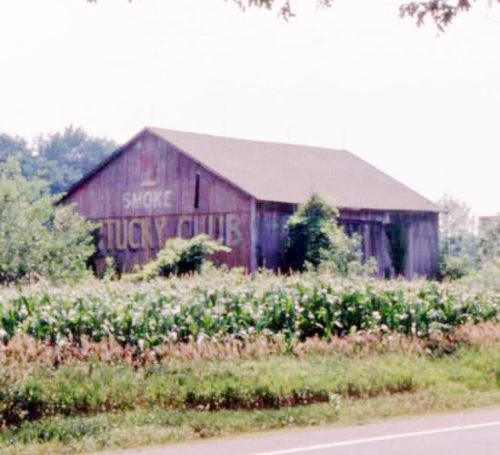
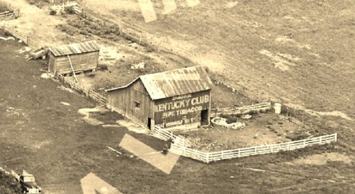
*GONE* (fallen and subsequently removed) Along the south side of US Rt. 6 (GAR Hwy) west of Albion St. (N 290 W) intersection, in Wawaka, by 1.3 miles. The barn was on the left side of US-6 headed west from Wawaka. The Kentucky Club sign faced east. One end. Red background.
*GONE* (painted over) Along the west side of S 50 W north of Lincoln Hwy (US-33) intersection, in Merriam, by 2.1 miles. The barn is on the left side of S 50 W headed north out of Merrian. The Kentucky Club sign faced east. One side. Black background.
*GONE* (painted over) Along the west side of CR-800 W south of the intersection with US-36, in Modoc, by 0.7 mile. The barn is on the right side of CR-800 W headed south out of Modoc. The Kentucky Club sign faced east. One end. Black background.
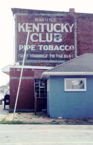
*GONE* (razed and removed for new Post Office building) At the southwest corner of the intersection of IN-5 (n. Jefferson St.) & Water St., in Cromwell. On the northeast side of the old post office. The Kentucky Club tobacco sign faced northeast. One side. Black background.
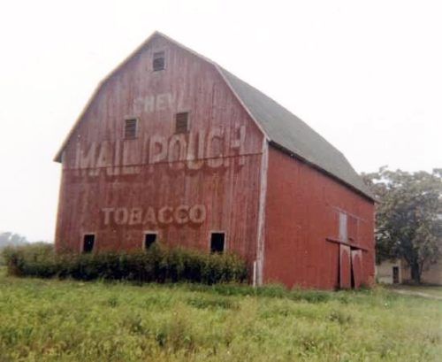
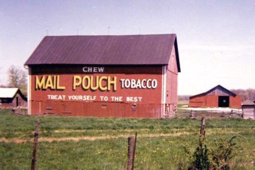
*GONE* (razed and removed) Along the southwest side of Decatur Rd. (US-33) east of the US-27 intersection (south of Decatur) by 3.6 miles. The barn was on the right side of Decatur Rd headed east from US-27. The Mail Pouch sign faced southeast. One end. Red background.
*GONE* (razed and removed) Along the east side of US Rt. 27, south of the US Rt. 27/US Rt. 33 junction by 1.9 miles. The barn was on the left side of the highway headed south. The Mail Pouch sign faced north. One end. Black background.
*GONE* (razed and removed) Along the east side of Townley Rd. (IN-101) north of South St., in Monroeville, by 2.1 miles. The barn was on the right side of Townley Rd. headed north from Monroeville. The Mail Pouch sign faced north. One end. Red background.
*GONE* (razed and removed - replaced with a new structure) Along the west side of Bluffton Road (IN-1) south of I-469 by about 0.2 mile. The barn was on the right side of the highway headed south. The Mail Pouch sign faced south. One side.
*GONE* (faded away/covered over) Along the east side of Bluffton Rd. (IN-1) south of I-469 (US-33) by about 0.3 mile. The building is on the left side of the highway headed south. The Mail Pouch sign faced north. One end. Black background.
*GONE* (faded away) Along the southwest side of US-33 (Lincoln Hwy/Goshen Rd) south of Churubusco by about 2.5 miles. The barn is on the right side of the highway headed southeast. The Mail Pouch sign faced northwest. One end. Original Black background. The northwest end of the barn is falling away, this barn will not be around much longer.
*GONE* (razed and removed) Along the southwest side of Decatur Rd. (US-27) northwest of I-469 (exit 11) by 1.8 miles. The barn was located on the left side of Decatur Rd (IUS-27) headed northwest. Mail Pouch sign on the east end; and, Mail Pouch sign on the south side. Red backgrounds.
*GONE* (razed and removed) Along the northwest side of Old 24 E Rd. southwest of the intersection with IN-101 by 4.7 miles. The barn was on the right side of the road headed southwest from IN-101. The Mail Pouch sign faced south. One side. Red background.
*GONE* (razed and removed - Barn gone by 1983 and the site is now completely cleared) Along the northwest side of IN-37 northeast of the Antwerp Rd. intersection, in Harlan, by 1.5 miles. The barn was on the left side of the highway headed northeast from Harlan. The Mail Pouch sign faced southwest. One end. Black Background.
*GONE* (razed and removed) Along the west side of Coldwater Rd. north of the I-69/US-24/US-30 interchange by 5.3 miles. The barn was on the left side of the road headed north from the interchange. The Mail Pouch sign faced south. One end. Black background.
*GONE* (razed and removed) Along the east side of IN-9/IN-46 east of the intersection with US-31 by 4.2 miles. The barn was on the right side of the highway headed north. The Mail Pouch sign faced north. One side. Black background.
This barn is located along IN-7 southeast of US-31 by just over 4.0 miles. The barn is on the right side of the highway headed southeast. The Mail Pouch side sign faces northeast. The Mail Pouch end sign faces northwest. Black backgrounds.
*GONE* (faded away) Along the northeast side of IN-11 (S Jonesville Rd.) south of the IN-46 intersection (just west of Columbus) by 3.5 miles. the barn is on the left side of IN-11 headed south. The Mail Pouch sign faced southeast. One end. Red background.
*GONE* (faded away) Along the west side of IN-9 north of the IN-46/25th St. intersection by 1.8 miles. The barn is on the left side of the highway headed north from IN-46. The Mail Pouch sign faced east. One side. Red background.
*GONE* (painted over) Along the east side of Jonesville Rd (IN-11) south of the intersection with IN-46 (just west of Columbus) by 1.6 miles. The barn is on the left side of the road headed south from IN-46. The Mail Pouh sign faced north. One end. Black background.
*GONE* (assumed fallen and concealled in the trees on the property) Along the southwest side of E. State St. (IN-7) southeast of the IN-46 intersection by about 375'. The barn was on the right side of the street headed southeast from IN-46. The Mail Pouch sign faced southeast. One end. Black background.
