MPB 38-30-28

Photo 1
Sides Painted
1;2
Color
Black
Structure
Barn
Unique Characteristics
None
Still Standing
No
Credits

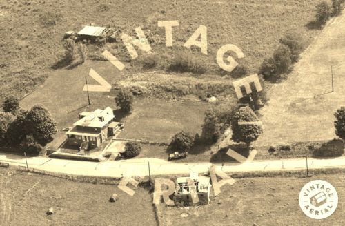
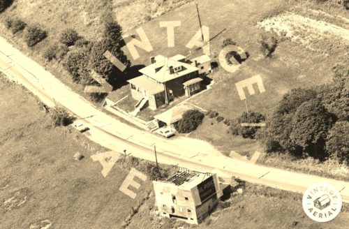
Photos 1 & 2 by unknown VA # 104-TGR-10 (1984) courtesy of Vintage Aerial

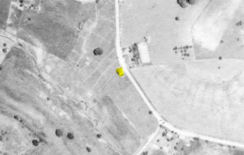
Photo 3 by unknown VA # 61-NGE-30 (1988) courtesy of Vintage Aerial

Photo 4 by unknown (July 12, 1939) courtesy of Penn Pilot

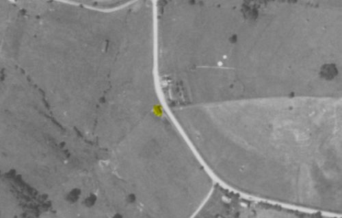
Photo 5 by unknown (Aug. 27, 1958) courtesy of Penn Pilot

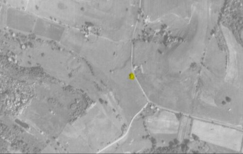
Photo 6 by unknown (Oct. 4, 1967) courtesy of Penn Pilot

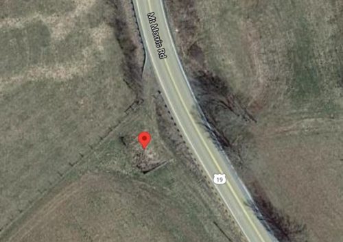
Photo 7 Google satellite image.
Other Information

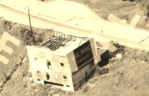
Photo 1 is an enlarged inset image from Photo 2.

The Penn Pilot program was used to determine where this Mail Pouch barn once stood. The barn is highlighted in yellow in photos 4-6.

The house and garage across the highway from where the barn was located have been razed and the site cleared. In Photo 7 (Google satellite image) the red pin is located within the outline of the old barn foundation.
Where to find it

*GONE* US Rt. 19 (Mt. Morris Rd.) south of PA Rt. 21 intersection, in Morrisville, by 5.1 miles. The barn was on the right side of the highway headed south. In photo 1 the Mail Pouch sign facing southeast is visible. Based on the orientation to the road, it is very possible that this barn had a Mail Pouch sign on the northwest end of the barn. Black background.
Address
1886 Mt Morris Rd (US-19)
City
Waynesburg
State
PA
Zipcode
15370
Country
USA
Latitude
N 39° 50.1962'
Longitude
W -80° 08.2547'
  • Photo 2
  • Photo 3
  • Photo 4
  • Photo 5
  • Photo 6
  • Photo 7