MPB 38-30-25

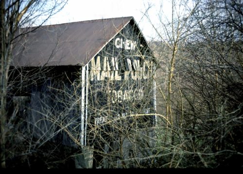
Photo 1
Sides Painted
1
Color
Black
Structure
Barn
Unique Characteristics
None
Still Standing
No
Credits

Photo 1 by Fred Yenerall (1978) (Submitted by Judy Thomas).

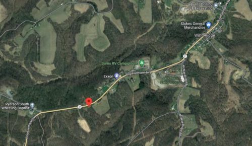
Photo 2 Google satellite image.
Other Information

Historic Aerial imagery (1970's) was searched for this barn. This was the only structure west of Wind Ridge all the way to the West Virginia line that fit the requirments for this barn. Any other structure that might have been the barn was researched and eliminated from consideration. The Historic Aerials distance measurement tool provided the decimal coordinates for the barn. These coordinats were input to the Google map progrm and the red pin on Photo 2 is the exaclt location where the barn was once located. This pin was used to determine the addresss and the location description.

Where to find it

*GONE* (razed and removed) Along the south side of Roy Furman Hwy (PA-21) west of Rush Rd. intersection, in Wind Ridge. by 1.0 mile. The barn was on the left side of the highway headed west from Wind Ridge. The Mail Pouch sign faced west. One end. Black baackground.
Address
407 Roy Furman Hwy (PA-21)
City
Wind Ridge
State
PA
Zipcode
15380
Country
USA
Latitude
N 39° 54.3587'
Longitude
W -80° 27.0133'
lat
39.905778
lng
-80.450222
  • Photo 2