Other Information
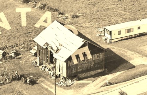
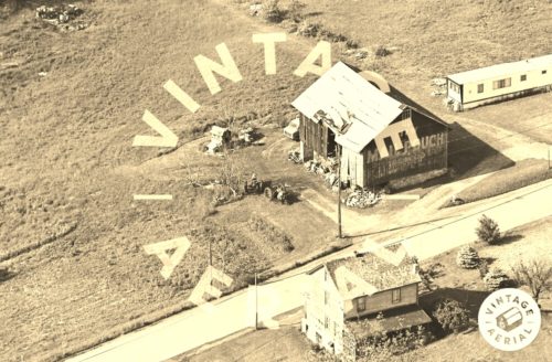
Photo 1 is an enlarged inset view from Photo 2.
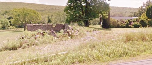
Photo 3 the mobile home remains. To the left is the remaining back wall of the barn.
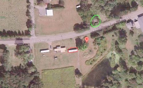
Historic Aerials' imagery (1983) clearly shows the barn and the other buildings in Photo 2. The distance measurement tool was used and the decimal coordiantes for the Mail Pouch barn were obtained. The coordinates were input to the Google map program and the red pin on Photo 4 is the exact location where the barn once stood. The mobile home remains and is circled in red. The farm house across the road from the Mail Pouch barn, is unoccupied and in very poor condition. The house is circled in lime.
Where to find it *GONE* (razed and removed) Along the south side of W. Market St. west of Water St. intersection, in Williamstown, by 0.7 mile. The barn was on the left side Of Market St. headed west out of Williamstown. The Mail Pouch sign faced north. One end. Black background.


