MPB 38-65-07

Photo 1
Sides Painted
1
Color
Black
Structure
Barn
Unique Characteristics
None
Still Standing
No
Credits

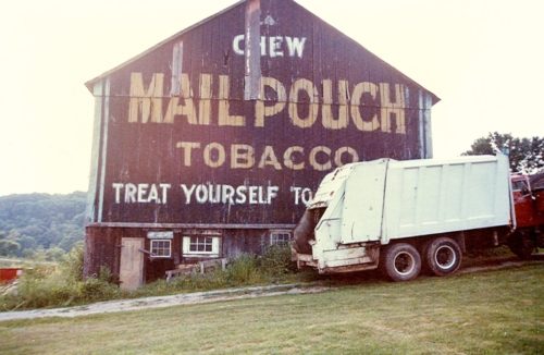
Photo 1 by Fred Yenerall (1977). 

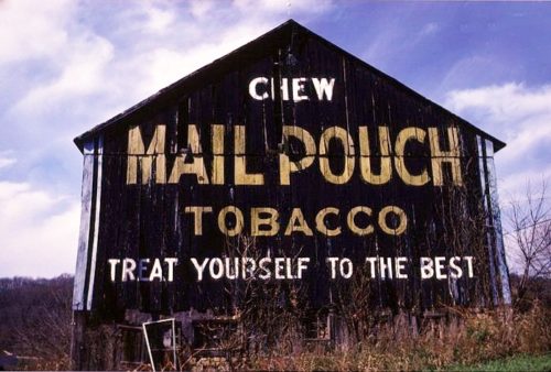
Photo 2 by Bill Plack (1985). 

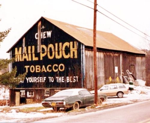
Photo 3 by Dave and Mary Ann Shaver (Aug. 10, 1986).

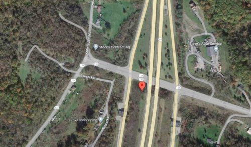
Photo 4 Google satellite image.
Other Information

This barn was razed and removed in 1991 to allow for the constructiion of the Amos K. Hutchinson By-Pass/PA-66 (toll-road).

This barn is clearly shown on Historic Aerials' imagery (1986). The distance measurement tool was used to obtain the decimal coordinates for the center of the barn. The coordinates were input to the Google map program and the red pin on Photo 4 is the exact location of where the barn once stood. The pin was used to determine the address.
Where to find it

*GONE* (razed and removed) West of Greensburg on PA Rt. 136 just past the south bound on-ramp for toll road PA Rt. 66, by about 400'. The barn was on the left side of the highway headed west from Greensburg. The Mail Pouch sign faced east. One end. Black background.
Address
4128 PA-136
City
Greensburg
State
PA
Zipcode
15601
Country
USA
Latitude
N 40° 16.7470'
Longitude
W -79° 36.7673'
lat
40.279116
lng
-79.612789
  • Photo 2
  • Photo 3
  • Photo 4