MPB 38-32-08

Photo 1
Sides Painted
1
Color
Red
Structure
Barn
Unique Characteristics
None
Still Standing
No
Credits

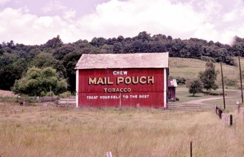
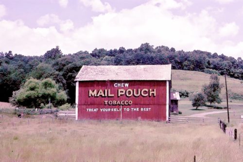
Photos 1 & 2 by Fred Yenerall (1977 - Submitted by Judy Thomas).

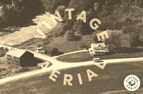
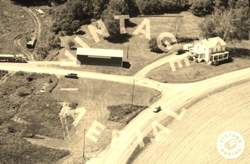
Photo 3 by unknown VA # 189-YIN-32 (1983) Courtesy of Vintage Aerial

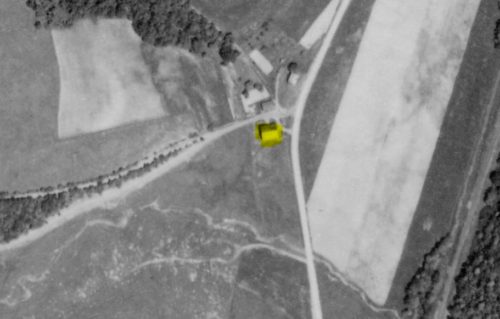
Photo 4 by unknown (May 31, 1939) courtesy of Penn Pilot

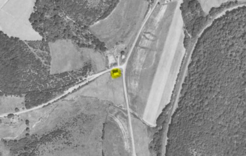
Photo 5 by unknown (Aug. 13, 1957) courtesy of Penn Pilot

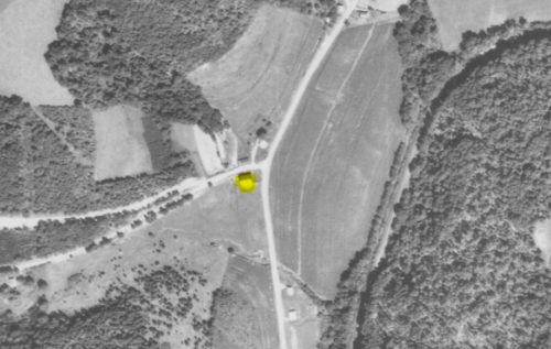
Photo 6 by unknown (Sept. 11, 1967) courtesy of Penn Pilot

Photo 7 by unknown VA # 17-NIN-30 (1988) courtesy of Vintage Aerial

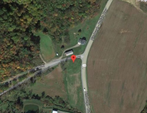
Photo 8 Google satellite image.
Other Information

The Penn Pilot program was used to determine where this barn once stood. Photos 4-6 show the location of the barn highlighted in yellow. Photo 8 is a Google satellite image provided to coordinate with photos 4-6. Photo 7 is provided to show that the barn had been razed and removed by 1988.

Where to find it

*GONE (razed and removed)* US Rt. 119 (Pittsburgh-Buffalo Highway) at the intersection with Johnson Rd.. The Johnson Rd. intersection is northeast of PA Rt. 85 intersection, in Home, by 6.8 miles. The barn was on the left side of the highway headed north. The Mail Pouch sign faced south. One side. Red background.
Address
16 Johnston Rd
City
Marion Center
State
PA
Zipcode
15759
Country
USA
Latitude
N 40° 48.94'
Longitude
W -79° 03.15'
lat
40.815667
lng
-79.052500
  • Photo 2
  • Photo 3
  • Photo 4
  • Photo 5
  • Photo 6
  • Photo 7
  • Photo 8